MyTopo
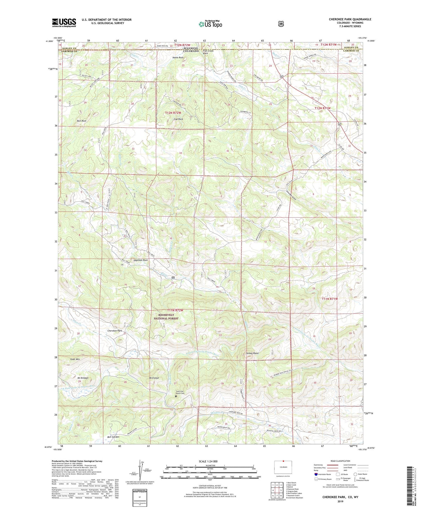
Cherokee Park Colorado US Topo Map
Couldn't load pickup availability
Also explore the Cherokee Park Forest Service Topo of this same quad for updated USFS data
2022 topographic map quadrangle Cherokee Park in the state of Colorado. Scale: 1:24000. Based on the newly updated USGS 7.5' US Topo map series, this map is in the following counties: Larimer, Albany. The map contains contour data, water features, and other items you are used to seeing on USGS maps, but also has updated roads and other features. This is the next generation of topographic maps. Printed on high-quality waterproof paper with UV fade-resistant inks.
Quads adjacent to this one:
West: Diamond Peak
Northwest: Best Ranch
North: Dale Creek
Northeast: Buford
East: Virginia Dale
Southeast: Livermore Mountain
South: Haystack Gulch
Southwest: Red Feather Lakes
Contains the following named places: Bull Creek, Bull Garden, Bull Rock, Cap Rock, Cherokee Park, Cherokee Ranch, Copper King Group, Copper King Group Mine, Devils Creek, Divide Creek, Fish Creek Rock, Goat Mountain, Haystack Rock, Home Rock, Langford Copper Mine, Langford of Trail Creek Iron Mine, Mill Creek, Mount Evelyn, Mount Kimball, Trail Creek, Trail Creek Ranch, Trails End, Trails End Ranch Cemetery, Turkey Roost, Willow Creek