MyTopo
Best Ranch Wyoming US Topo Map
Couldn't load pickup availability
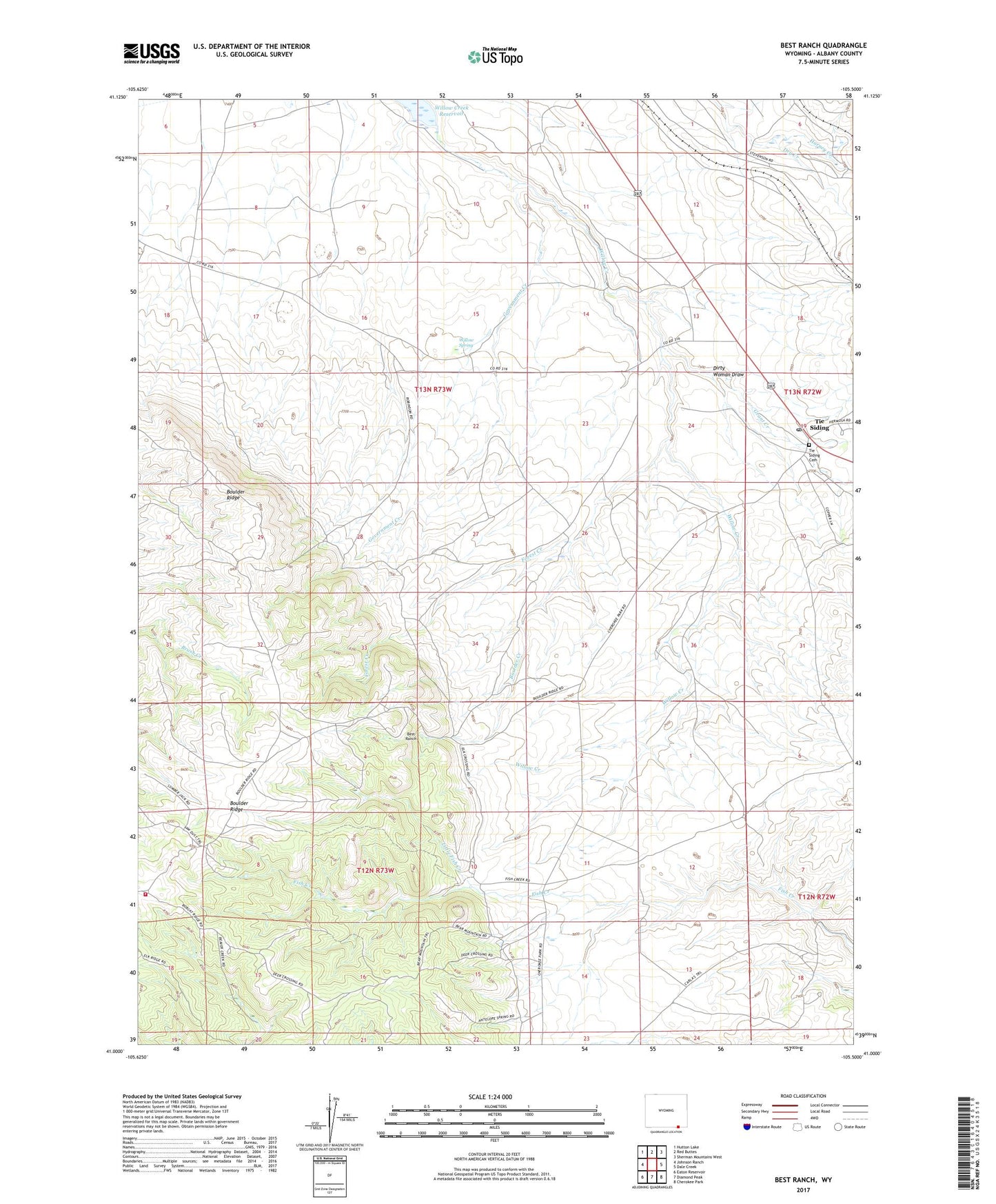
2021 topographic map quadrangle Best Ranch in the state of Wyoming. Scale: 1:24000. Based on the newly updated USGS 7.5' US Topo map series, this map is in the following counties: Albany. The map contains contour data, water features, and other items you are used to seeing on USGS maps, but also has updated roads and other features. This is the next generation of topographic maps. Printed on high-quality waterproof paper with UV fade-resistant inks.
Quads adjacent to this one:
West: Johnson Ranch
Northwest: Hutton Lake
North: Red Buttes
Northeast: Sherman Mountains West
East: Dale Creek
Southeast: Cherokee Park
South: Diamond Peak
Southwest: Eaton Reservoir
This map covers the same area as the classic USGS quad with code o41105a5.
Contains the following named places: Best Ranch, Boulder Creek, Dirty Woman Draw, Dry Creek, Forest Creek, Frazer Ranch, Government Creek, Grant Creek, Higby Ranch, King Solomon Claim, Little Fish Creek, Overland Trail, Robertson Ranch, Russell Ranch, Tie Siding, Tie Siding Cemetery, Tie Siding Fire Department, Tie Siding Post Office, Weaver Ranch, Willow Creek Dam, Willow Creek Reservoir, Willow Spring, Wright Ranch, ZIP Code: 82084