MyTopo
Circle Dot Gulch Colorado US Topo Map
Couldn't load pickup availability
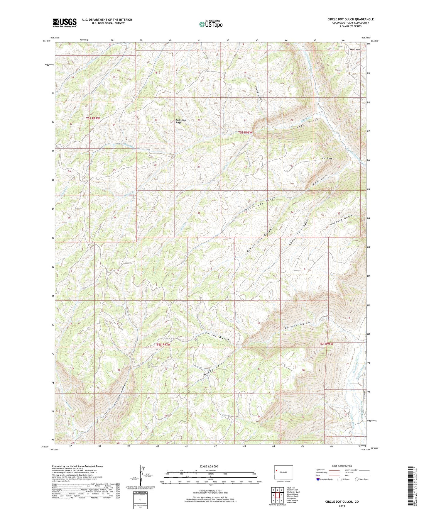
2022 topographic map quadrangle Circle Dot Gulch in the state of Colorado. Scale: 1:24000. Based on the newly updated USGS 7.5' US Topo map series, this map is in the following counties: Garfield. The map contains contour data, water features, and other items you are used to seeing on USGS maps, but also has updated roads and other features. This is the next generation of topographic maps. Printed on high-quality waterproof paper with UV fade-resistant inks.
Quads adjacent to this one:
West: Mount Blaine
Northwest: Bull Fork
North: Cutoff Gulch
Northeast: McCarthy Gulch
East: Forked Gulch
Southeast: Parachute
South: Red Pinnacle
Southwest: Long Point
This map covers the same area as the classic USGS quad with code o39108e2.
Contains the following named places: Bear Run, Cascade Canyon, Circle Dot Gulch, Corral Gulch, Crawford Trail, Davis Point, Farmer Mutual Mine, Garden Gulch, House Log Gulch, Jackrabbit Ridge, Jangle Ditch, Light Gulch, Little Creek, McKay Gulch, Red Gulch, Red Point, Sheep Gulch, Sheep Kill Gulch, Willow Creek, Wolf Creek