
MyTopo
Clark Colorado US Topo Map
Couldn't load pickup availability
Also explore the Clark Forest Service Topo of this same quad for updated USFS data
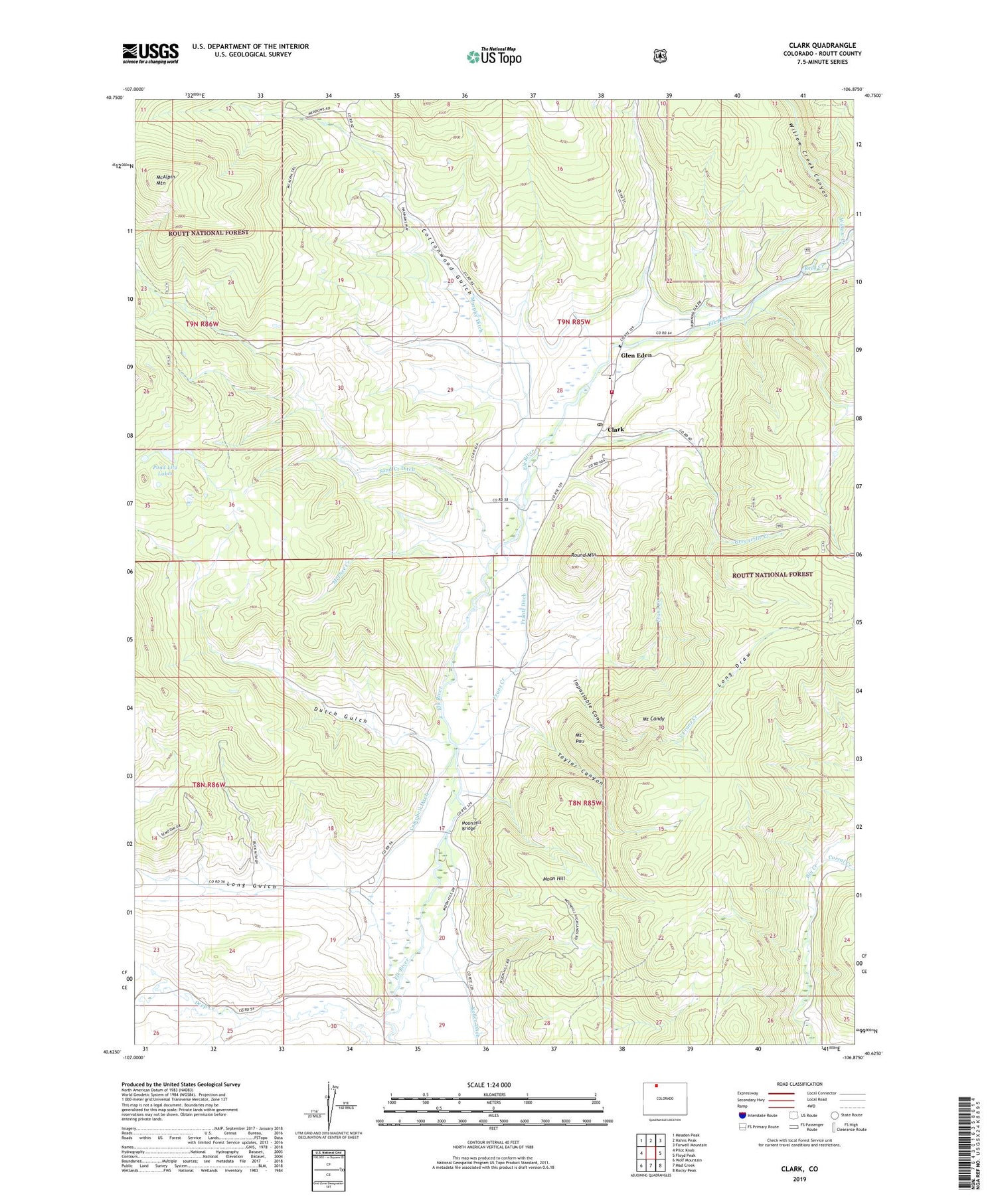
2022 topographic map quadrangle Clark in the state of Colorado. Scale: 1:24000. Based on the newly updated USGS 7.5' US Topo map series, this map is in the following counties: Routt. The map contains contour data, water features, and other items you are used to seeing on USGS maps, but also has updated roads and other features. This is the next generation of topographic maps. Printed on high-quality waterproof paper with UV fade-resistant inks.
Quads adjacent to this one:
West: Pilot Knob
Northwest: Meaden Peak
North: Hahns Peak
Northeast: Farwell Mountain
East: Floyd Peak
Southeast: Rocky Peak
South: Mad Creek
Southwest: Wolf Mountain
This map covers the same area as the classic USGS quad with code o40106f8.
Contains the following named places: Big Creek Bridge Trail, Campbell Ditch, Clark, Clark Post Office, Corral Creek, Cottonwood Gulch, Dutch Gulch, Frantz Ditch, Franz Creek, Glen Eden, Greenville Creek, Greenville Mine, Greenville Shaft, Impassable Canyon, Keller Ditch, Long Draw, Long Gulch, McAlpin Mountain, McPhee Creek, Moon Hill, Moon Hill Bridge, Moon Hill School, Mount Candy, Mount Pau, Murphy Ditch, North Routt Fire Protection District Station 1, Pond Lily Lakes, Reed Creek, Rock Creek, Round Mountain, Sand Creek, Sand Creek Ditch, South Franz Creek, Taylor Canyon, Willow Creek, Willow Creek Canyon


