
MyTopo
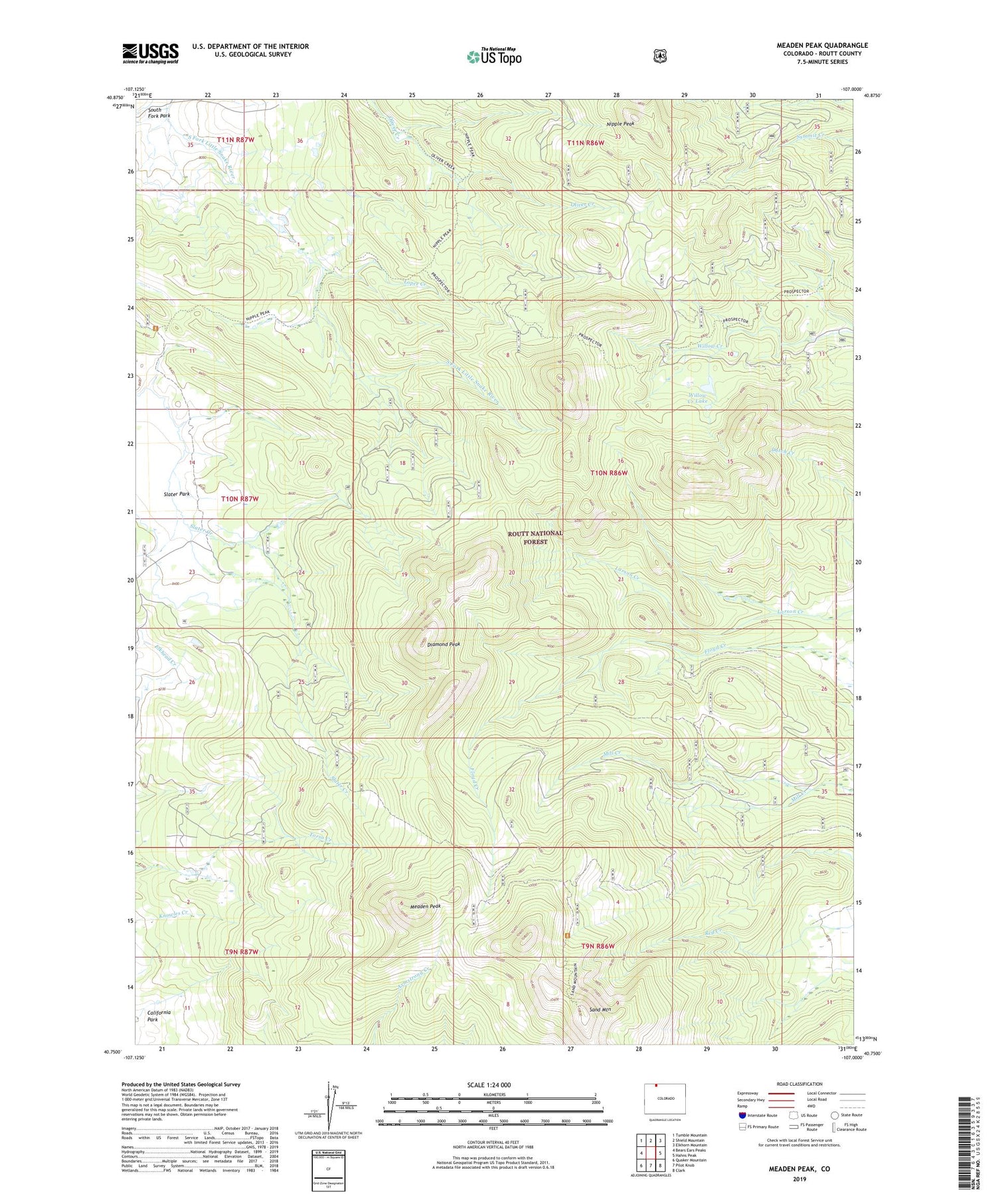
Meaden Peak Colorado US Topo Map
Couldn't load pickup availability
Also explore the Meaden Peak Forest Service Topo of this same quad for updated USFS data
2022 topographic map quadrangle Meaden Peak in the state of Colorado. Scale: 1:24000. Based on the newly updated USGS 7.5' US Topo map series, this map is in the following counties: Routt. The map contains contour data, water features, and other items you are used to seeing on USGS maps, but also has updated roads and other features. This is the next generation of topographic maps. Printed on high-quality waterproof paper with UV fade-resistant inks.
Quads adjacent to this one:
West: Bears Ears Peaks
Northwest: Tumble Mountain
North: Shield Mountain
Northeast: Elkhorn Mountain
East: Hahns Peak
Southeast: Clark
South: Pilot Knob
Southwest: Quaker Mountain
This map covers the same area as the classic USGS quad with code o40107g1.
Contains the following named places: Diamond Peak, Jolley Ranch, Lopez Creek, Meaden Peak, Nipple Peak, Prospector Trail, Sand Mountain, Smith Ranch, South Fork Park, Success Mine, Willow Creek Lake


