
MyTopo
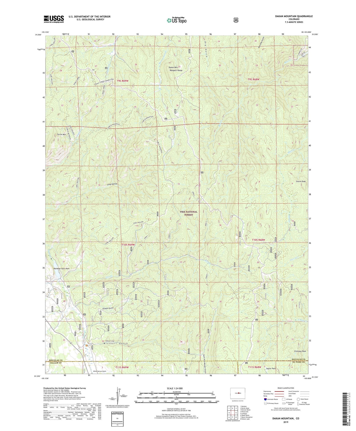
Dakan Mountain Colorado US Topo Map
Couldn't load pickup availability
Also explore the Dakan Mountain Forest Service Topo of this same quad for updated USFS data
2022 topographic map quadrangle Dakan Mountain in the state of Colorado. Scale: 1:24000. Based on the newly updated USGS 7.5' US Topo map series, this map is in the following counties: Douglas, Teller, El Paso. The map contains contour data, water features, and other items you are used to seeing on USGS maps, but also has updated roads and other features. This is the next generation of topographic maps. Printed on high-quality waterproof paper with UV fade-resistant inks.
Quads adjacent to this one:
West: Westcreek
Northwest: Deckers
North: Devils Head
Northeast: Dawson Butte
East: Larkspur
Southeast: Palmer Lake
South: Mount Deception
Southwest: Signal Butte
This map covers the same area as the classic USGS quad with code o39105b1.
Contains the following named places: Baldwin Pegmatite Mine, C and S Mine, Chimney Peak, Dakan Mountain, Denver Pegmatite Mine, Fern Creek, Fern Creek Mine, Glen Spielman Mine, Illinois Gulch, Little Anna Mine, Little Eagle Mine, Little Eddy Mine, Little Joe Mine, Lone Pine Mine, Long Hollow Trail, Lost Dutchman Mine, Missouri Gulch, Missouri Gulch Trail, Rainbow Falls Park, Rusty Pick Mine, Skeleton Number Two Mine, South Fork Missouri Gulch, South Manitou Park Trail, Spielman Mine, Storm Peak, Turtle Mountain, Watson Park Mine, White Spruce Gulch


