MyTopo
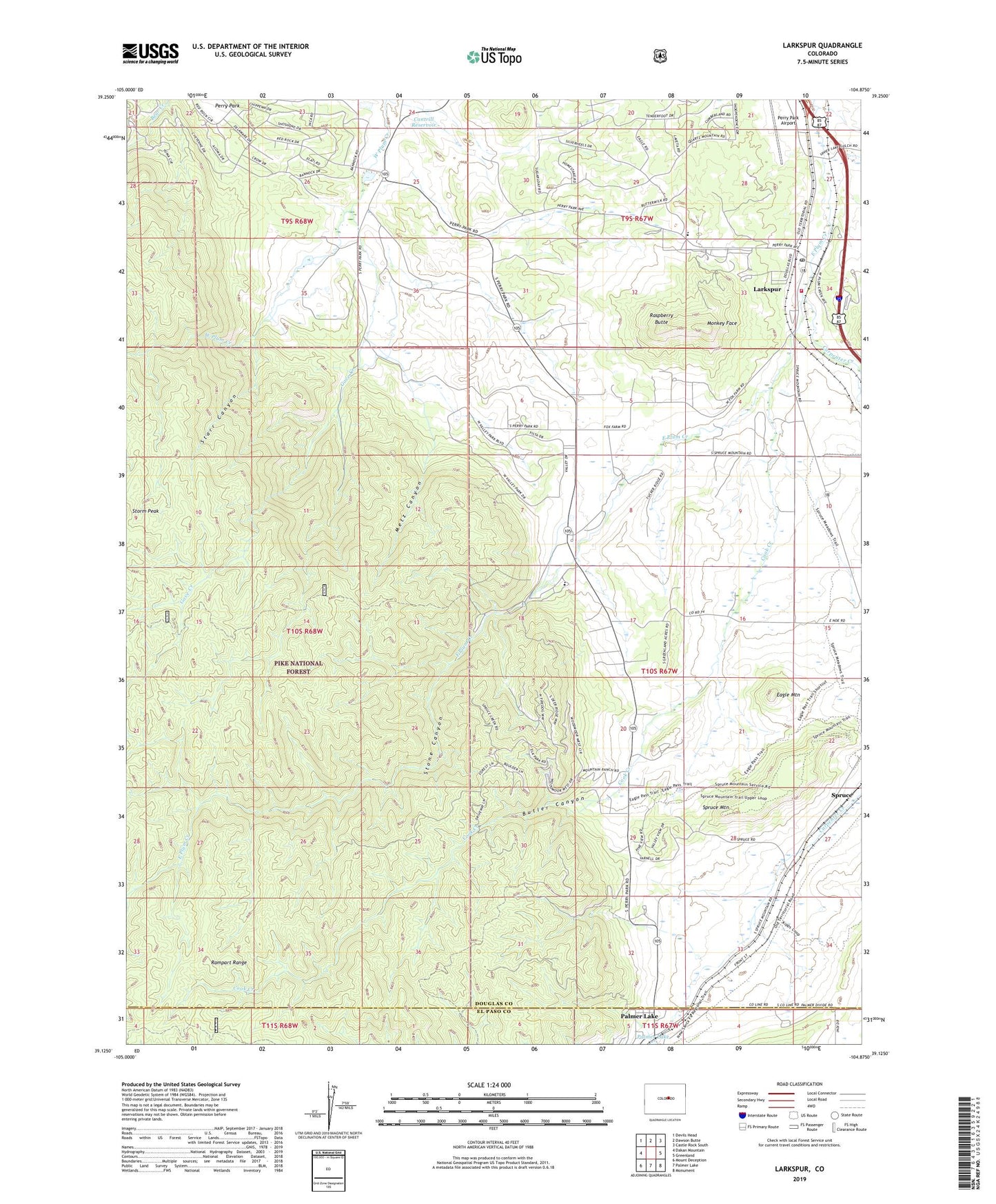
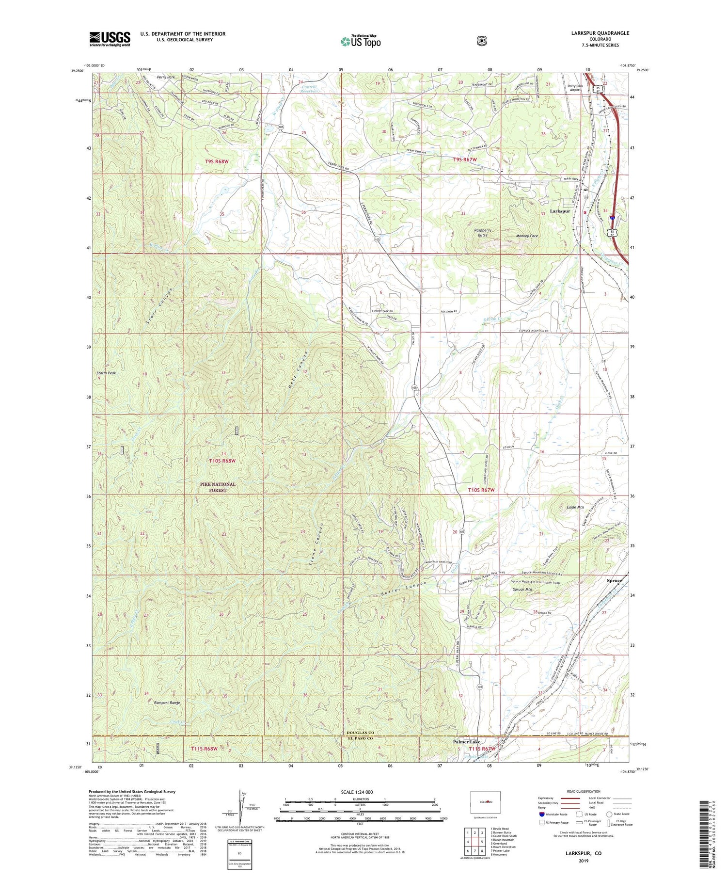
Larkspur Colorado US Topo Map
Couldn't load pickup availability
Also explore the Larkspur Forest Service Topo of this same quad for updated USFS data
2022 topographic map quadrangle Larkspur in the state of Colorado. Scale: 1:24000. Based on the newly updated USGS 7.5' US Topo map series, this map is in the following counties: Douglas, El Paso. The map contains contour data, water features, and other items you are used to seeing on USGS maps, but also has updated roads and other features. This is the next generation of topographic maps. Printed on high-quality waterproof paper with UV fade-resistant inks.
Quads adjacent to this one:
West: Dakan Mountain
Northwest: Devils Head
North: Dawson Butte
Northeast: Castle Rock South
East: Greenland
Southeast: Monument
South: Palmer Lake
Southwest: Mount Deception
This map covers the same area as the classic USGS quad with code o39104b8.
Contains the following named places: Ahlmaaz Gove Ditch, Butler Canyon, Cantrill Dam, Cantrill Reservoir, Carpenter Creek, Churchill Mine, Cook Creek, Crystal Springs Ranch, Eagle Mountain, East Plum Creek Ditch, Fazzio Ditch, Gove Creek, Green Valley Ranch, Higginson Pit, Kountz Ditch, Larkspur, Larkspur Elementary School, Larkspur Fire Protection District Station 161, Larkspur Post Office, Metz Canyon, Monkey Face, Perry Park South Ranch, Raspberry Butte, Spruce, Spruce Mountain, Stark Creek, Starr Canyon, Stone Canyon, Swank Cabin, Town of Larkspur, ZIP Code: 80118