MyTopo
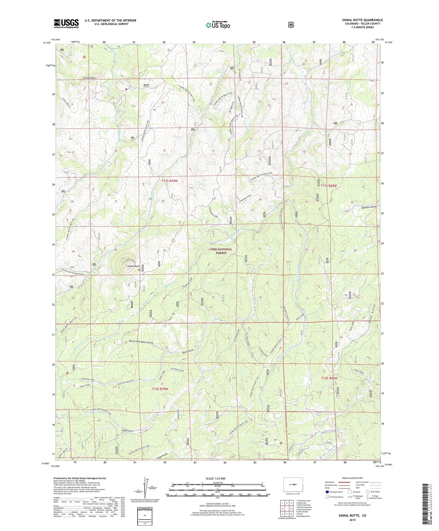
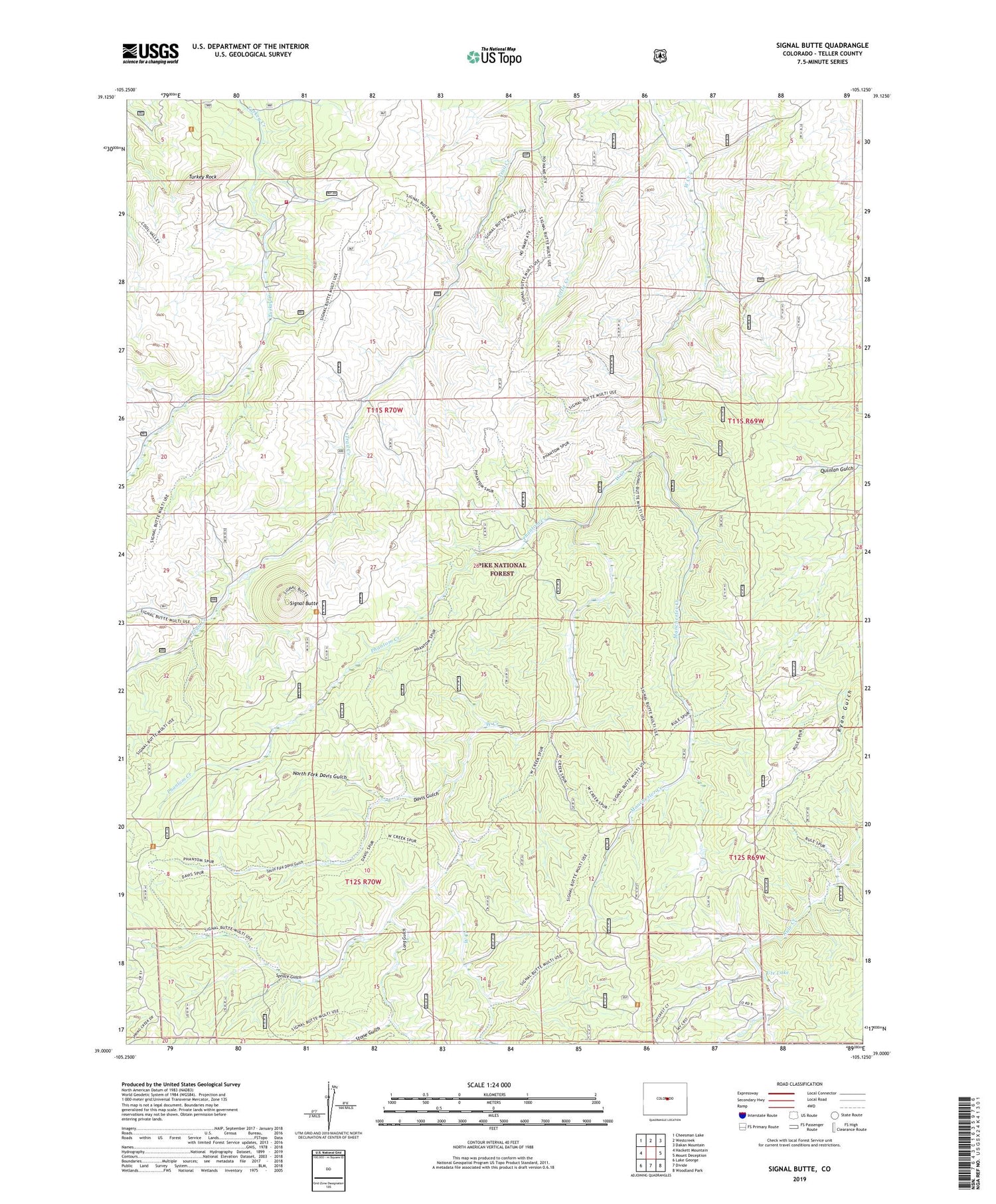
Signal Butte Colorado US Topo Map
Couldn't load pickup availability
Also explore the Signal Butte Forest Service Topo of this same quad for updated USFS data
2022 topographic map quadrangle Signal Butte in the state of Colorado. Scale: 1:24000. Based on the newly updated USGS 7.5' US Topo map series, this map is in the following counties: Teller. The map contains contour data, water features, and other items you are used to seeing on USGS maps, but also has updated roads and other features. This is the next generation of topographic maps. Printed on high-quality waterproof paper with UV fade-resistant inks.
Quads adjacent to this one:
West: Hackett Mountain
Northwest: Cheesman Lake
North: Westcreek
Northeast: Dakan Mountain
East: Mount Deception
Southeast: Woodland Park
South: Divide
Southwest: Lake George
This map covers the same area as the classic USGS quad with code o39105a2.
Contains the following named places: Big Turkey Campground, Davis Gulch, Hy-Brook Ranch, Little Creek, Long Gulch, Lost Valley Ranch, Manchester Creek, Mountain Communities Fire Protection District Station 1 Turkey Rock, North Fork Davis Gulch, Old Phantom Creek Ranger Station, Phantom Creek, Phantom Creek Trail, Rideout Ranch, Rule Creek Dam, Rule Creek Trail, Rule Ridge Trail, Signal Butte, Snowflake Mine, South Fork Davis Gulch, Spruce Gulch, Stone Gulch, Trail Creek Campground, Turkey Rock, Turkey Rock Ranch, Ute Lake