MyTopo
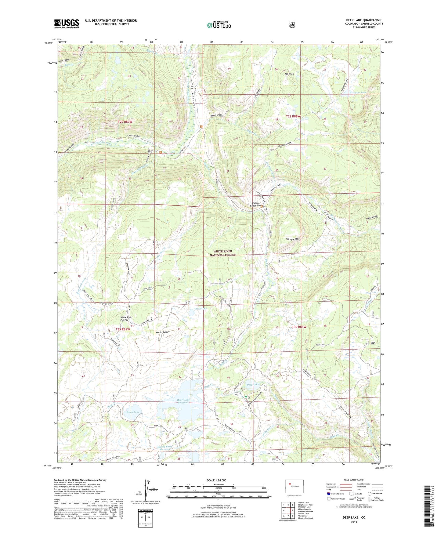
Deep Lake Colorado US Topo Map
Couldn't load pickup availability
Also explore the Deep Lake Forest Service Topo of this same quad for updated USFS data
2022 topographic map quadrangle Deep Lake in the state of Colorado. Scale: 1:24000. Based on the newly updated USGS 7.5' US Topo map series, this map is in the following counties: Garfield. The map contains contour data, water features, and other items you are used to seeing on USGS maps, but also has updated roads and other features. This is the next generation of topographic maps. Printed on high-quality waterproof paper with UV fade-resistant inks.
Quads adjacent to this one:
West: Blair Mountain
Northwest: Oyster Lake
North: Big Marvine Peak
Northeast: Trappers Lake
East: Sweetwater Lake
Southeast: Broken Rib Creek
South: Carbonate
Southwest: Adams Lake
This map covers the same area as the classic USGS quad with code o39107g3.
Contains the following named places: Bison Lake, Bison Lake Campground, Bison Lake Dam, Buck Creek, Clock Lake, Deep Lake, Deep Lake Campground, Deep Lake Campground Number 2, Dry Buck Creek, Elk Knob, Fawn Creek, Heart Lake, Heart Lake Dam, Heart Lake Reservoir, Hunns Peak, Indian Camp Pass, Indian Lake, Klines Folly Campground, Nichols Creek, Supply Basin Campground, Supply Basin Reservoir, The Meadows, Triangle Mountain, Upper Short Creek, Wagonwheel Creek, White Owl Creek