MyTopo
Elder Colorado US Topo Map
Couldn't load pickup availability
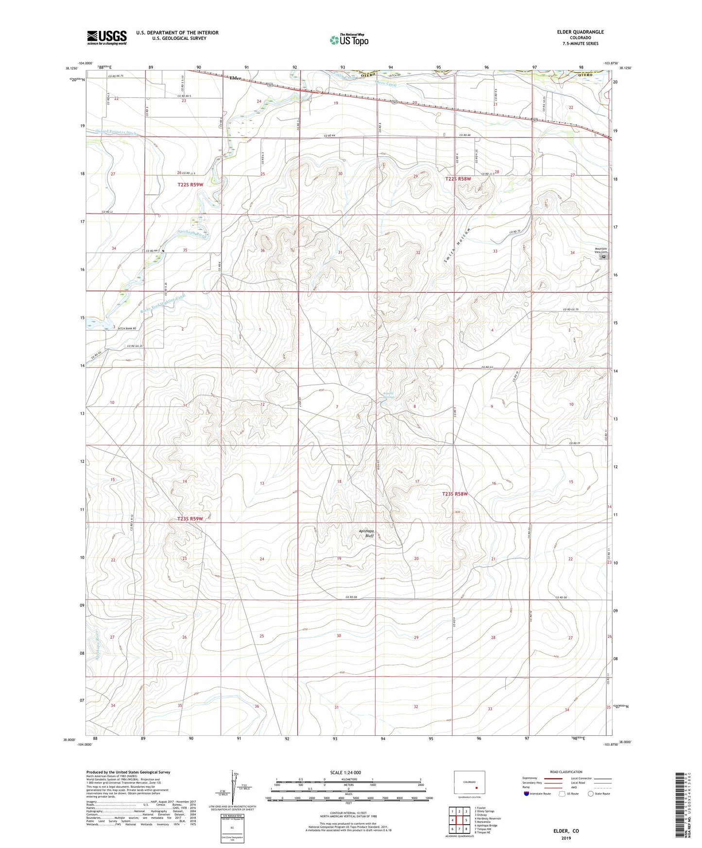
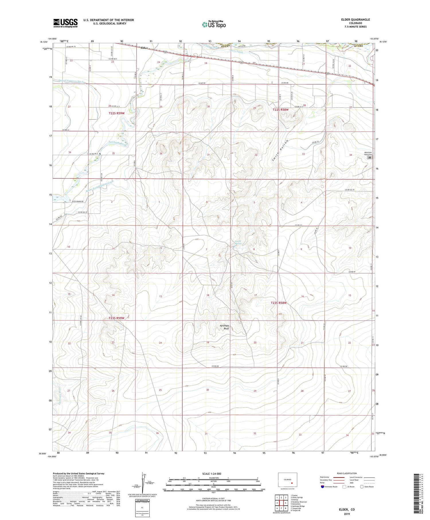
2022 topographic map quadrangle Elder in the state of Colorado. Scale: 1:24000. Based on the newly updated USGS 7.5' US Topo map series, this map is in the following counties: Otero, Crowley. The map contains contour data, water features, and other items you are used to seeing on USGS maps, but also has updated roads and other features. This is the next generation of topographic maps. Printed on high-quality waterproof paper with UV fade-resistant inks.
Quads adjacent to this one:
West: Hardesty Reservoir
Northwest: Fowler
North: Olney Springs
Northeast: Ordway
East: Manzanola
Southeast: Timpas NE
South: Timpas NW
Southwest: Apishapa Bridge
This map covers the same area as the classic USGS quad with code o38103a8.
Contains the following named places: Apishapa Bluff, Arnold Springs, Elder, Mountain View Cemetery, Rocky Ford Highline Canal, Smith Hollow, ZIP Code: 81058