
MyTopo
Apishapa Bridge Colorado US Topo Map
Couldn't load pickup availability
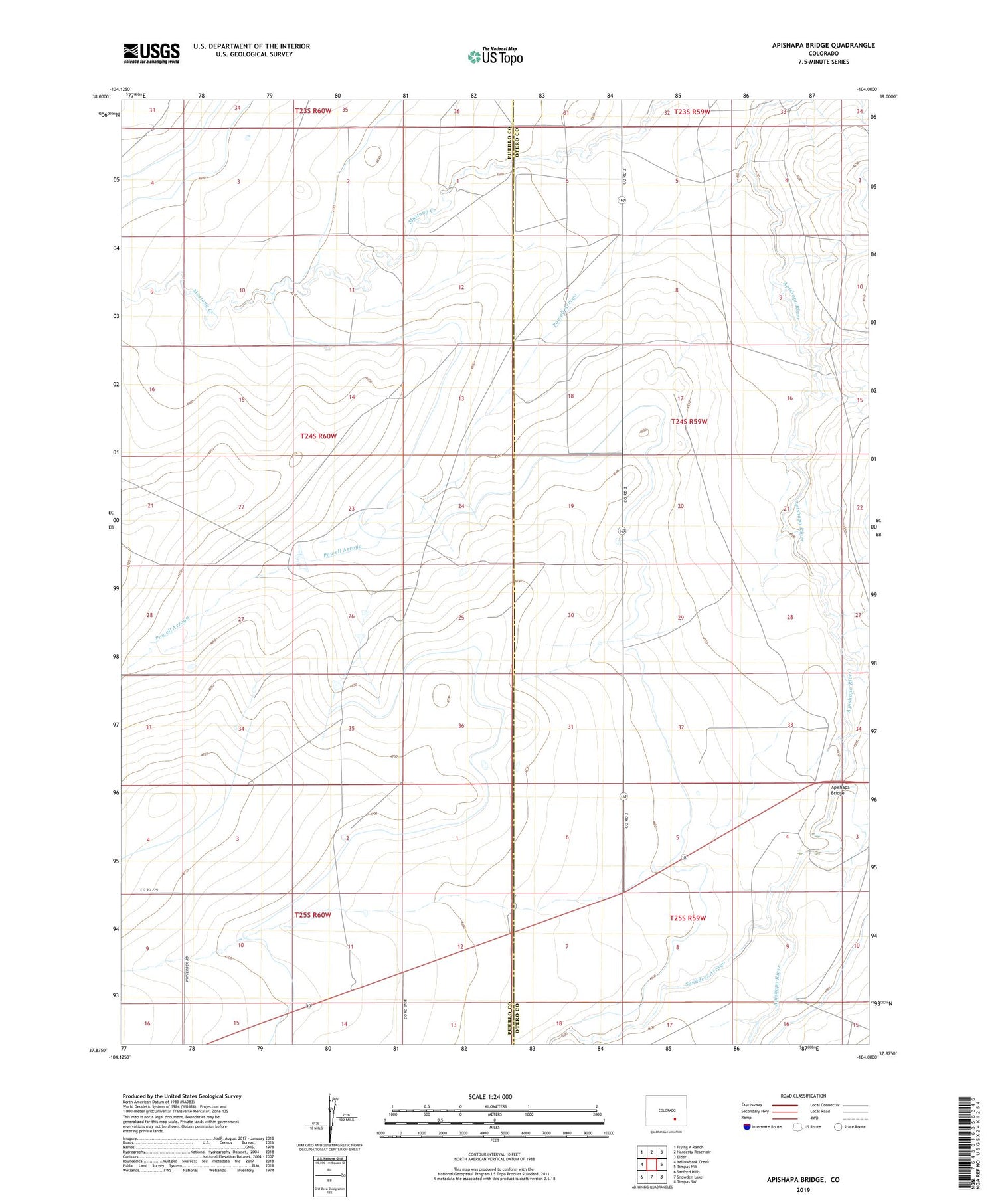
2022 topographic map quadrangle Apishapa Bridge in the state of Colorado. Scale: 1:24000. Based on the newly updated USGS 7.5' US Topo map series, this map is in the following counties: Pueblo, Otero. The map contains contour data, water features, and other items you are used to seeing on USGS maps, but also has updated roads and other features. This is the next generation of topographic maps. Printed on high-quality waterproof paper with UV fade-resistant inks.
Quads adjacent to this one:
West: Yellowbank Creek
Northwest: Flying A Ranch
North: Hardesty Reservoir
Northeast: Elder
East: Timpas NW
Southeast: Timpas SW
South: Snowden Lake
Southwest: Sanford Hills
This map covers the same area as the classic USGS quad with code o37104h1.
Contains the following named places: Apishapa Bridge, Mustang Reservoir Canal, Powell Arroyo, Saunders Arroyo, ZIP Code: 81039


