
MyTopo
Elwood Pass Colorado US Topo Map
Couldn't load pickup availability
Also explore the Elwood Pass Forest Service Topo of this same quad for updated USFS data
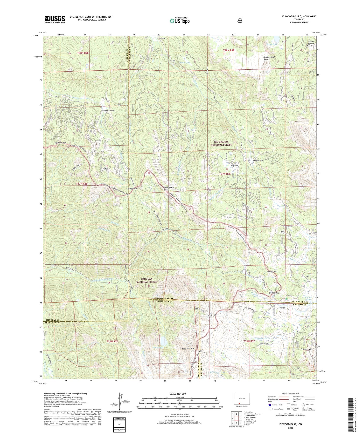
2022 topographic map quadrangle Elwood Pass in the state of Colorado. Scale: 1:24000. Based on the newly updated USGS 7.5' US Topo map series, this map is in the following counties: Rio Grande, Mineral, Archuleta, Conejos. The map contains contour data, water features, and other items you are used to seeing on USGS maps, but also has updated roads and other features. This is the next generation of topographic maps. Printed on high-quality waterproof paper with UV fade-resistant inks.
Quads adjacent to this one:
West: Wolf Creek Pass
Northwest: Mount Hope
North: Beaver Creek Reservoir
Northeast: Del Norte Peak
East: Summitville
Southeast: Platoro
South: Summit Peak
Southwest: Blackhead Peak
This map covers the same area as the classic USGS quad with code o37106d6.
Contains the following named places: Bear Creek, Big Park, Black Diamond Mine, Bonito Pass, Campo Molino, Crater Creek, Crater Lake, Elwood Creek, Elwood Pass, Fivemile Park, Handkerchief Mesa, Hot Creek Stock Driveway, Lady Bug Mine, Long Trek Mountain, Lost Creek, McCormick Cabin, Middle Fork Park Creek, Minesite Cabin, Poage Lake, Prospect Mountain, Railroad Pass, Robert Burns Claim, Schinzel Flats, Silver Creek Trail, Summit Pass, Swale Lake, West Fork Park Creek


