
MyTopo
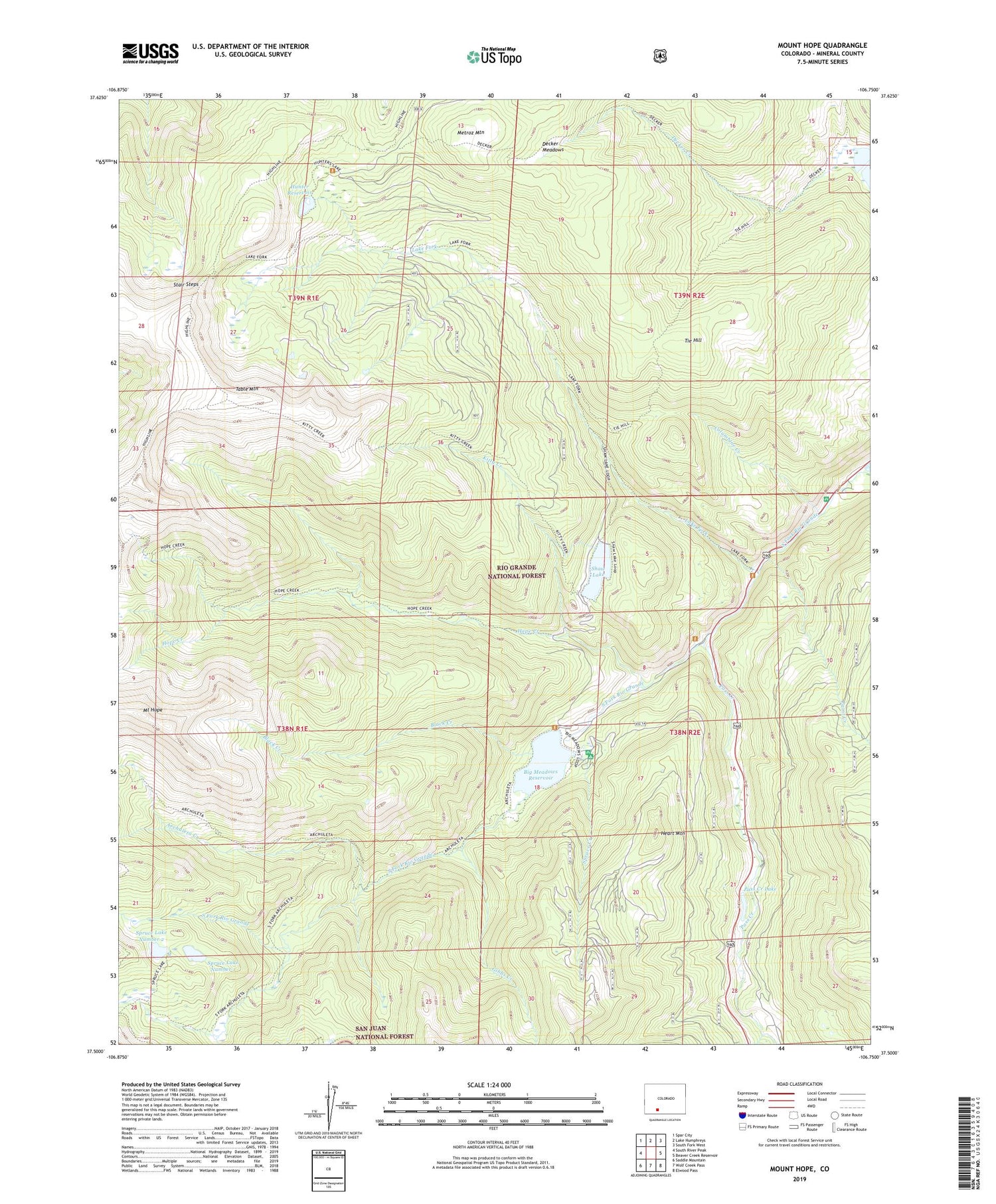
Mount Hope Colorado US Topo Map
Couldn't load pickup availability
Also explore the Mount Hope Forest Service Topo of this same quad for updated USFS data
2022 topographic map quadrangle Mount Hope in the state of Colorado. Scale: 1:24000. Based on the newly updated USGS 7.5' US Topo map series, this map is in the following counties: Mineral. The map contains contour data, water features, and other items you are used to seeing on USGS maps, but also has updated roads and other features. This is the next generation of topographic maps. Printed on high-quality waterproof paper with UV fade-resistant inks.
Quads adjacent to this one:
West: South River Peak
Northwest: Spar City
North: Lake Humphreys
Northeast: South Fork West
East: Beaver Creek Reservoir
Southeast: Elwood Pass
South: Wolf Creek Pass
Southwest: Saddle Mountain
This map covers the same area as the classic USGS quad with code o37106e7.
Contains the following named places: Archuleta Creek, Big Meadows Campground, Big Meadows Dam, Big Meadows Reservoir, Black Creek, Columbine Campground, Columbine Creek, Decker Meadows, Fisherman Parking, Gibbs Creek, Heart Mountain, Highline Trail, Hope Creek, Hunter Reservoir, Hunters Lake, Hunters Lake Dam, Hunters Lake Trailhead, Kitty Creek, Lake Fork, Lake Fork Campground, Lake Fork National Recreation Trail, Metroz Mountain, Metroz Park Upper Dam, Metroz Reservoir, Mount Hope, Paint Creek, Pass Creek, Pass Creek Lake, Shaw Dam, Shaw Lake, Spruce Creek, Spruce Lake Number 1, Spruce Lake Number 1 Dam, Spruce Lake Number 2, Spruce Lake Number 2 Dam, Spruce Lakes, Stair Steps, Table Mountain, Tie Hill


