
MyTopo
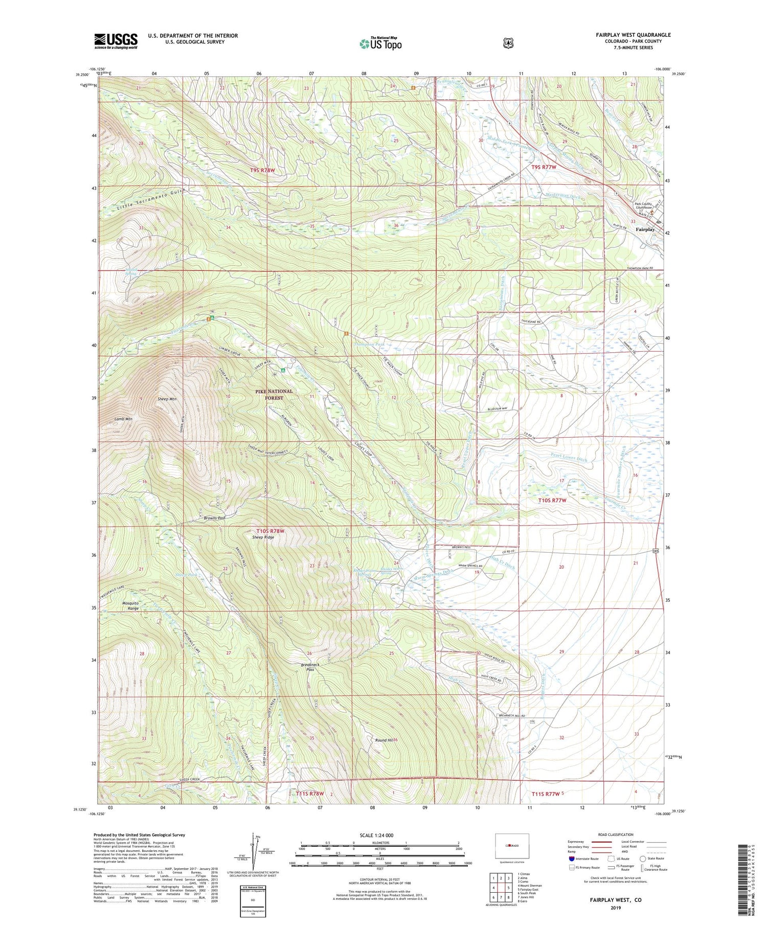
Fairplay West Colorado US Topo Map
Couldn't load pickup availability
Also explore the Fairplay West Forest Service Topo of this same quad for updated USFS data
2022 topographic map quadrangle Fairplay West in the state of Colorado. Scale: 1:24000. Based on the newly updated USGS 7.5' US Topo map series, this map is in the following counties: Park. The map contains contour data, water features, and other items you are used to seeing on USGS maps, but also has updated roads and other features. This is the next generation of topographic maps. Printed on high-quality waterproof paper with UV fade-resistant inks.
Quads adjacent to this one:
West: Mount Sherman
Northwest: Climax
North: Alma
Northeast: Como
East: Fairplay East
Southeast: Garo
South: Jones Hill
Southwest: South Peak
This map covers the same area as the classic USGS quad with code o39106b1.
Contains the following named places: Almgren Tie Camp, Barco Mine, Breakneck Pass, Browns Pass, Columbia Number 1 Ditch, Denver Mine, Duguesne Smelter, East Leadville, Emma Mine, Fairplay, Fairplay Mining Ditch, Fairplay Post Office, Four Mile Campground, Fourmile Number 9 Ditch, Freedom Mine, High Creek Ditch, Holland, Horseshoe, Horseshoe Campground, Kurt Mine, Lamb Mountain, Limber Grove Trail, Little Nell Mine, Little Nellie Mine, Little Sacramento Gulch, Michigan Mine, Mudsill Mine, Mudsill Spring, Mullenville, Peart Lower Ditch, Peart Upper Ditch, Pennsylvania Creek, Placer Ditch, Platte River Placers Mine, Revenue Mine, Rhodes Warm Spring, Rhodes Warm Springs, Rogers Ditch, Round Hill, Sacramento, Sacramento Creek, Sacramento Ditch, Sacramento Heliport, Sacramento Mine, Sheep Mountain, Sheep Park, Sheep Ridge, Sherwood Mine, Silver Star Mine, Sitting Bull Mine, South Park City Museum, Spar Mine, Thompson Park, Troy Mine, Warm Springs Ditch, Watseka Mine, Westerman Ditch


