MyTopo
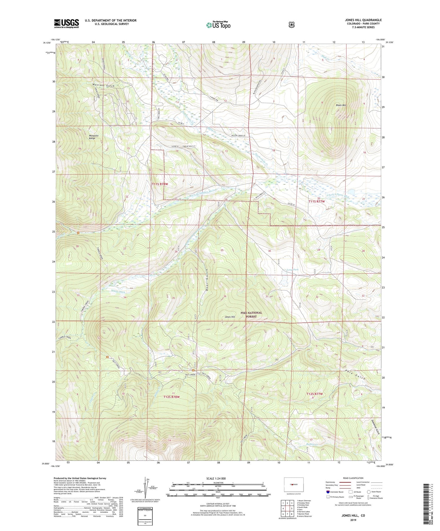
Jones Hill Colorado US Topo Map
Couldn't load pickup availability
Also explore the Jones Hill Forest Service Topo of this same quad for updated USFS data
2022 topographic map quadrangle Jones Hill in the state of Colorado. Scale: 1:24000. Based on the newly updated USGS 7.5' US Topo map series, this map is in the following counties: Park. The map contains contour data, water features, and other items you are used to seeing on USGS maps, but also has updated roads and other features. This is the next generation of topographic maps. Printed on high-quality waterproof paper with UV fade-resistant inks.
Quads adjacent to this one:
West: South Peak
Northwest: Mount Sherman
North: Fairplay West
Northeast: Fairplay East
East: Garo
Southeast: Antero Reservoir
South: Marmot Peak
Southwest: Harvard Lakes
This map covers the same area as the classic USGS quad with code o39106a1.
Contains the following named places: Bear Gulch, Black Mountain, Cave Creek, Golden Calf Mine, Jones Hill, Long Park, Lynch Creek, Mikles Ditch, Platte Station Ditch, Rich Creek, Rich Creek Campground, Rough and Tumbling Creek, Salt Creek Trail, Sheep Creek, South London Mine, Tom Dick and Harry Mine, Tumble Creek Trail, Twelvemile Club, Twelvemile Creek, Watrous Gulch, Weston Pass Ranch, Willow Creek