MyTopo
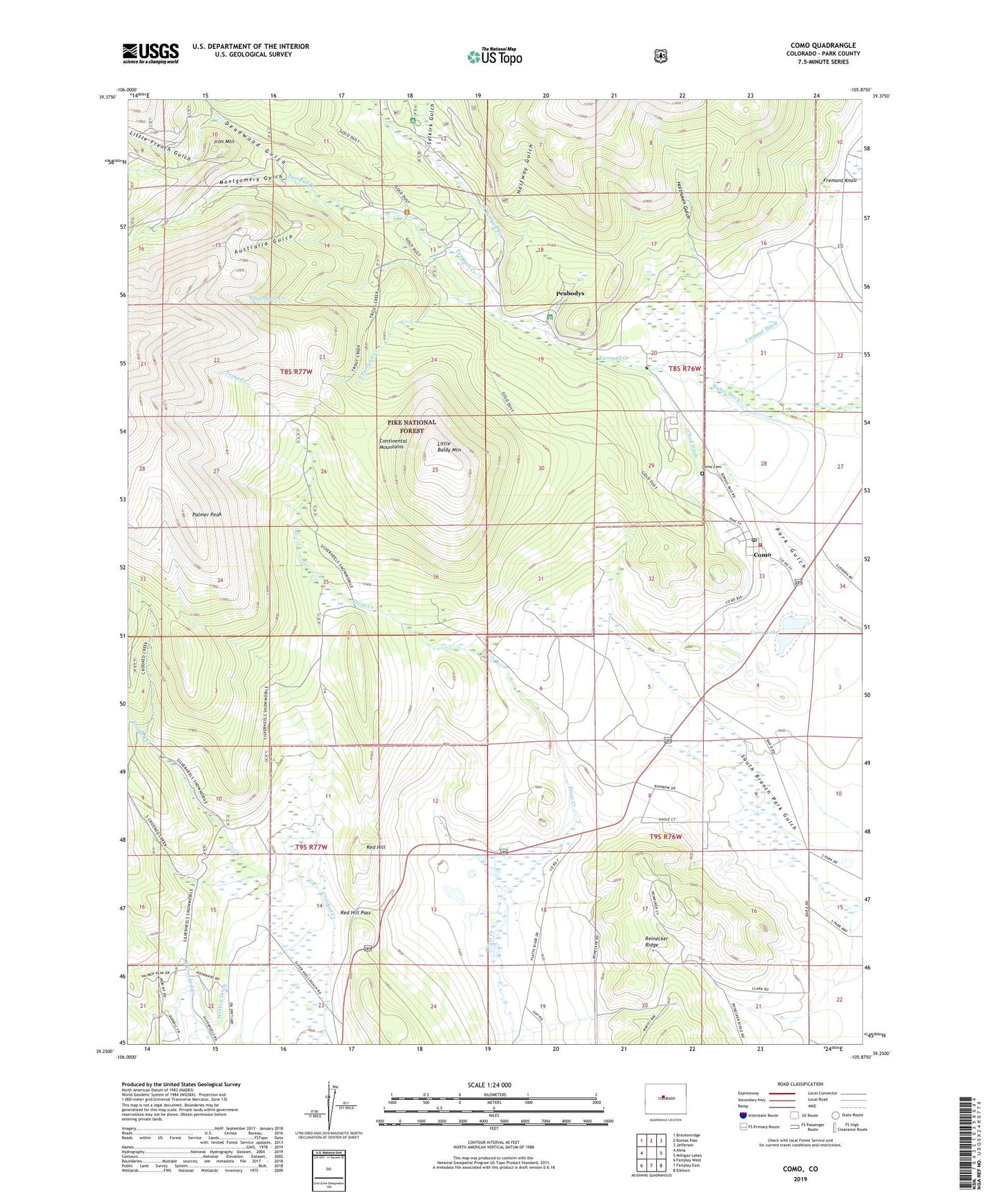
Como Colorado US Topo Map
Couldn't load pickup availability
Also explore the Como Forest Service Topo of this same quad for updated USFS data
2022 topographic map quadrangle Como in the state of Colorado. Scale: 1:24000. Based on the newly updated USGS 7.5' US Topo map series, this map is in the following counties: Park. The map contains contour data, water features, and other items you are used to seeing on USGS maps, but also has updated roads and other features. This is the next generation of topographic maps. Printed on high-quality waterproof paper with UV fade-resistant inks.
Quads adjacent to this one:
West: Alma
Northwest: Breckenridge
North: Boreas Pass
Northeast: Jefferson
East: Milligan Lakes
Southeast: Elkhorn
South: Fairplay East
Southwest: Fairplay West
This map covers the same area as the classic USGS quad with code o39105c8.
Contains the following named places: Anderson Brewer Ditch, Australia Gulch, Bar D Ranch, Circle V Bar Eightmile Ranch, Circle V Bar Line Camp, Circle V Bar Ranch, Clark Ranch, Como, Como Cemetery, Como Lake, Como Post Office, Davis Overlook, Deadwood Gulch, Deadwood Gulch Claims Mine, Fortune Placer Mine, Fremont Ditch, Fremont School, Gold Dust Trail, Halfway Gulch, Hamilton, Hawkeye Mining Company Mine, Holthusen Gulch, Iron Mountain, Jefferson - Como Fire Protection District Station 2 Como, Little Baldy Mountain, Little French Gulch, Look Tunnel, Montgomery Gulch, North Tarryall Creek, O'Neil Ditch, Palmer Peak, Park County Claims Mine, Peabodys, Red Hill Pass, Red Hill Ranch, Robinson Ranch, Rocking R Sky Ranch, Selkirk Campground, Selkirk Gulch, Silverheels Creek, Silverheels Ditch, Silverheels Mine, South Tarryall Creek, Trout Creek Ditch, Uhl Cabin, Wadley Ditch 1, Wadley Ditch 2, Welch Sawmill, Weston Ditch