MyTopo
Fish Creek Colorado US Topo Map
Couldn't load pickup availability
Also explore the Fish Creek Forest Service Topo of this same quad for updated USFS data
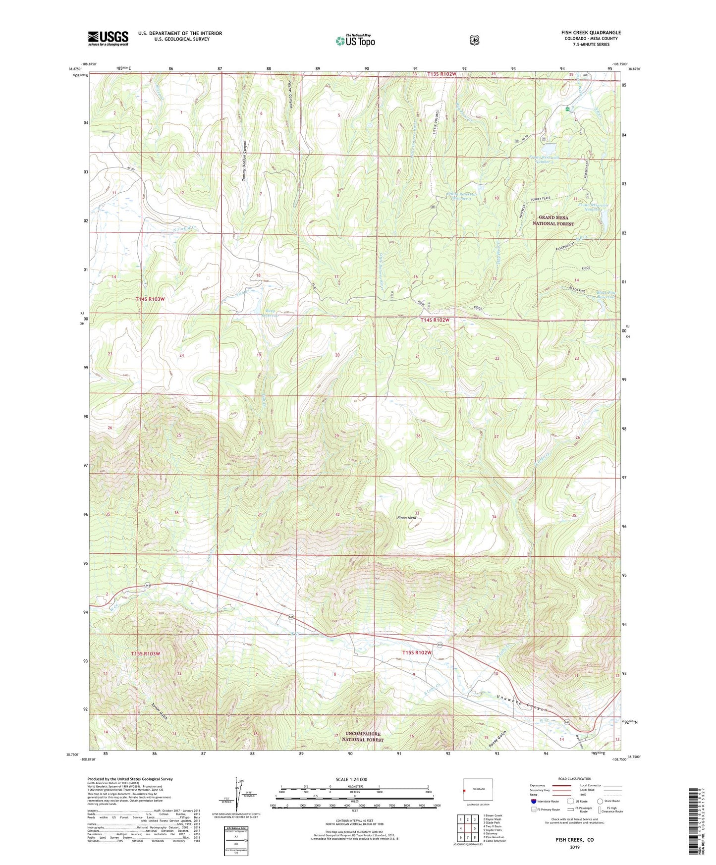
2022 topographic map quadrangle Fish Creek in the state of Colorado. Scale: 1:24000. Based on the newly updated USGS 7.5' US Topo map series, this map is in the following counties: Mesa. The map contains contour data, water features, and other items you are used to seeing on USGS maps, but also has updated roads and other features. This is the next generation of topographic maps. Printed on high-quality waterproof paper with UV fade-resistant inks.
Quads adjacent to this one:
West: Two V Basin
Northwest: Bieser Creek
North: Payne Wash
Northeast: Glade Park
East: Snyder Flats
Southeast: Casto Reservoir
South: Pine Mountain
Southwest: Gateway
This map covers the same area as the classic USGS quad with code o38108g7.
Contains the following named places: Bear Canyon, Bear Creek, Black Pine Reservoir, Burg Dam, Burg Reservoir, Fish Creek, Fruita Number 1 Dam, Fruita Number 2 Dam, Fruita Number 3 Dam, Fruita Picnic Area, Fruita Reservoir Number 3, Fruita Reservoir Number One, Fruita Reservoir Number Two, Hay Press Campground, North Lobe Creek, Pansy Gulch, Pinon Mesa, South Lobe Creek