MyTopo
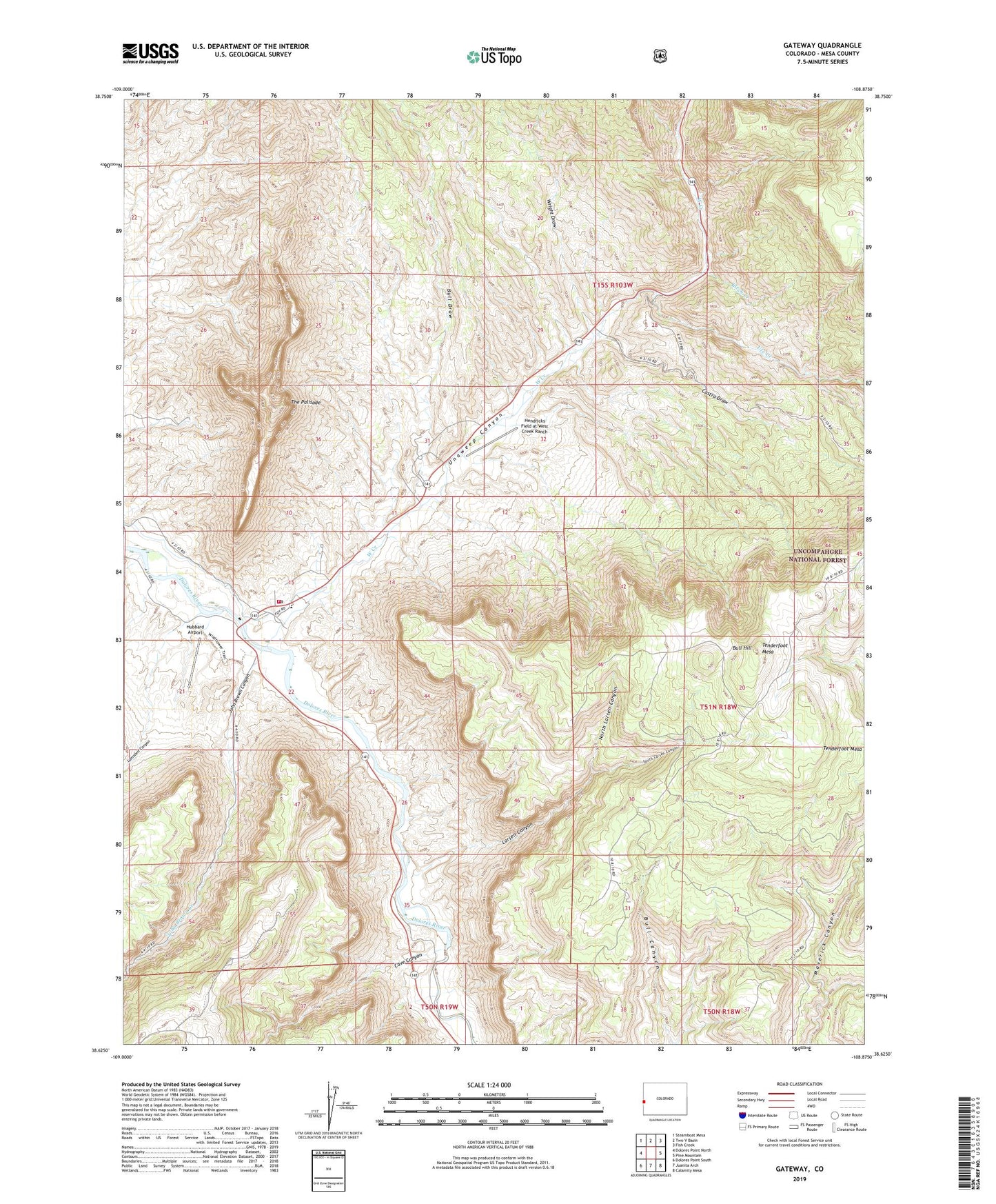
Gateway Colorado US Topo Map
Couldn't load pickup availability
Also explore the Gateway Forest Service Topo of this same quad for updated USFS data
2022 topographic map quadrangle Gateway in the state of Colorado. Scale: 1:24000. Based on the newly updated USGS 7.5' US Topo map series, this map is in the following counties: Mesa. The map contains contour data, water features, and other items you are used to seeing on USGS maps, but also has updated roads and other features. This is the next generation of topographic maps. Printed on high-quality waterproof paper with UV fade-resistant inks.
Quads adjacent to this one:
West: Dolores Point North
Northwest: Steamboat Mesa
North: Two V Basin
Northeast: Fish Creek
East: Pine Mountain
Southeast: Calamity Mesa
South: Juanita Arch
Southwest: Dolores Point South
This map covers the same area as the classic USGS quad with code o38108f8.
Contains the following named places: Birch Creek, Black Mama Number 3 Mine, Bull Draw, Bull Hill, Castro Draw, Cave Canyon, Gateway, Gateway - Unaweep Fire Protection District, Gateway Post Office, Hendricks Field at West Creek Ranch, Hubbard Airport, John Brown Canyon, John Brown Creek, Larsen Canyon, Liberty Bell Number 2 Mine, Lumsden Canyon, Mammoth Mine, North Larsen Canyon, Protector Mine, Rajah Group Mines, Rena Mine, Shelby Dean Two Mine, South Larsen Canyon, Tenderfoot Camp, Tenderfoot Group Mine, Tenderfoot Mesa, The Palisade, Ute Creek, Vanadium King Mine, Vanaking Number 1 Mine, Wayside Chaple, West Creek, Wright Draw