MyTopo
Pine Mountain Colorado US Topo Map
Couldn't load pickup availability
Also explore the Pine Mountain Forest Service Topo of this same quad for updated USFS data
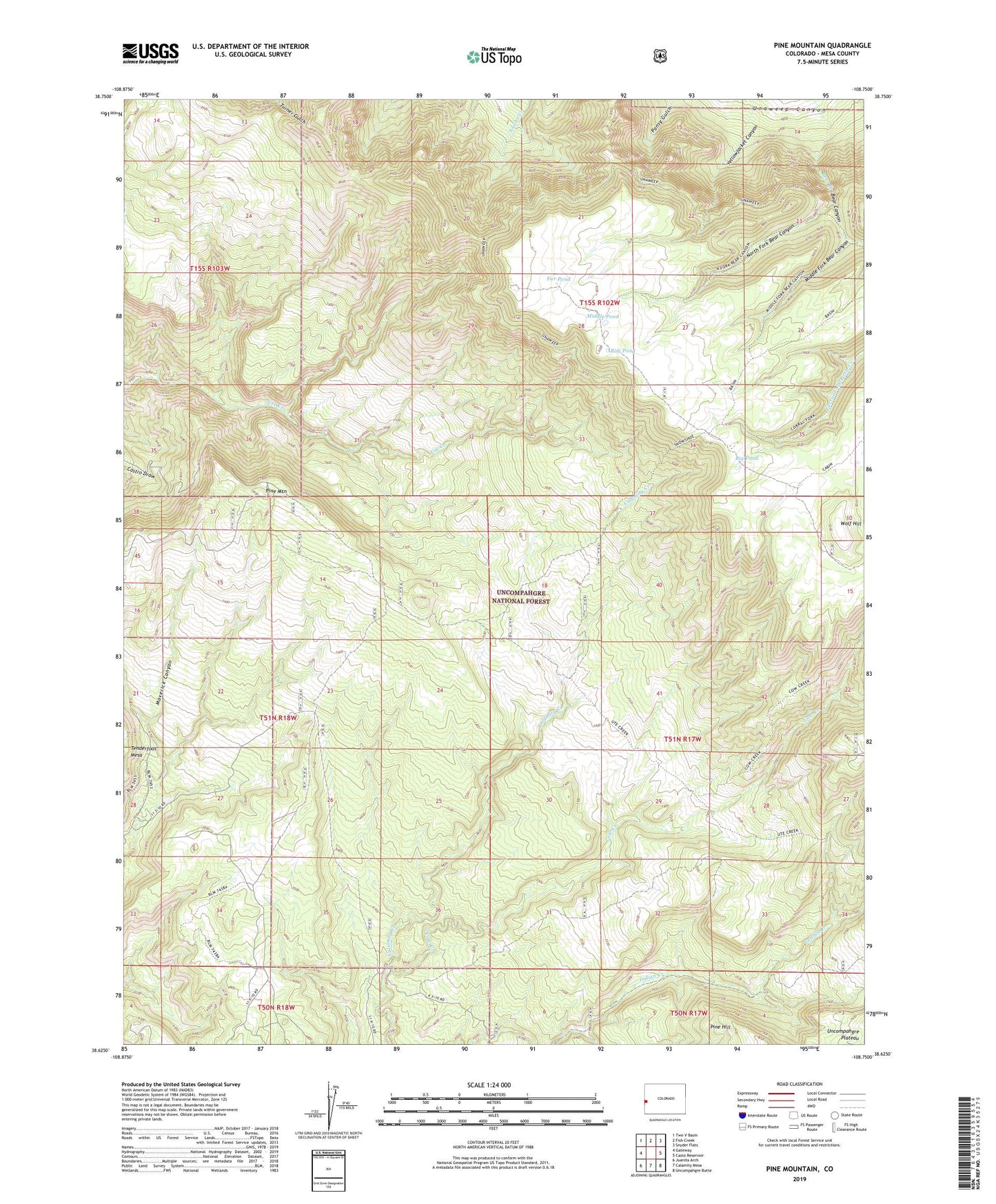
2022 topographic map quadrangle Pine Mountain in the state of Colorado. Scale: 1:24000. Based on the newly updated USGS 7.5' US Topo map series, this map is in the following counties: Mesa. The map contains contour data, water features, and other items you are used to seeing on USGS maps, but also has updated roads and other features. This is the next generation of topographic maps. Printed on high-quality waterproof paper with UV fade-resistant inks.
Quads adjacent to this one:
West: Gateway
Northwest: Two V Basin
North: Fish Creek
Northeast: Snyder Flats
East: Casto Reservoir
Southeast: Uncompahgre Butte
South: Calamity Mesa
Southwest: Juanita Arch
This map covers the same area as the classic USGS quad with code o38108f7.
Contains the following named places: Big Pond, Cow Creek, Far Pond, Maverick Mine, Middle Fork Bear Canyon, Middle Pond, North Fork Bear Canyon, Pine Mountain, Rim Pond, Snowshoe Trail, Wolf Hill, Yellow Jacket Mine, Yellowjacket Canyon