
MyTopo
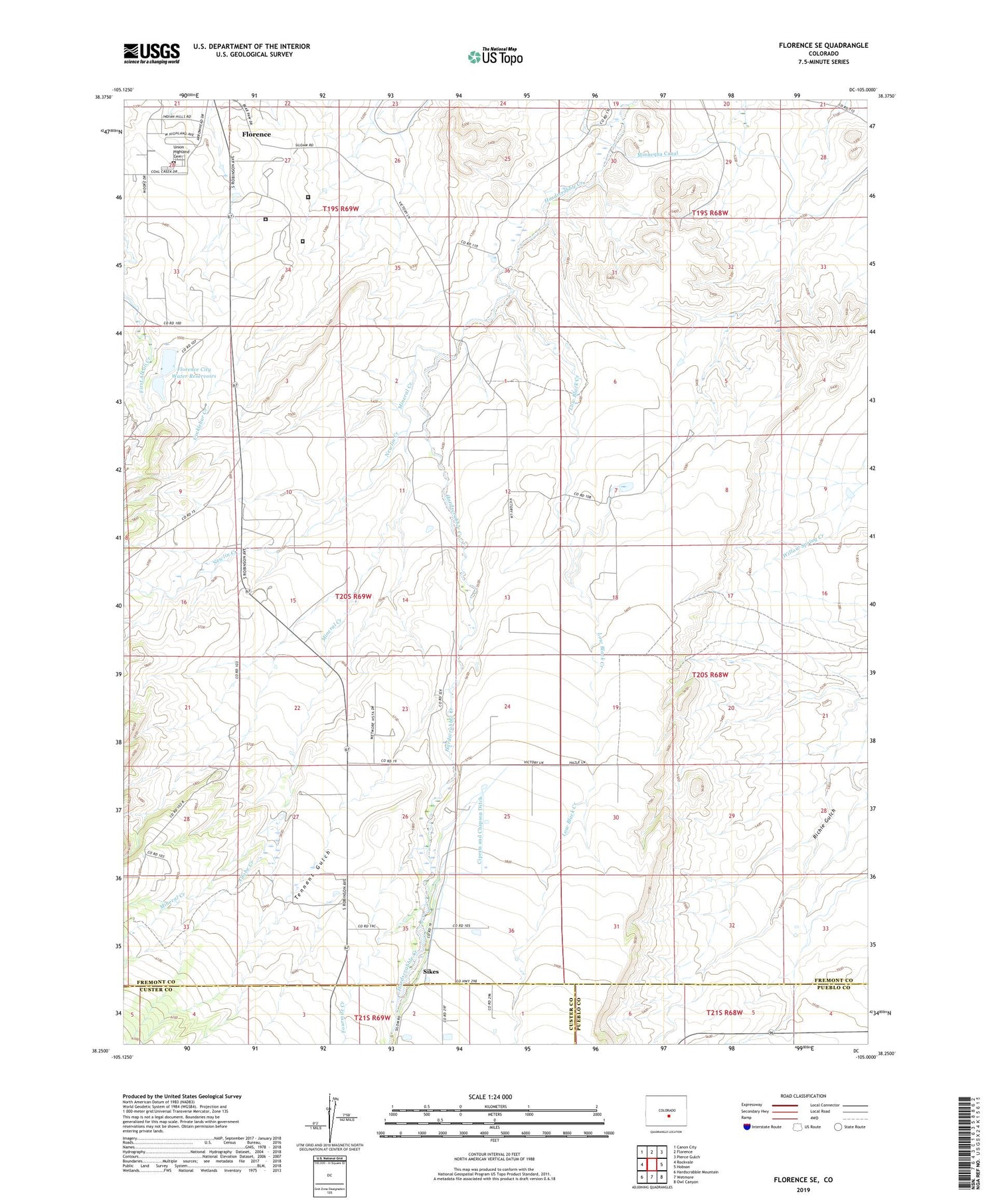
Florence SE Colorado US Topo Map
Couldn't load pickup availability
2022 topographic map quadrangle Florence SE in the state of Colorado. Scale: 1:24000. Based on the newly updated USGS 7.5' US Topo map series, this map is in the following counties: Fremont, Custer, Pueblo. The map contains contour data, water features, and other items you are used to seeing on USGS maps, but also has updated roads and other features. This is the next generation of topographic maps. Printed on high-quality waterproof paper with UV fade-resistant inks.
Quads adjacent to this one:
West: Rockvale
Northwest: Canon City
North: Florence
Northeast: Pierce Gulch
East: Hobson
Southeast: Owl Canyon
South: Wetmore
Southwest: Hardscrabble Mountain
This map covers the same area as the classic USGS quad with code o38105c1.
Contains the following named places: Adobe Creek, Ciperts and Chapson Ditch, Dew Hope Church, Federal Correctional Institution Florence - Medium, Florence City Water Reservoirs, Fourmile Creek, Low Black Creek, Mineral Creek, Mountain View Community Hall, Newlin Creek, Sikes, Tennant Gulch, Union Highland Cemetery, United States Administative Security Penitentiary Florence, United States Penitentiary Florence - High


