MyTopo
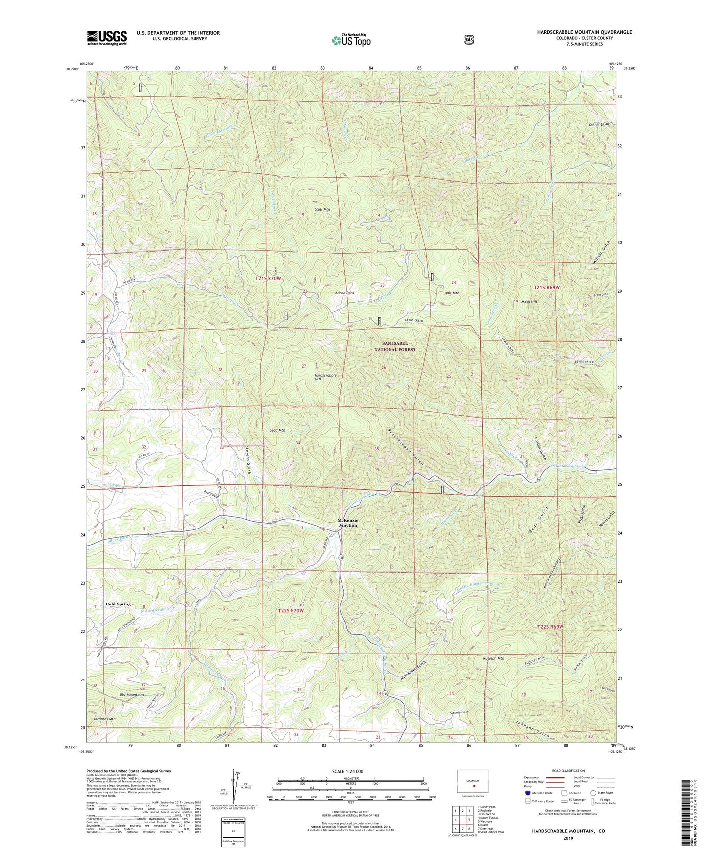
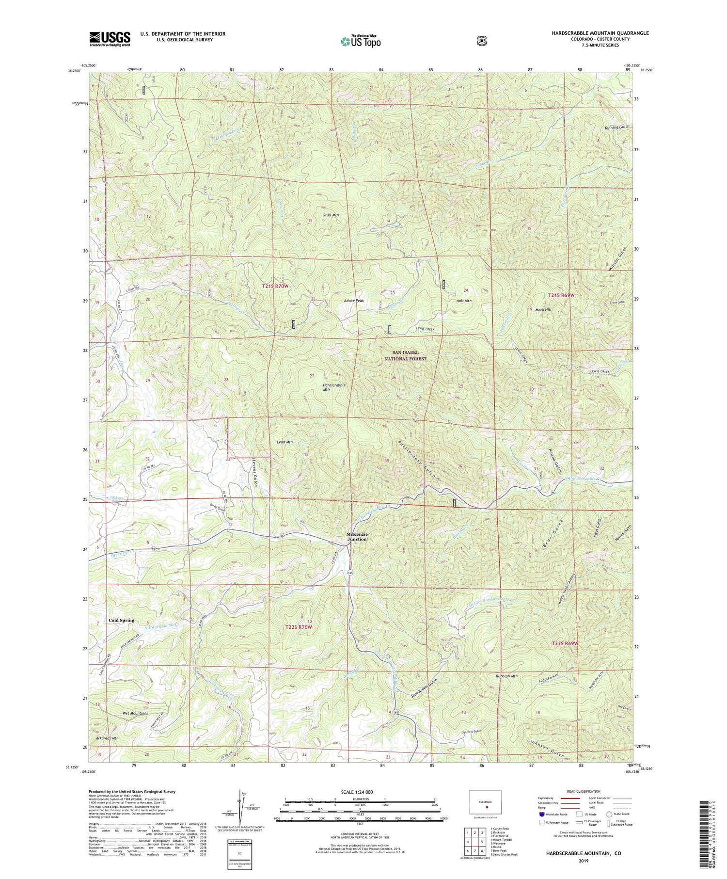
Hardscrabble Mountain Colorado US Topo Map
Couldn't load pickup availability
Also explore the Hardscrabble Mountain Forest Service Topo of this same quad for updated USFS data
2022 topographic map quadrangle Hardscrabble Mountain in the state of Colorado. Scale: 1:24000. Based on the newly updated USGS 7.5' US Topo map series, this map is in the following counties: Custer. The map contains contour data, water features, and other items you are used to seeing on USGS maps, but also has updated roads and other features. This is the next generation of topographic maps. Printed on high-quality waterproof paper with UV fade-resistant inks.
Quads adjacent to this one:
West: Mount Tyndall
Northwest: Curley Peak
North: Rockvale
Northeast: Florence SE
East: Wetmore
Southeast: Saint Charles Peak
South: Deer Peak
Southwest: Rosita
This map covers the same area as the classic USGS quad with code o38105b2.
Contains the following named places: Adobe Peak, Bear Gulch, Bettis Gulch, Bishop Creek, Cold Spring, Fourth Newlin Creek, Hardscrabble Mountain, Holt Mountain, Hoza Ranch Mine, Jean Brown Gulch, Junkins Park Creek, Lead Mountain, McKenzie Junction, Mineral-Stevens Trail, Mock Hill, Poison Gulch, Rattlesnake Gulch, Riggs Gulch, Rudolph Mountain, Rudolph Mountain Trail, Satterly Gulch, Sewell Ranch Mine, Silver Park Creek, Silver Park School, Smith Creek, Smith Creek Campground, South Fork North Hardscrabble Creek, Stevens Gulch, Stull Mountain, Terrible Mine, Washout Creek, Wild Girl Mine, Willow Creek