MyTopo
Highline Lake Colorado US Topo Map
Couldn't load pickup availability
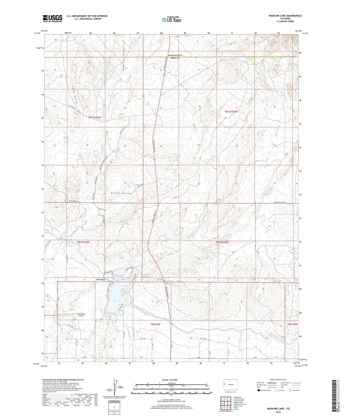
2022 topographic map quadrangle Highline Lake in the state of Colorado. Scale: 1:24000. Based on the newly updated USGS 7.5' US Topo map series, this map is in the following counties: Mesa, Garfield. The map contains contour data, water features, and other items you are used to seeing on USGS maps, but also has updated roads and other features. This is the next generation of topographic maps. Printed on high-quality waterproof paper with UV fade-resistant inks.
Quads adjacent to this one:
West: Badger Wash
Northwest: Carbonera
North: Howard Canyon
Northeast: Garvey Canyon
East: Ruby Lee Reservoir
Southeast: Fruita
South: Mack
Southwest: Ruby Canyon
This map covers the same area as the classic USGS quad with code o39108c7.
Contains the following named places: Camp Gulch, Coyote Wash, Demaree Canyon, Dry Canyon Wash, Garfield Mesa, Highline Lake, Highline Lake State Recreational Area, Mack Mesa, Mack Mesa Airport, Mack Mesa Dam, Mack Mesa Lake, Mack Wash, Upper Highline Dam, Upper Highline Reservoir, Wade Retention Dam, ZIP Code: 81524