
MyTopo
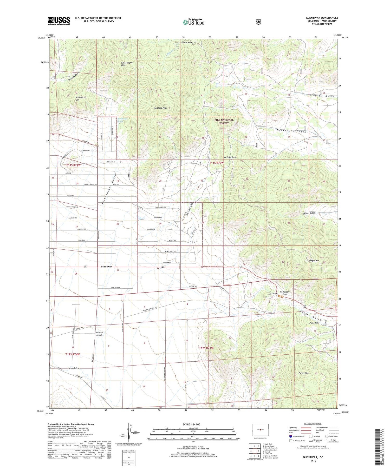
Glentivar Colorado US Topo Map
Couldn't load pickup availability
Also explore the Glentivar Forest Service Topo of this same quad for updated USFS data
2022 topographic map quadrangle Glentivar in the state of Colorado. Scale: 1:24000. Based on the newly updated USGS 7.5' US Topo map series, this map is in the following counties: Park. The map contains contour data, water features, and other items you are used to seeing on USGS maps, but also has updated roads and other features. This is the next generation of topographic maps. Printed on high-quality waterproof paper with UV fade-resistant inks.
Quads adjacent to this one:
West: Sulphur Mountain
Northwest: Eagle Rock
North: Farnum Peak
Northeast: McCurdy Mountain
East: Tarryall
Southeast: Elevenmile Canyon
South: Spinney Mountain
Southwest: Guffey NW
This map covers the same area as the classic USGS quad with code o39105a5.
Contains the following named places: Antelope Airpark, Badger Mountain, Badger Mountain Heliport, Big Sheep Horn Claim Mine, Blue-green Lode Number One Mine, Blue-green Lode Number Two Mine, Christie-Ward-Lucky Thirteen Number One Mine, Glentivar, Great Western Mine, La Salle Pass, Martland Gulch, Martland Peak, Meteor Mine, Pipe Springs Campground, Pulver Mountain, Puma Hills, Rishaberger Mountain, Rishaberger Spring, Roger Publishing Company Mine, Schoolmarm Mountain, Wilkerson Pass, Wilkerson Pass Visitor Center


