
MyTopo
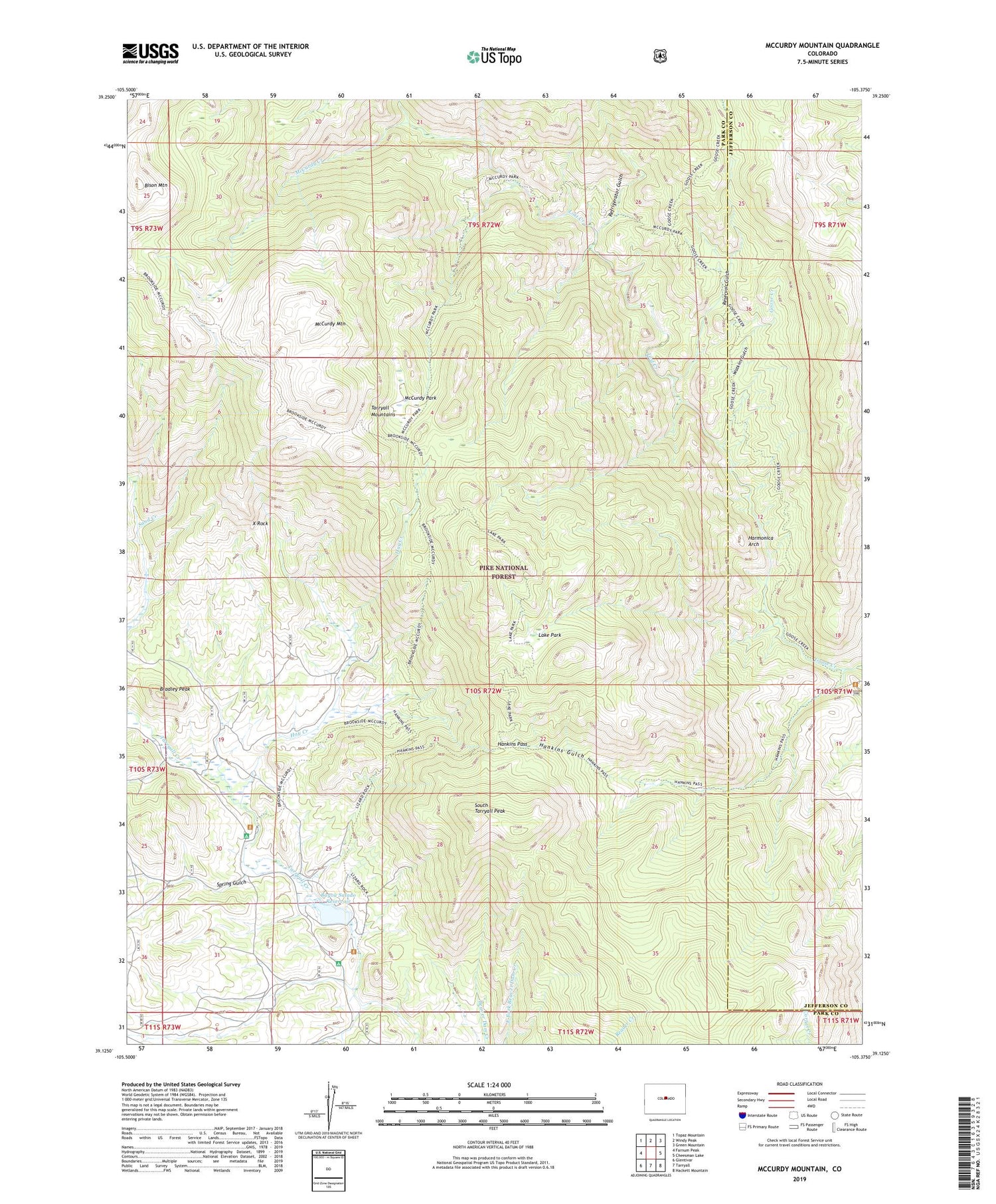
McCurdy Mountain Colorado US Topo Map
Couldn't load pickup availability
Also explore the McCurdy Mountain Forest Service Topo of this same quad for updated USFS data
2022 topographic map quadrangle McCurdy Mountain in the state of Colorado. Scale: 1:24000. Based on the newly updated USGS 7.5' US Topo map series, this map is in the following counties: Park, Jefferson. The map contains contour data, water features, and other items you are used to seeing on USGS maps, but also has updated roads and other features. This is the next generation of topographic maps. Printed on high-quality waterproof paper with UV fade-resistant inks.
Quads adjacent to this one:
West: Farnum Peak
Northwest: Topaz Mountain
North: Windy Peak
Northeast: Green Mountain
East: Cheesman Lake
Southeast: Hackett Mountain
South: Tarryall
Southwest: Glentivar
This map covers the same area as the classic USGS quad with code o39105b4.
Contains the following named places: Bayou Salado Dam, Bayou Salado Reservoir, Bearcat Mines, Bison Ditch, Bison Mountain, Bradley Peak, Goose Creek Campground, Hankins Gulch, Hankins Pass, Hankins Trail, Harmonica Arch, Hay Creek, Hay Creek Ditch, Lake Park, Lake Park Trail, Lost Creek, Lost Creek Wilderness, Lost Park Mine, McCurdy Creek, McCurdy Mountain, McCurdy Park, Michael A Mahoney Ditch, Pike National Forest, Refrigerator Gulch, Reservoir Gulch, South Tarryall Peak, Spring Gulch, Spruce Campground, Spruce Grove Campground, Twin Eagles Picnic Area, Twin Eagles Trailhead, Watkins Gulch, X Rock, X Rock Campground


