MyTopo
Elevenmile Canyon Colorado US Topo Map
Couldn't load pickup availability
Also explore the Elevenmile Canyon Forest Service Topo of this same quad for updated USFS data
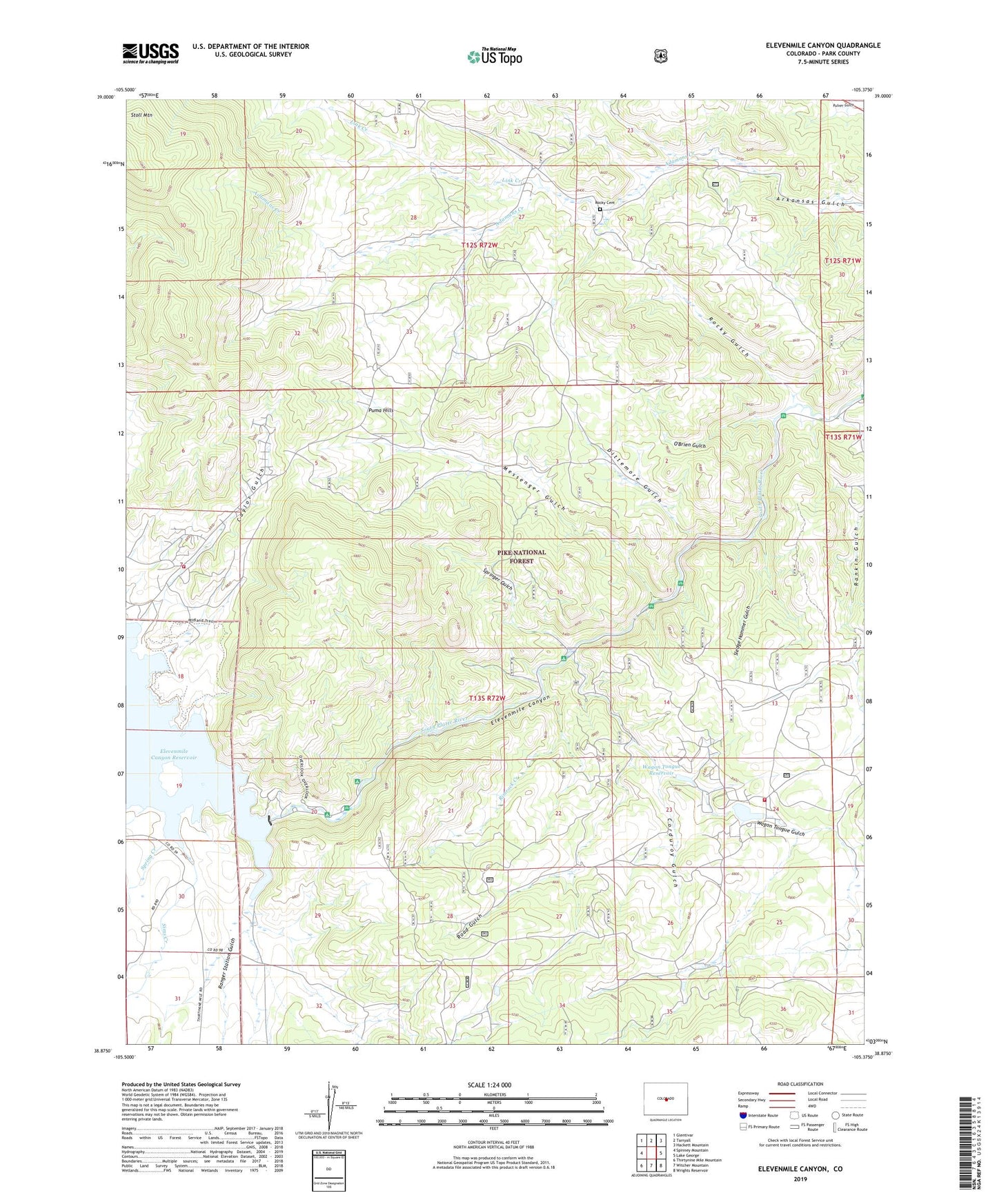
2022 topographic map quadrangle Elevenmile Canyon in the state of Colorado. Scale: 1:24000. Based on the newly updated USGS 7.5' US Topo map series, this map is in the following counties: Park. The map contains contour data, water features, and other items you are used to seeing on USGS maps, but also has updated roads and other features. This is the next generation of topographic maps. Printed on high-quality waterproof paper with UV fade-resistant inks.
Quads adjacent to this one:
West: Spinney Mountain
Northwest: Glentivar
North: Tarryall
Northeast: Hackett Mountain
East: Lake George
Southeast: Wrights Reservoir
South: Witcher Mountain
Southwest: Thirtynine Mile Mountain
This map covers the same area as the classic USGS quad with code o38105h4.
Contains the following named places: Abell Ranch, Bryan Ranch, Camp Alexander, Caylor Gulch, Corduroy Gulch, Cove Campground, Dittemore Gulch, Eleven Mile Canyon Dam, Elevenmile Picnic Area, Hartsel Ranch, Idlewilde Picnic Area, Lake George Fire Protection District Station 2, Lake George Fire Protection District Station 3, Lewis Ranch, Link Creek, Lone Chimney, Messenger Gulch, Messenger Gulch Picnic Area, O'Brien Gulch, Ranger Station Gulch, Rankin Gulch, Reservoir Campground, Rimrock Creek, Road Gulch, Rocky Cemetery, Rocky Gulch, Sims Creek, Sledge Hammer Gulch, Sleeping Tom Summer Homes, Spring Creek, Springer Gulch, Wagon Tongue Campground, Wagon Tongue Dam, Wagon Tongue Gulch, Wagon Tongue Number 2 Dam, Wagon Tongue Reservoir