MyTopo
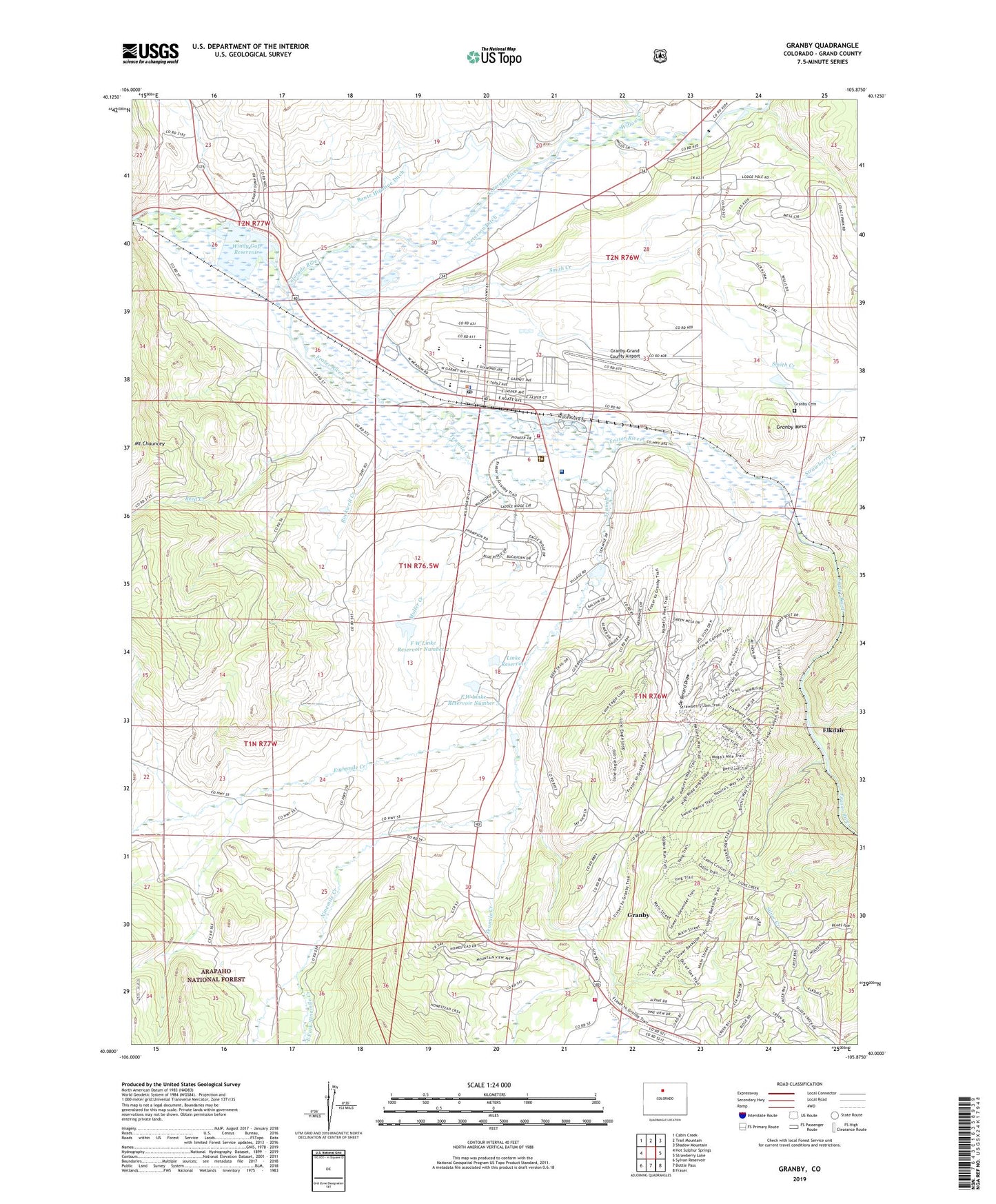
Granby Colorado US Topo Map
Couldn't load pickup availability
Also explore the Granby Forest Service Topo of this same quad for updated USFS data
2022 topographic map quadrangle Granby in the state of Colorado. Scale: 1:24000. Based on the newly updated USGS 7.5' US Topo map series, this map is in the following counties: Grand. The map contains contour data, water features, and other items you are used to seeing on USGS maps, but also has updated roads and other features. This is the next generation of topographic maps. Printed on high-quality waterproof paper with UV fade-resistant inks.
Quads adjacent to this one:
West: Hot Sulphur Springs
Northwest: Cabin Creek
North: Trail Mountain
Northeast: Shadow Mountain
East: Strawberry Lake
Southeast: Fraser
South: Bottle Pass
Southwest: Sylvan Reservoir
This map covers the same area as the classic USGS quad with code o40105a8.
Contains the following named places: Behler Creek, Bunte Highline Ditch, Central Assembly of God Church, Church of Christ, Coyote Creek, De Berard Draw, East Fork Ninemile Creek, East Grand Middle School, Eightmile Creek, Eightmile School, Elkdale, Elkdale Post Office, F W Linke Number 2 Dam, F W Linke Number 3 Dam, F W Linke Reservoir Number 2, F W Linke Reservoir Number 3, Flying Heels Arena, Fraser River, Granby, Granby Cemetery, Granby Elementary School, Granby Police Department, Granby Post Office, Granby Sports Park Airport, Granby-Grand County Airport, Grand County Emergency Medical Services Station 1, Grand Fire Protection District 1 Headquarters Station, Grand Fire Protection District 1 Red Dirt Station, KRKY-AM (Granby), Linke Dam, Linke Reservoir, Lord of the Valley Lutheran Church, Middle Park High School, Middle Park Medical Center - Granby Campus, Mount Chauncey, Muller Creek, Ninemile Creek, Peterson Ditch, Reed Creek, Rockwell Creek, Silver Creek Ski Area, Smith Creek, Strawberry Creek, Sulphur District Ranger Office, Tabernash Campground, Tenmile Creek, Town of Granby, West Fork Ninemile Creek, Willow Creek, Windy Gap Reservoir