
MyTopo
Sylvan Reservoir Colorado US Topo Map
Couldn't load pickup availability
Also explore the Sylvan Reservoir Forest Service Topo of this same quad for updated USFS data
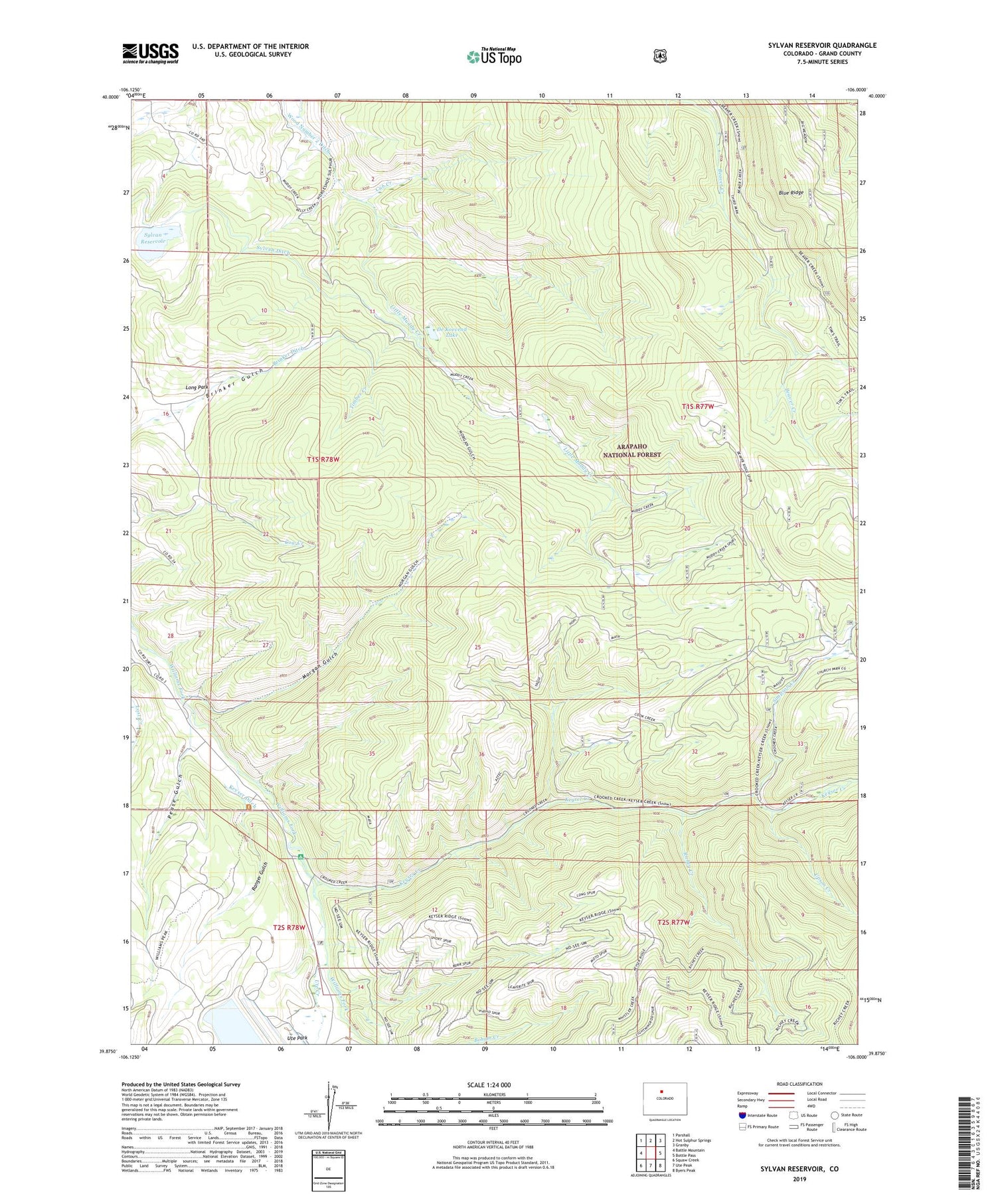
2022 topographic map quadrangle Sylvan Reservoir in the state of Colorado. Scale: 1:24000. Based on the newly updated USGS 7.5' US Topo map series, this map is in the following counties: Grand. The map contains contour data, water features, and other items you are used to seeing on USGS maps, but also has updated roads and other features. This is the next generation of topographic maps. Printed on high-quality waterproof paper with UV fade-resistant inks.
Quads adjacent to this one:
West: Battle Mountain
Northwest: Parshall
North: Hot Sulphur Springs
Northeast: Granby
East: Bottle Pass
Southeast: Byers Peak
South: Ute Peak
Southwest: Squaw Creek
This map covers the same area as the classic USGS quad with code o39106h1.
Contains the following named places: Brinker Ditch, Cook Creek, Cub Creek, De Koevend Lake, Hermosa School, Horseshoe Campground, Horseshoe Guard Station, Horseshoe Ranger Station, Horseshoe Sulfur Trail, Kelly Creek, Keyser Creek, Keyser Ditch, Long Park, Morgan Gulch, Muddy Keyser Trail, Pease Gulch, Ranger Gulch, Richey Creek, Simpson Creek, Sulfur Trail, Sylvan Dam, Sylvan Ditch, Sylvan Reservoir, Timber Creek, Upson Creek, Ute Creek, Ute Park, Ute Park School, ZIP Code: 80468


