MyTopo
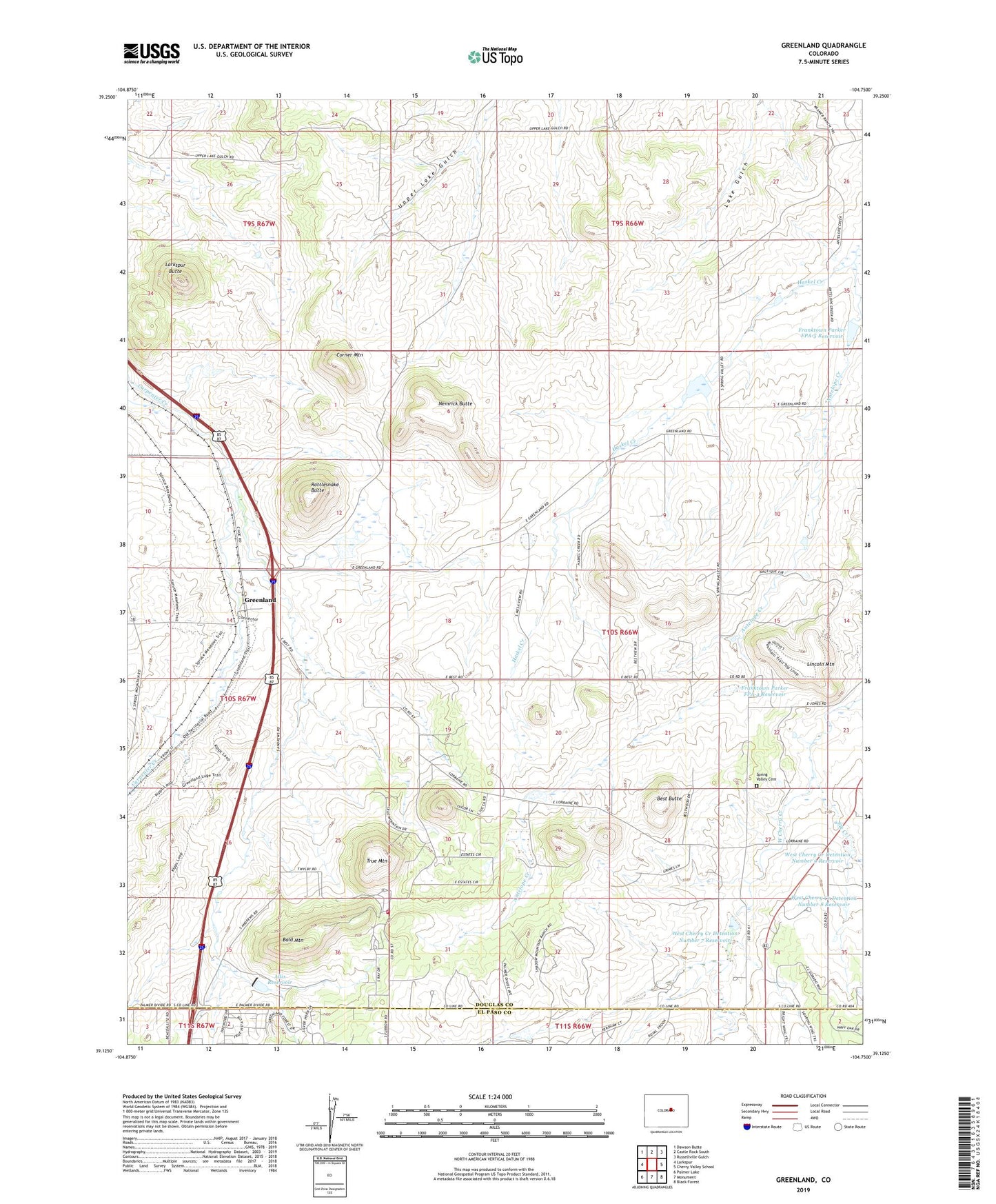
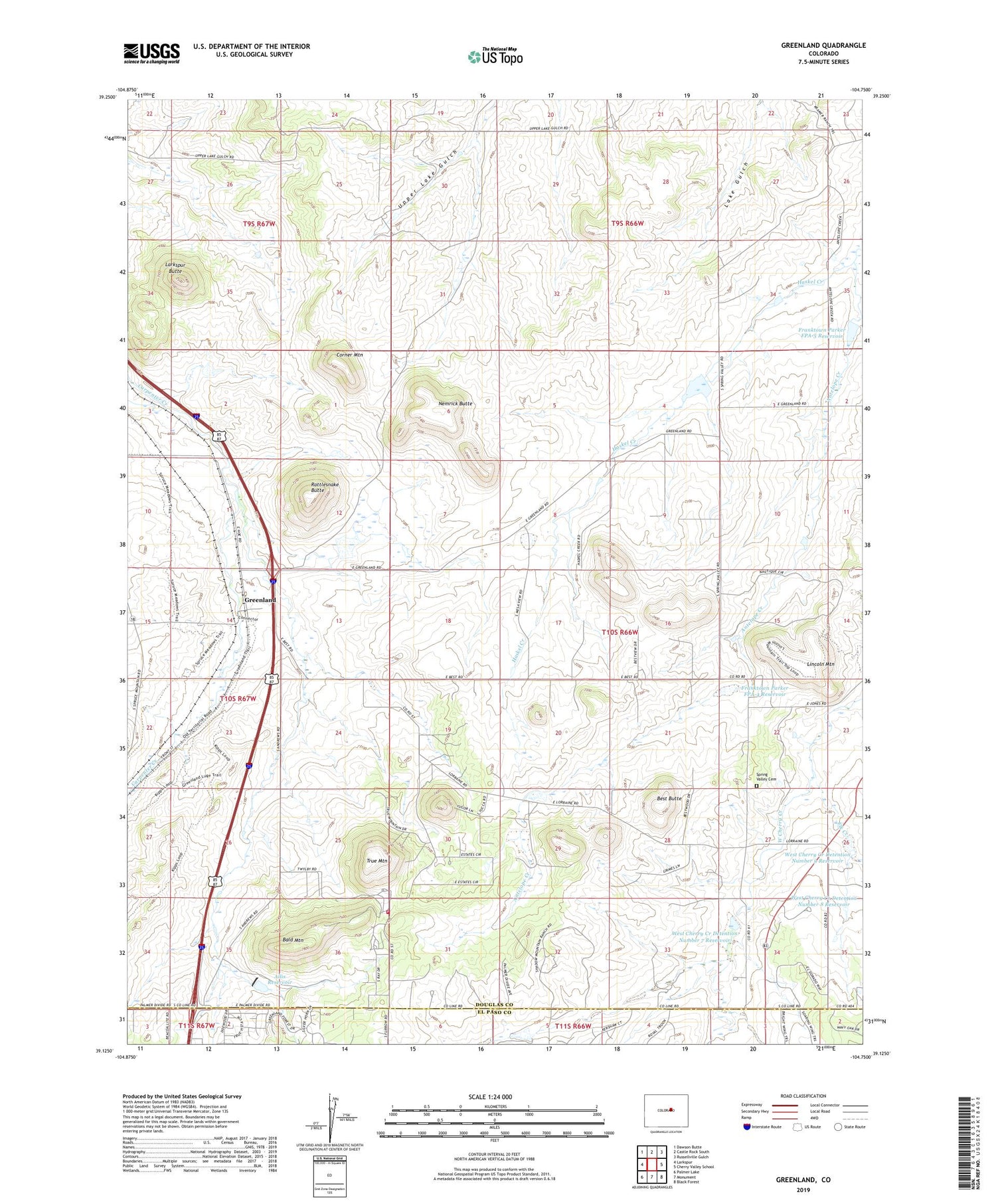
Greenland Colorado US Topo Map
Couldn't load pickup availability
2022 topographic map quadrangle Greenland in the state of Colorado. Scale: 1:24000. Based on the newly updated USGS 7.5' US Topo map series, this map is in the following counties: Douglas, El Paso. The map contains contour data, water features, and other items you are used to seeing on USGS maps, but also has updated roads and other features. This is the next generation of topographic maps. Printed on high-quality waterproof paper with UV fade-resistant inks.
Quads adjacent to this one:
West: Larkspur
Northwest: Dawson Butte
North: Castle Rock South
Northeast: Russellville Gulch
East: Cherry Valley School
Southeast: Black Forest
South: Monument
Southwest: Palmer Lake
This map covers the same area as the classic USGS quad with code o39104b7.
Contains the following named places: Allis Dam, Allis Reservoir, Bald Mountain, Best Butte, Corner Mountain, Elk Creek, Franktown Parker FPA-4 Dam, Franktown Parker FPA-4 Reservoir, Franktown Parker FPA-5 Dam, Franktown Parker FPA-5 Reservoir, Greenland, Greenland Ranch, Haskel Creek, Larkspur Butte, Larkspur Fire Protection District Station 164 Bald Mountain, Lincoln Mountain, Lincoln Ranch, Nemrick Butte, Rattlesnake Butte, Spring Valley Cemetery, Spring Valley School, True Mountain, West Cherry Creek Detention Number 7 Dam, West Cherry Creek Detention Number 7 Reservoir, West Cherry Creek Detention Number 8 Reservoir, West Cherry Creek Detention Number 9 Dam, West Cherry Creek Detention Number 9 Reservoir