MyTopo
Russellville Gulch Colorado US Topo Map
Couldn't load pickup availability
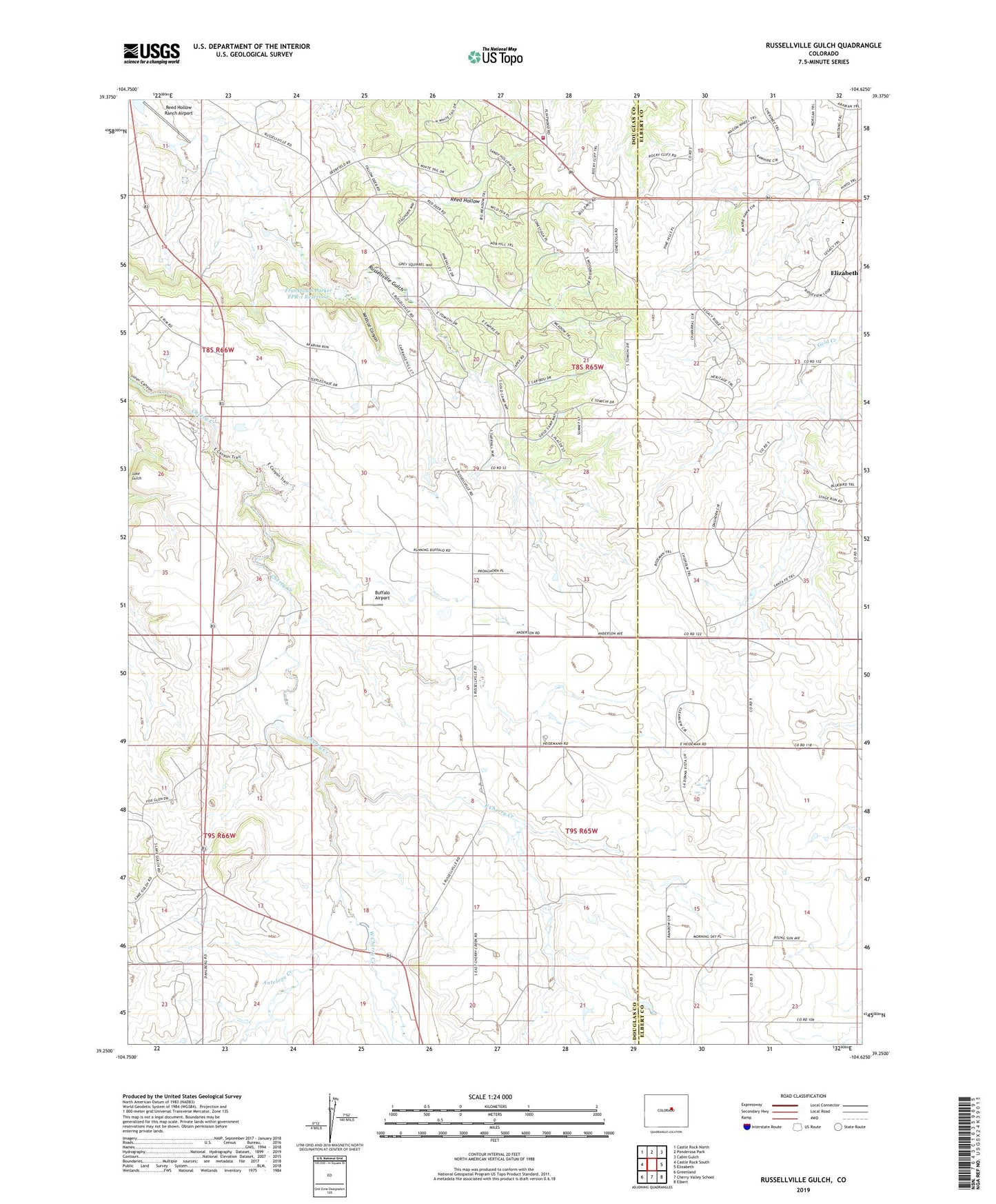
2022 topographic map quadrangle Russellville Gulch in the state of Colorado. Scale: 1:24000. Based on the newly updated USGS 7.5' US Topo map series, this map is in the following counties: Douglas, Elbert. The map contains contour data, water features, and other items you are used to seeing on USGS maps, but also has updated roads and other features. This is the next generation of topographic maps. Printed on high-quality waterproof paper with UV fade-resistant inks.
Quads adjacent to this one:
West: Castle Rock South
Northwest: Castle Rock North
North: Ponderosa Park
Northeast: Cabin Gulch
East: Elizabeth
Southeast: Elbert
South: Cherry Valley School
Southwest: Greenland
This map covers the same area as the classic USGS quad with code o39104c6.
Contains the following named places: Antelope Creek, Barney Bird Reservoir Number One, Buffalo Airport, Cimarron, East Cherry Creek, Franktown Fire Protection District Station 183, Franktown Parker FPR-1 Dam, Franktown Parker FPR-1 Reservoir, Franktown Parker FPR-2 Dam, Franktown Parker FPR-2 Reservoir, Goodrich Ditch, Jenny Lode, Kostroski Airport, Legacy Academy, R E Coulter Mine, Reed Hollow, Reed Hollow Ranch Airport, Russellville, West Cherry Creek, Wildcat Canyon, ZIP Code: 80116