MyTopo
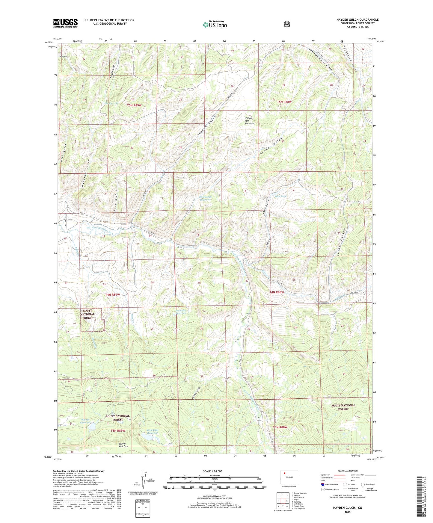
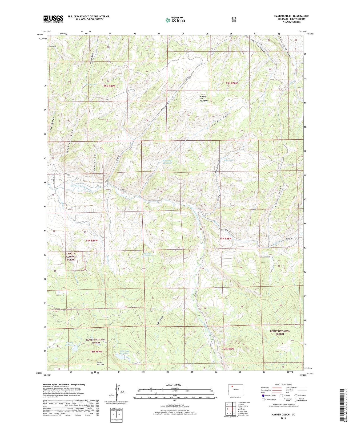
Hayden Gulch Colorado US Topo Map
Couldn't load pickup availability
Also explore the Hayden Gulch Forest Service Topo of this same quad for updated USFS data
2022 topographic map quadrangle Hayden Gulch in the state of Colorado. Scale: 1:24000. Based on the newly updated USGS 7.5' US Topo map series, this map is in the following counties: Routt. The map contains contour data, water features, and other items you are used to seeing on USGS maps, but also has updated roads and other features. This is the next generation of topographic maps. Printed on high-quality waterproof paper with UV fade-resistant inks.
Quads adjacent to this one:
West: Pagoda
Northwest: Breeze Mountain
North: Hayden
Northeast: Mount Harris
East: Dunckley
Southeast: Dunckley Pass
South: Pagoda Peak
Southwest: Slide Creek
This map covers the same area as the classic USGS quad with code o40107c3.
Contains the following named places: Barton Mine, Butler Reservoir, Butler Reservoir Dam, Card Gulch, Denton Strip Mine, Detwiller Reservoir, Dillabaugh Reservoir, Dowden Gulch, Dunstan Gulch, Flattop Dam, Hayden Gulch, Knife Edge Dam, Knife Edge Reservoir, Lone Gulch, Maud Wise Reservoir, Millers Gulch, Mills Pond, Moody Lake, Rice Mine, Sand Creek, Second Canyon, Sedimentation Pond HG-1 Dam, Sedimentation Pond HG-1 Reservoir, Sedimentation Pond HG-3 Dam, Sedimentation Pond HG-3 Reservoir, Sedimentation Pond HG-4 Dam, Sedimentation Pond HG-4 Reservoir, Sedimentation Pond HG-5 Dam, Sedimentation Pond HG-5 Reservoir, Sun Mine, Willow Creek, Wyman Reservoir