MyTopo
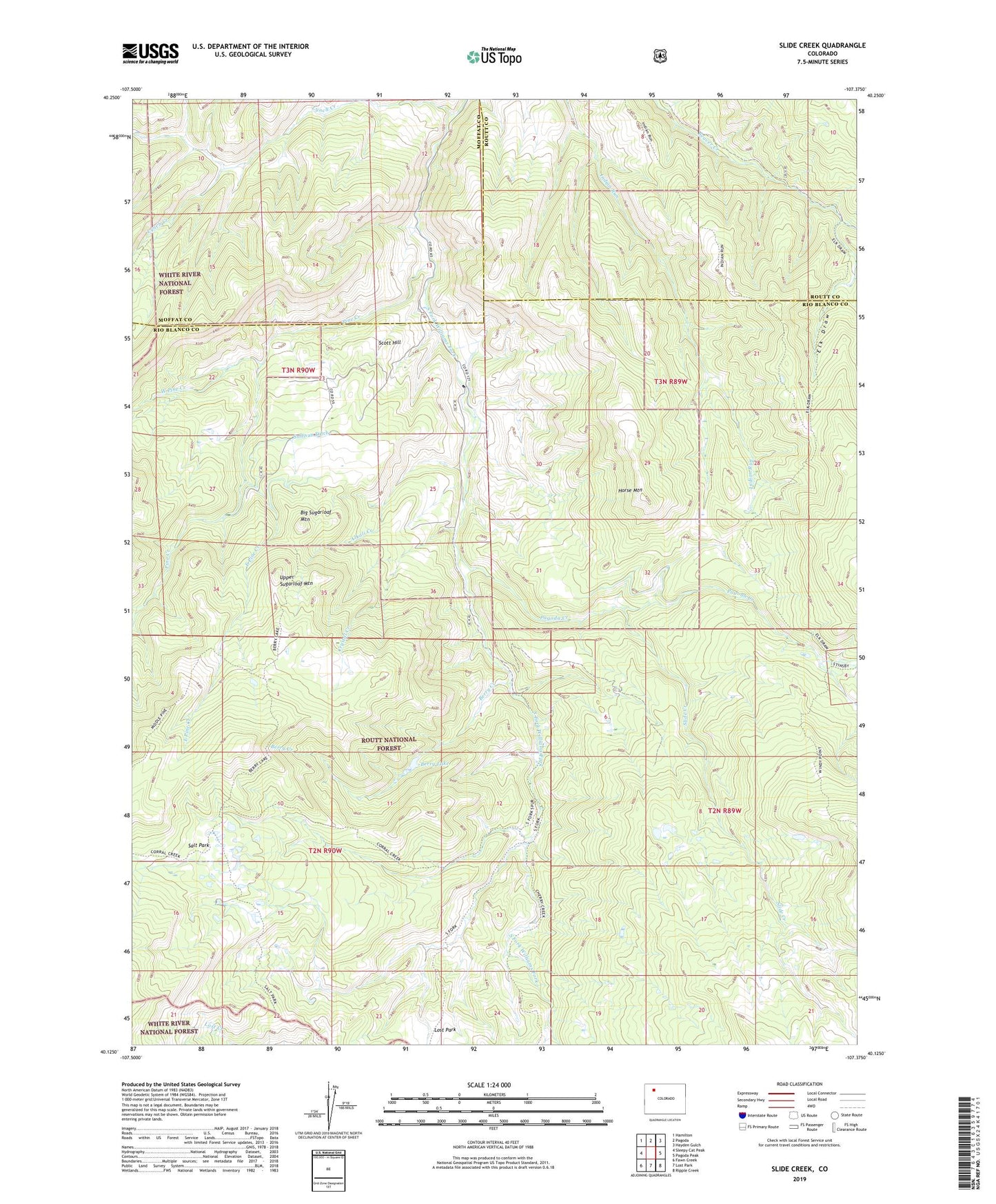
Slide Creek Colorado US Topo Map
Couldn't load pickup availability
Also explore the Slide Creek Forest Service Topo of this same quad for updated USFS data
2022 topographic map quadrangle Slide Creek in the state of Colorado. Scale: 1:24000. Based on the newly updated USGS 7.5' US Topo map series, this map is in the following counties: Rio Blanco, Moffat, Routt. The map contains contour data, water features, and other items you are used to seeing on USGS maps, but also has updated roads and other features. This is the next generation of topographic maps. Printed on high-quality waterproof paper with UV fade-resistant inks.
Quads adjacent to this one:
West: Sleepy Cat Peak
Northwest: Hamilton
North: Pagoda
Northeast: Hayden Gulch
East: Pagoda Peak
Southeast: Ripple Creek
South: Lost Park
Southwest: Fawn Creek
This map covers the same area as the classic USGS quad with code o40107b4.
Contains the following named places: Alkali Creek, Berry Creek, Berry Lake, Big Sugarloaf Mountain, Corral Creek, Crystal Creek, East Pine Creek, Elk Draw, Horse Mountain, Lynch Creek, Pagoda Creek, Pine Creek, Salt Park, Scott Hill, Slide Creek, Sullivan Ditch, Upper Sugarloaf Mountain, West Pine Creek, Wet Park