MyTopo
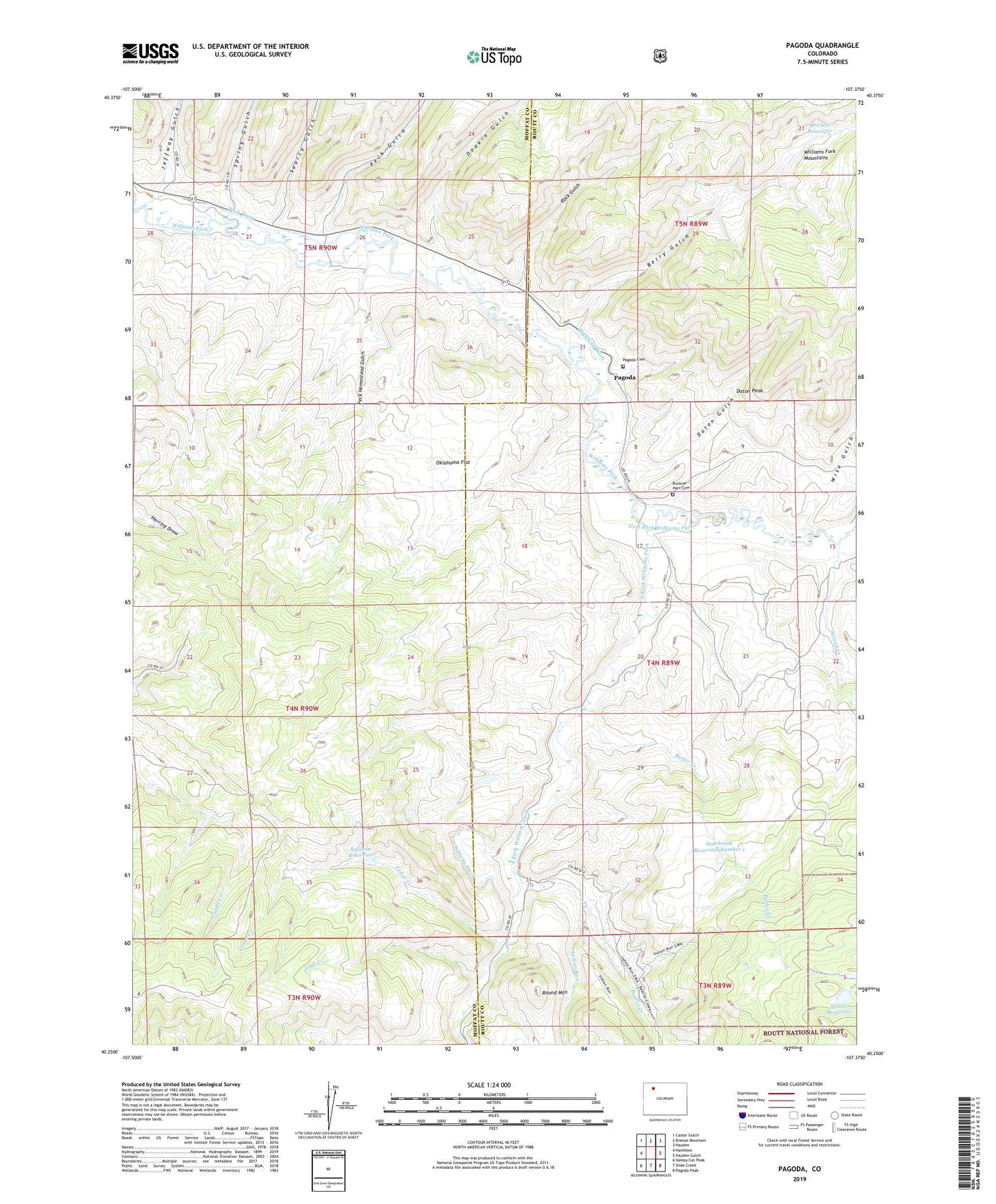
Pagoda Colorado US Topo Map
Couldn't load pickup availability
Also explore the Pagoda Forest Service Topo of this same quad for updated USFS data
2022 topographic map quadrangle Pagoda in the state of Colorado. Scale: 1:24000. Based on the newly updated USGS 7.5' US Topo map series, this map is in the following counties: Moffat, Routt. The map contains contour data, water features, and other items you are used to seeing on USGS maps, but also has updated roads and other features. This is the next generation of topographic maps. Printed on high-quality waterproof paper with UV fade-resistant inks.
Quads adjacent to this one:
West: Hamilton
Northwest: Castor Gulch
North: Breeze Mountain
Northeast: Hayden
East: Hayden Gulch
Southeast: Pagoda Peak
South: Slide Creek
Southwest: Sleepy Cat Peak
This map covers the same area as the classic USGS quad with code o40107c4.
Contains the following named places: Beaver Creek, Bennett Reservoir, Berry Gulch, Breeze Mountain Mine, Buckner - Hart Cemetery, Butler Creek, Cedar Creek, Cedar Creek Mine, Coal Creek, Daton Gulch, Daton Peak, Deakin Gulch, East Fork Williams Fork, Highland Ditch, Indian Run, Indian Run Campground, Jeffway Gulch, Jubb Creek, Oklahoma Flat, Pagoda, Pagoda Cemetery, Peck Ditch, Peck Gulch, Peck Homestead Gulch, Rock Gulch, Round Mountain, Saddle Dam, Saddle Reservoir, Sagebrush Reservoir Number 1, Searcy Gulch, Second Creek, South Fork Williams Fork, Spring Gulch, Sullivan Dam, Sullivan Ditch, Sullivan Reservoir, Wise Gulch