MyTopo
Hickey Bridge Colorado US Topo Map
Couldn't load pickup availability
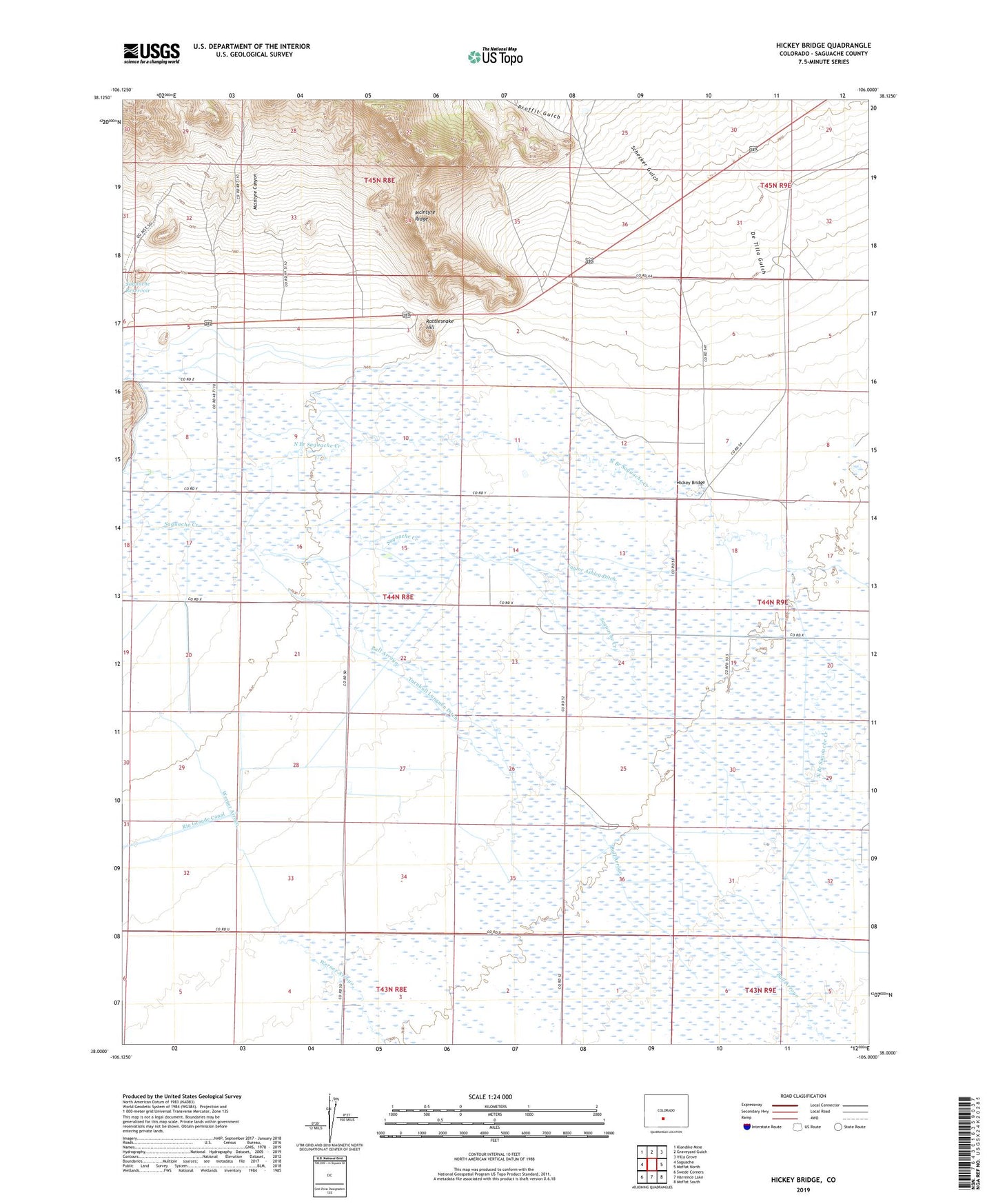
2022 topographic map quadrangle Hickey Bridge in the state of Colorado. Scale: 1:24000. Based on the newly updated USGS 7.5' US Topo map series, this map is in the following counties: Saguache. The map contains contour data, water features, and other items you are used to seeing on USGS maps, but also has updated roads and other features. This is the next generation of topographic maps. Printed on high-quality waterproof paper with UV fade-resistant inks.
Quads adjacent to this one:
West: Saguache
Northwest: Klondike Mine
North: Graveyard Gulch
Northeast: Villa Grove
East: Moffat North
Southeast: Moffat South
South: Harrence Lake
Southwest: Swede Corners
This map covers the same area as the classic USGS quad with code o38106a1.
Contains the following named places: 32 South Ditch, Braun Brothers Ditch Number 1, Campbell Ditch 5, Campbell Number 6, Coleman South Ditch, De Tilla Gulch, Hickey Bridge, McIntyre Canyon, Phillips Ditch 1, Phillips Ditch 2, Proffit Gulch, Proffitt Company Ditch, Proffitt McDonough Ditch, Quartet Ditch, Rattlesnake Hill, Roberts Company Ditch, Saguache Division, Schecker Gulch, Seitz McClure Ashley Ditch, Taylor Ashley Ditch, Turnbull Lunguen Ditch, Woodard Well