
MyTopo
Saguache Colorado US Topo Map
Couldn't load pickup availability
Also explore the Saguache Forest Service Topo of this same quad for updated USFS data
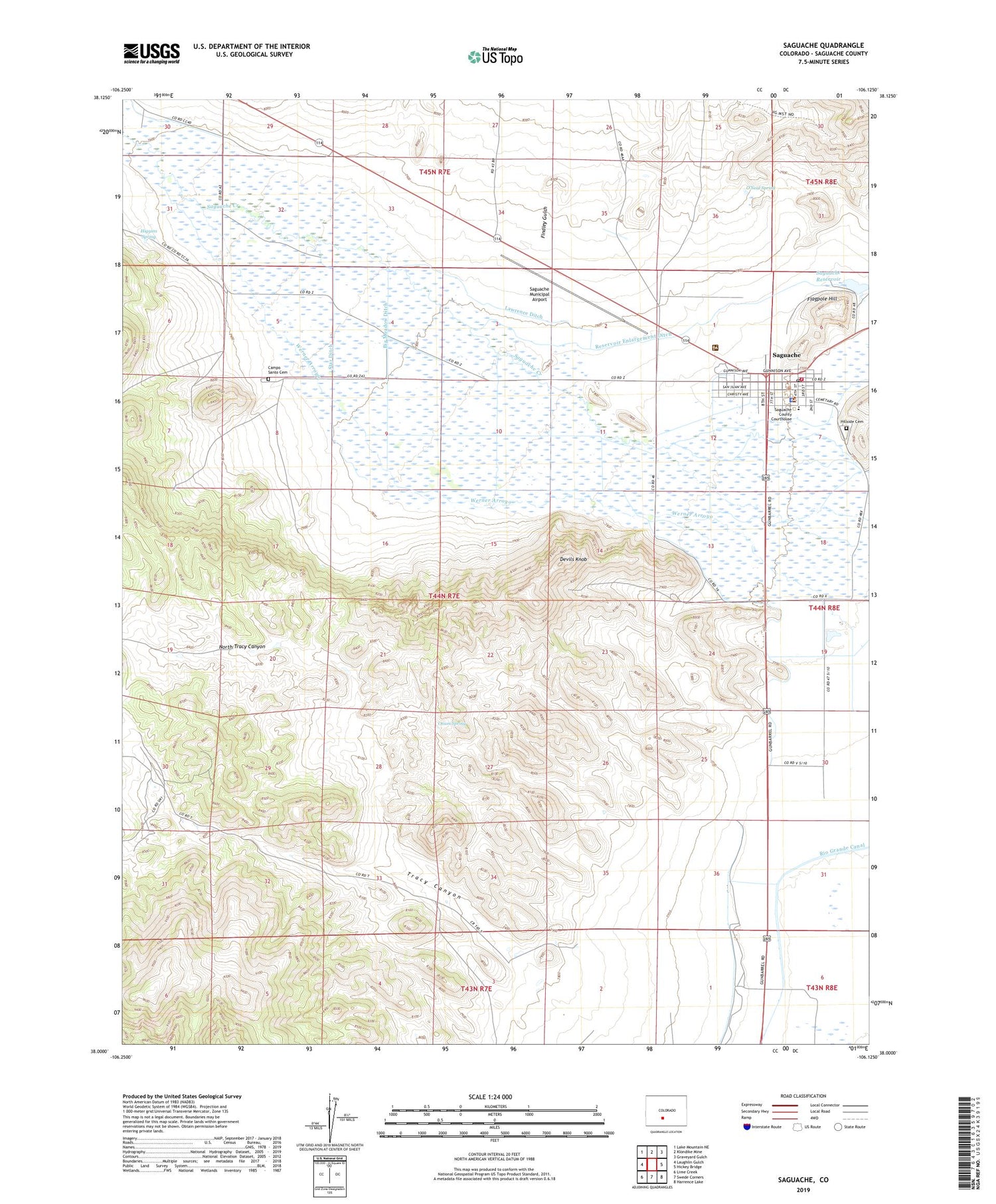
2022 topographic map quadrangle Saguache in the state of Colorado. Scale: 1:24000. Based on the newly updated USGS 7.5' US Topo map series, this map is in the following counties: Saguache. The map contains contour data, water features, and other items you are used to seeing on USGS maps, but also has updated roads and other features. This is the next generation of topographic maps. Printed on high-quality waterproof paper with UV fade-resistant inks.
Quads adjacent to this one:
West: Laughlin Gulch
Northwest: Lake Mountain NE
North: Klondike Mine
Northeast: Graveyard Gulch
East: Hickey Bridge
Southeast: Harrence Lake
South: Swede Corners
Southwest: Lime Creek
This map covers the same area as the classic USGS quad with code o38106a2.
Contains the following named places: Big Meadow Ditch, Campo Santo Cemetery, Church In the Valley, Community United Methodist Church, Devils Knob, Findley Gulch, Flagpole Hill, Fullerton Ditch 2, Gotthelf Samora Ditch, Higgins Spring, Hillside Cemetery, Lawrence Ditch, Malone Ditch, Morrison Ditch, Mountain Valley School, North Saguache County Volunteer Department, North Tracy Canyon, O'Neal Spring, Onion Spring, Pitkkin Avenue Baptist Church, Reservoir Enlargement Ditch, Russell Ditch 4, Sagauache County Comprehensive Health Clinic, Saguache, Saguache County Courthouse, Saguache County Jail, Saguache County Museum, Saguache County Sheriff's Office, Saguache Dam, Saguache District Ranger Office, Saguache Emergency Management Services, Saguache Fire Department, Saguache Municipal Airport, Saguache Post Office, Saguache Reservoir, Saguache Town Hall, Saint Agnes Catholic Church Mission, Seguache County Library, Star Ditch, Town of Saguache, Tracy Canyon, Woodard Brothers Ditch


