MyTopo
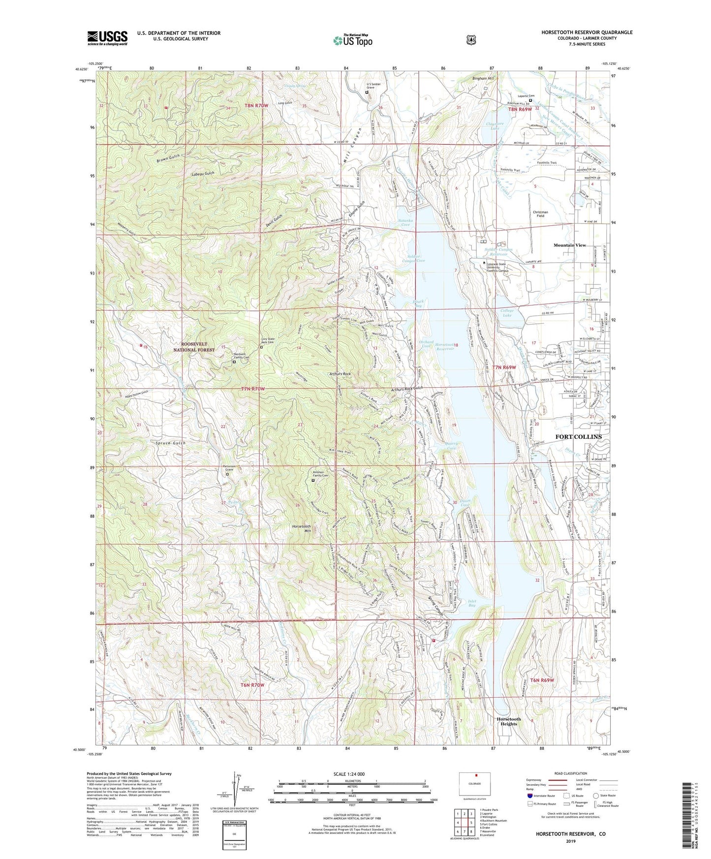
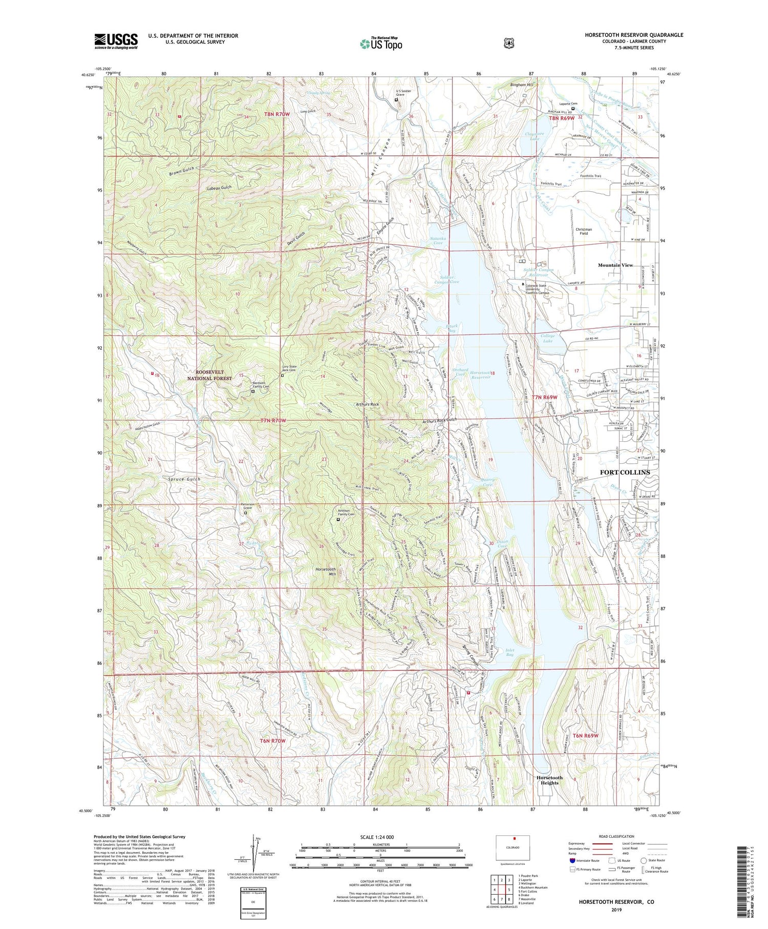
Horsetooth Reservoir Colorado US Topo Map
Couldn't load pickup availability
Also explore the Horsetooth Reservoir Forest Service Topo of this same quad for updated USFS data
2022 topographic map quadrangle Horsetooth Reservoir in the state of Colorado. Scale: 1:24000. Based on the newly updated USGS 7.5' US Topo map series, this map is in the following counties: Larimer. The map contains contour data, water features, and other items you are used to seeing on USGS maps, but also has updated roads and other features. This is the next generation of topographic maps. Printed on high-quality waterproof paper with UV fade-resistant inks.
Quads adjacent to this one:
West: Buckhorn Mountain
Northwest: Poudre Park
North: Laporte
Northeast: Wellington
East: Fort Collins
Southeast: Loveland
South: Masonville
Southwest: Drake
This map covers the same area as the classic USGS quad with code o40105e2.
Contains the following named places: Arthurs Rock, Arthurs Rock Gulch, Ball Scheelite Mine, Bardwell Family Cemetery, Bellvue State Fish Hatchery, Bingham Hill, Brown Gulch, Buckhorn Highline Ditch, Cache la Poudre Monument, Christman Field, Claymore Dam, Claymore Lake, Cloudy Spring, College Lake, College Number 3 Dam, Devil Gulch, Dixon Canal, Dixon Canyon Dam, Dixon Cove, Dixon Reservoir, Dry Lake, Eltuck Bay, Empire Gulch, Estes Belle Claim, Happy Hollow Gulch, Hilltop Claim, Horsetooth Dam, Horsetooth Heights, Horsetooth Mountain, Horsetooth Reservoir, Hughes Stadium, Inlet Bay, KCSU-FM (Fort Collins), Kinnison Family Cemetery, KTCL-FM (Fort Collins), Labeau Gulch, Laporte Cemetery, Laurence Creek, Lory State Park, Lory State Park Cemetery, Mill Canyon, Mill Creek, Mountain View, Orchard Cove, Overland Stage Station, Patterson Grave, Pleasant Valley and Lake Canal, Poudre Fire Authority Fire Station 9, Poudre Fire Authority Station 11, Poudre Fire Authority Training Center, Quarry Cove, Rist Canyon Volunteer Fire Department Station 4, Satanka Cove, Satanka Dike Dam, Soldier Canyon, Soldier Canyon Cove, Soldier Canyon Dam, Soldier Canyon Reservoir, Spring Canyon, Spring Canyon Dam, Spring Creek, Spring Creek Dam, Spruce Gulch, U S Soldier Grave, Well Gulch, ZIP Codes: 80521, 80526