MyTopo
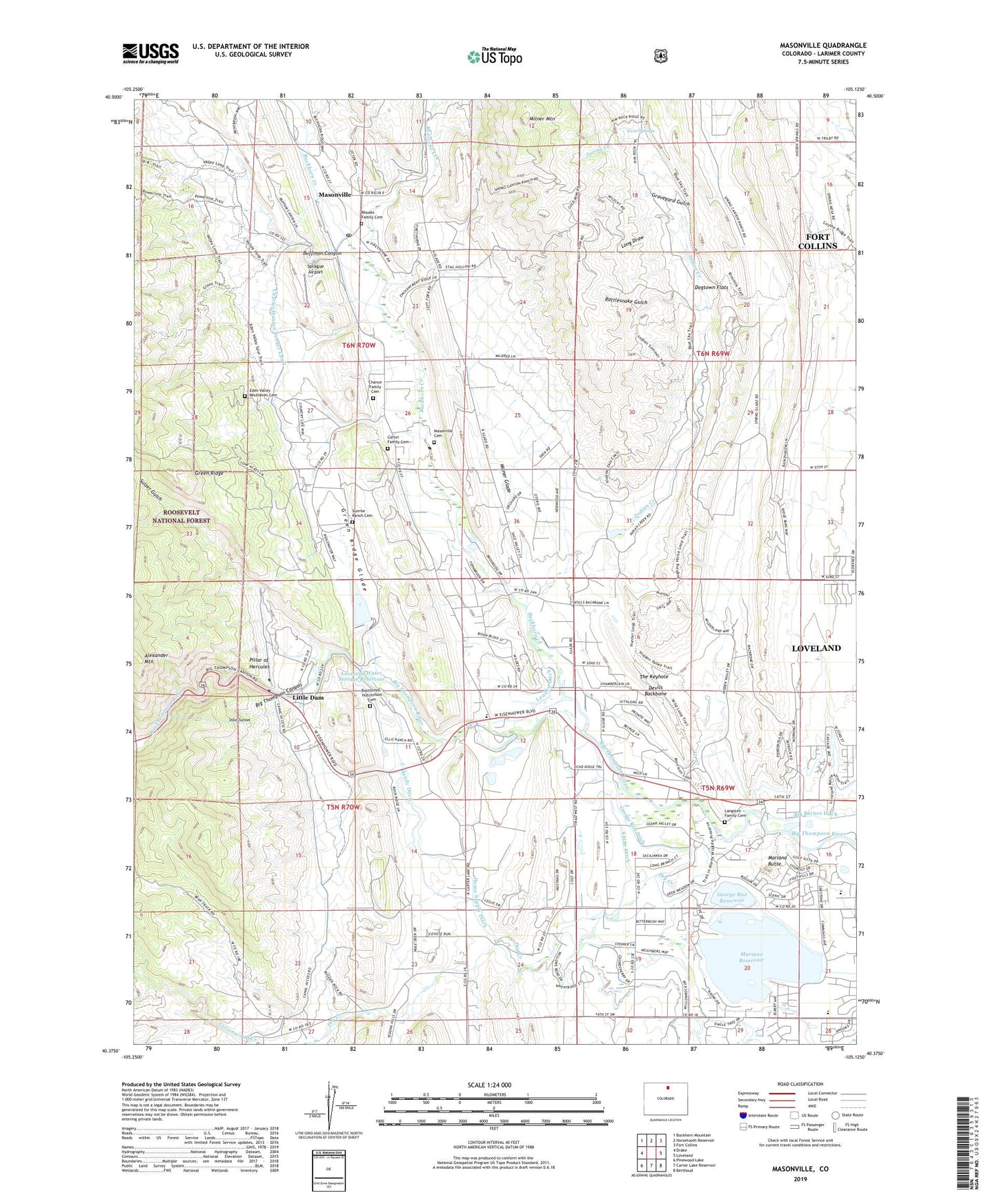
Masonville Colorado US Topo Map
Couldn't load pickup availability
Also explore the Masonville Forest Service Topo of this same quad for updated USFS data
2022 topographic map quadrangle Masonville in the state of Colorado. Scale: 1:24000. Based on the newly updated USGS 7.5' US Topo map series, this map is in the following counties: Larimer. The map contains contour data, water features, and other items you are used to seeing on USGS maps, but also has updated roads and other features. This is the next generation of topographic maps. Printed on high-quality waterproof paper with UV fade-resistant inks.
Quads adjacent to this one:
West: Drake
Northwest: Buckhorn Mountain
North: Horsetooth Reservoir
Northeast: Fort Collins
East: Loveland
Southeast: Berthoud
South: Carter Lake Reservoir
Southwest: Pinewood Lake
This map covers the same area as the classic USGS quad with code o40105d2.
Contains the following named places: Big Thompson Canyon, Big Thompson Elementary School, Big Thompson Power Plant, Big Thompson Siphon, Boothroyd - Hutchinson Cemetery, Buckhorn Creek, Buckhorn Mine, Buckhorn Presbyterian Church, Buffman Canyon, Calvary United Reformed Church, Carter Family Cemetery, Carter Tunnel Mine, Chance Family Cemetery, Colorado Stone Company Pit, Devils Backbone, Dille Tunnel, Dogtown Flats, Dry Creek, Eden Valley Resthaven Cemetery, George Rist Dam, George Rist Ditch, George Rist Reservoir, Graveyard Gulch, Green Ridge Glade, Horsetooth Supply Canal, Indian Creek, Langston Family Cemetery, Little Dam, Long Draw, Loveland Division, Loveland Filtration Plant, Loveland Quarry, Loveland Sandstone Quarry, Loveland Water Storage Dam, Loveland Water Storage Reservoir, Loveland Water Tanks, Mariana Butte, Mariano Dam, Mariano Reservoir, Mason Ranch Mine, Masonville, Masonville Cemetery, Masonville Mine, Masonville Post Office, Milner Glade, Milner Mountain, Mint Quarry, MYM Pit, Pillar of Hercules, Rattlesnake Gulch, Redstone Creek, Redstone Quarry, Rhodes Family Cemetery, Sprague Airport, Sulzer Gulch, Sunrise Ranch Cemetery, The Keyhole, The Narrows, Troupe Quarry, Twin Springs, Victory Irrigation Canal, Weaver Quarry, White Quarry