MyTopo
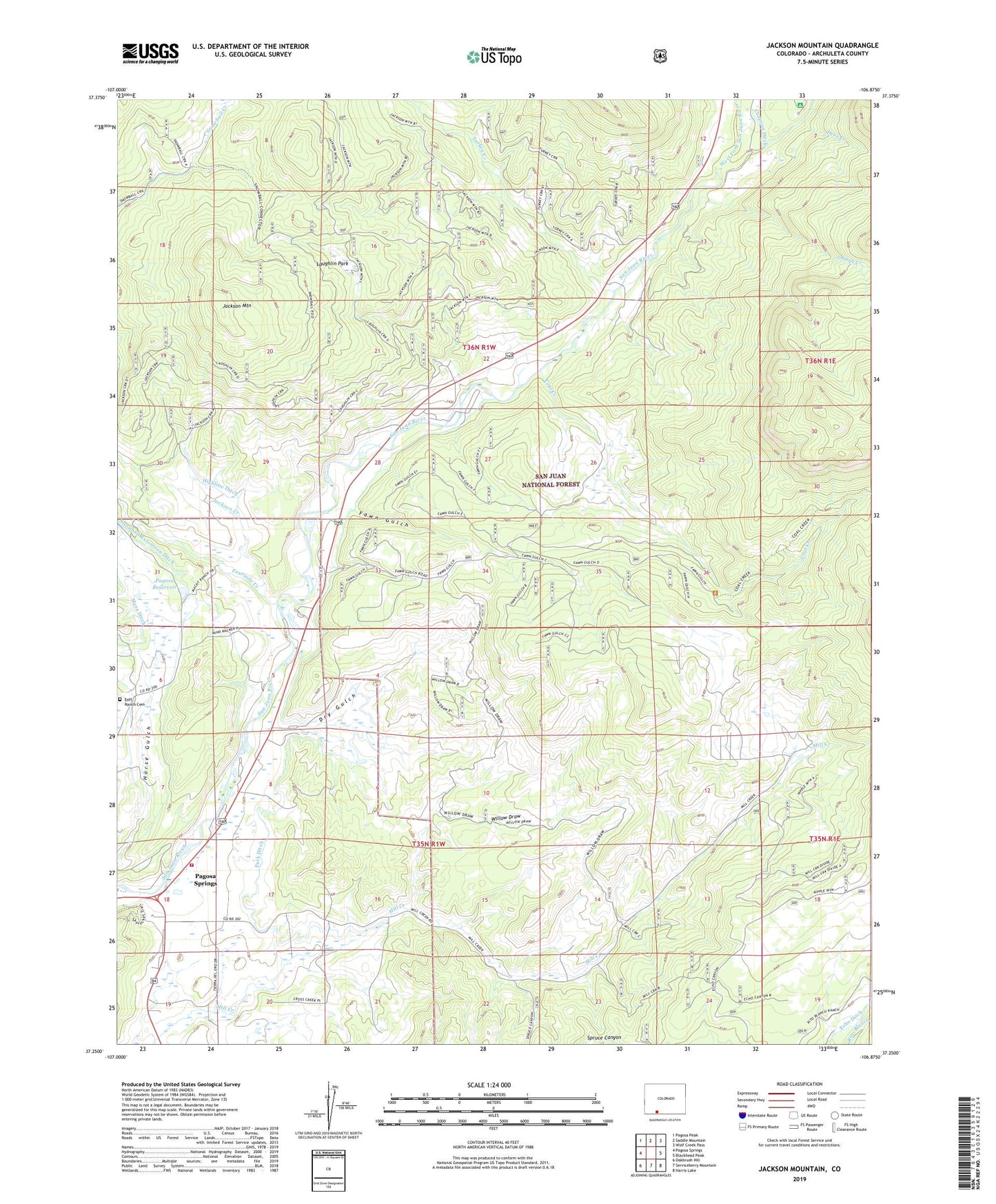
Jackson Mountain Colorado US Topo Map
Couldn't load pickup availability
Also explore the Jackson Mountain Forest Service Topo of this same quad for updated USFS data
2022 topographic map quadrangle Jackson Mountain in the state of Colorado. Scale: 1:24000. Based on the newly updated USGS 7.5' US Topo map series, this map is in the following counties: Archuleta. The map contains contour data, water features, and other items you are used to seeing on USGS maps, but also has updated roads and other features. This is the next generation of topographic maps. Printed on high-quality waterproof paper with UV fade-resistant inks.
Quads adjacent to this one:
West: Pagosa Springs
Northwest: Pagosa Peak
North: Saddle Mountain
Northeast: Wolf Creek Pass
East: Blackhead Peak
Southeast: Harris Lake
South: Serviceberry Mountain
Southwest: Oakbrush Hill
This map covers the same area as the classic USGS quad with code o37106c8.
Contains the following named places: Coal Creek, Cox Mine, Deer Creek, Dowell Mine, Dry Gulch, East Fork San Juan River, Eoff Ranch Cemetery, Fawn Gulch, Fourmile Creek, Highline Ditch, Horse Gulch, Hott Ranch, Jackson Creek, Jackson Mountain, Johnny Creek, Kleckner Mine, Laughlin Park, Mesa Ditch, Pagosa Dam, Pagosa Fire Protection District Station 4 Highway 160 East, Pagosa Reservoir, Park Ditch, Red Ryder Rodeo Grounds, Saddleback Ranch, Spruce Canyon, Three Meadows Ranch, Three Quarter Circles Ranch, Treasure, Treasure Guard Station, Turkey Creek, West Fork San Juan River, Willow Draw