
MyTopo
Pagosa Peak Colorado US Topo Map
Couldn't load pickup availability
Also explore the Pagosa Peak Forest Service Topo of this same quad for updated USFS data
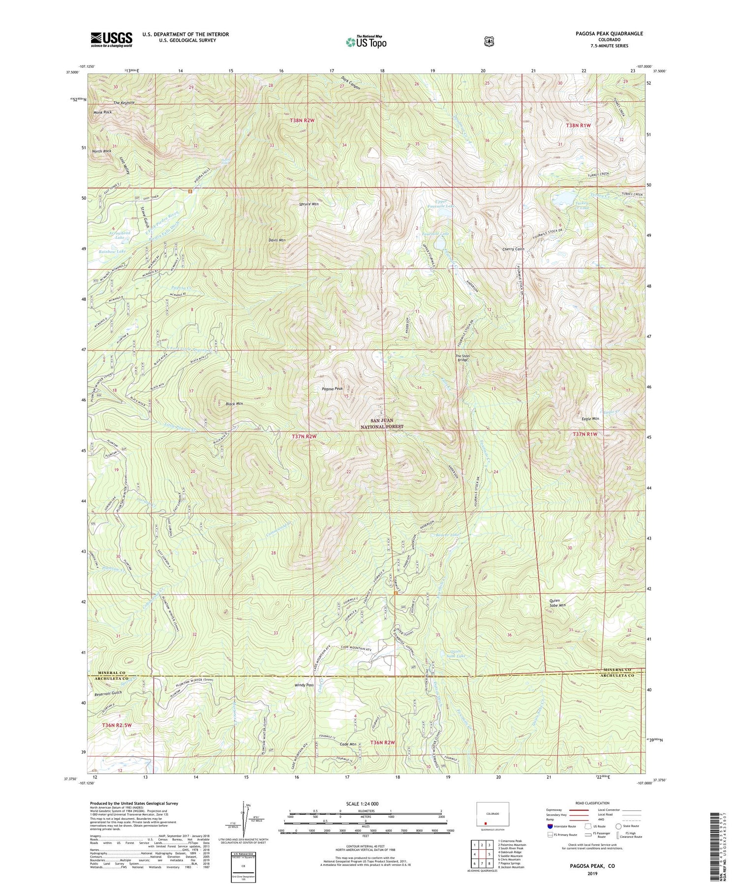
2022 topographic map quadrangle Pagosa Peak in the state of Colorado. Scale: 1:24000. Based on the newly updated USGS 7.5' US Topo map series, this map is in the following counties: Mineral, Archuleta. The map contains contour data, water features, and other items you are used to seeing on USGS maps, but also has updated roads and other features. This is the next generation of topographic maps. Printed on high-quality waterproof paper with UV fade-resistant inks.
Quads adjacent to this one:
West: Oakbrush Ridge
Northwest: Cimarrona Peak
North: Palomino Mountain
Northeast: South River Peak
East: Saddle Mountain
Southeast: Jackson Mountain
South: Pagosa Springs
Southwest: Chris Mountain
This map covers the same area as the classic USGS quad with code o37107d1.
Contains the following named places: Arrowhead Lake, Beaver Lake, Black Mountain, Cade Creek, Cade Mountain, Cade Ranch, Cherry Cairn, Davis Mountain, Eagle Mountain, Falls Creek, Fourmile Lake, Fourmile Stock Trail, Fourmile Trailhead, Jim Tree Mine, Lost Valley, Martinez Creek Trail, Minor Notch Ranch, Monk Rock, North Rock, Pagosa Peak, Piedra Falls, Quien Sabe Lake, Quien Sabe Mountain, Rainbow Lake, Spruce Mountain, Stove Gulch, The Keyhole, The Steel Bridge, Turkey Creek Lake, Turkey Lake Trail, Upper Fourmile Lake, Windy Pass


