MyTopo
Little Dome Colorado US Topo Map
Couldn't load pickup availability
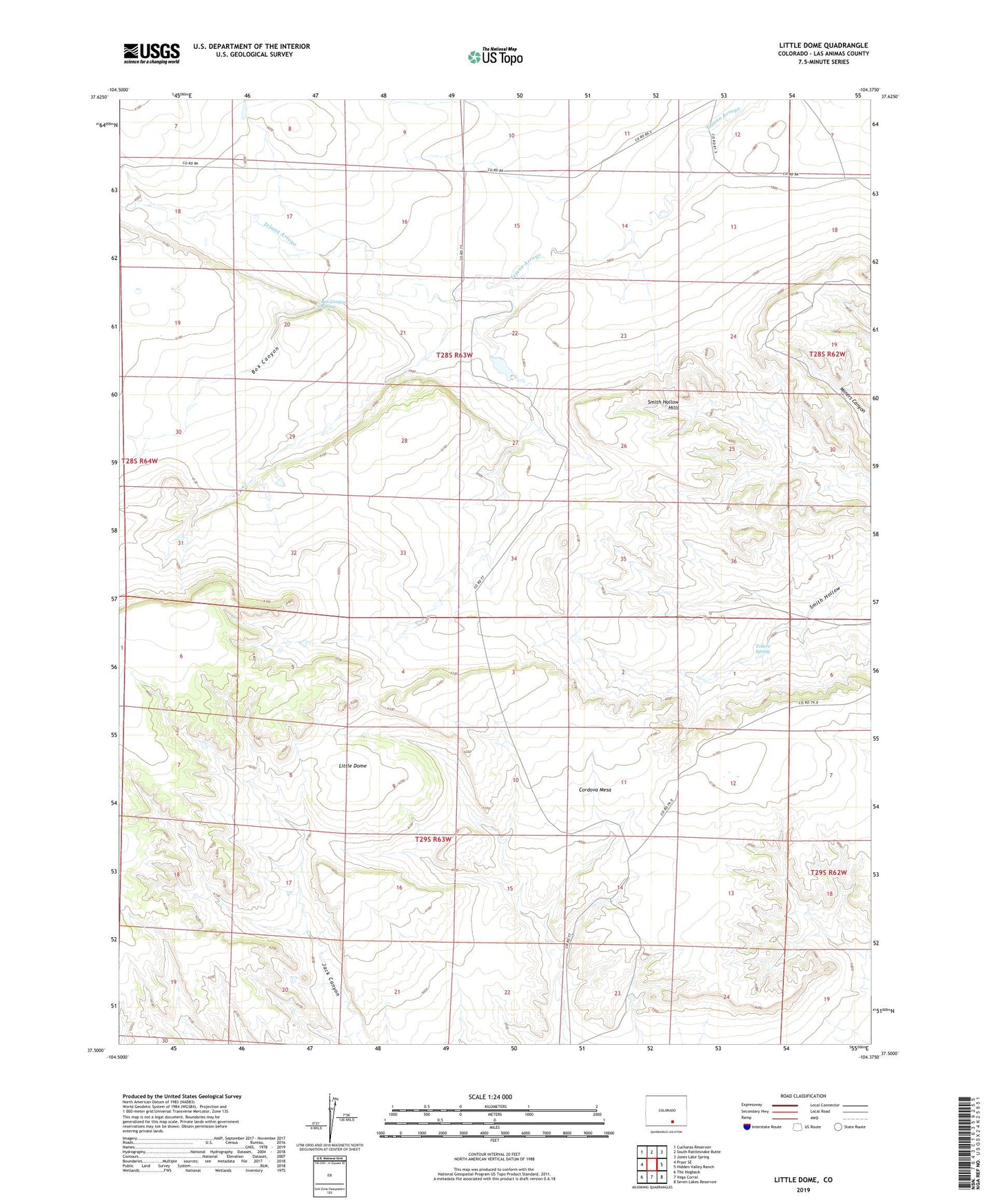
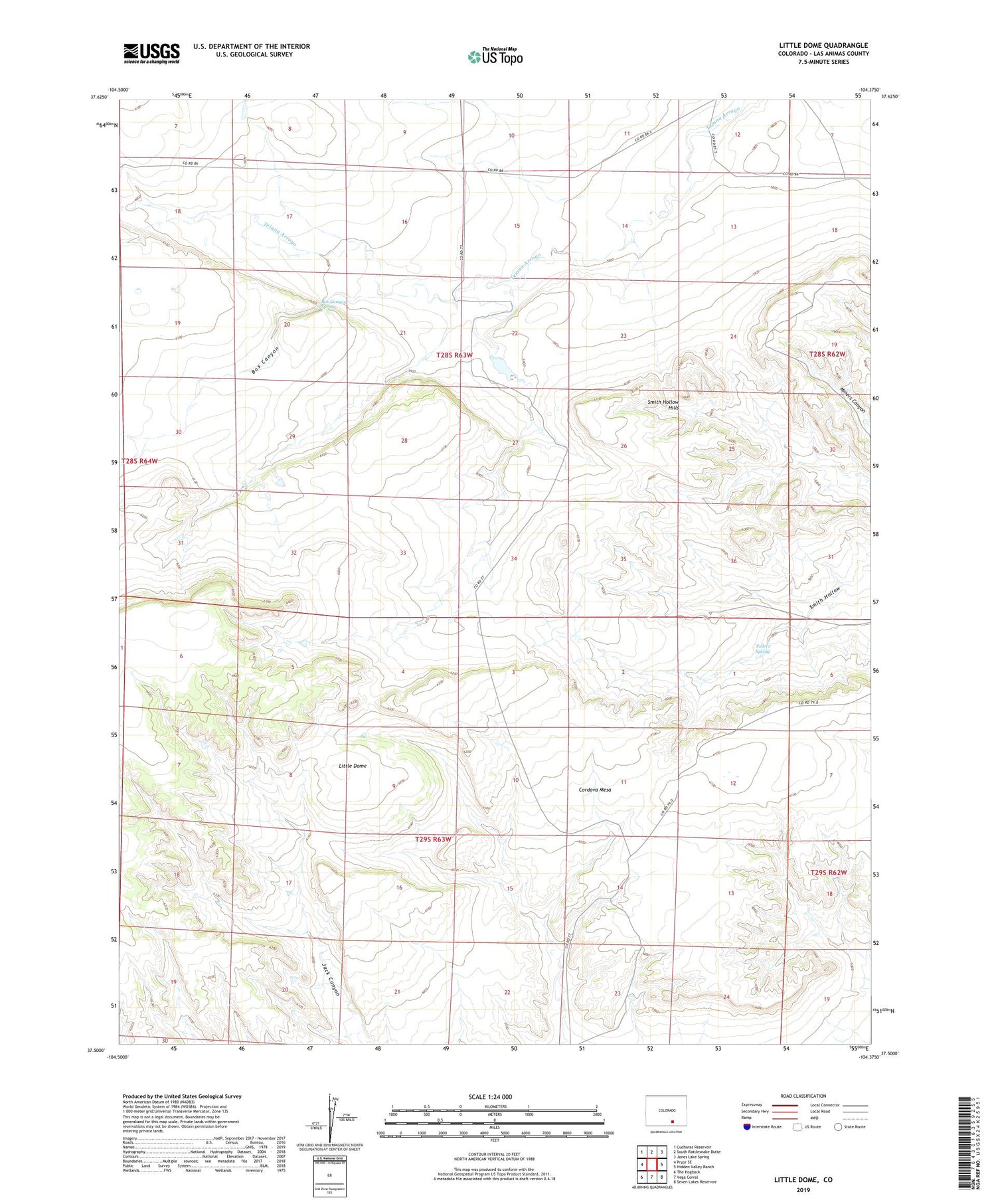
2022 topographic map quadrangle Little Dome in the state of Colorado. Scale: 1:24000. Based on the newly updated USGS 7.5' US Topo map series, this map is in the following counties: Las Animas. The map contains contour data, water features, and other items you are used to seeing on USGS maps, but also has updated roads and other features. This is the next generation of topographic maps. Printed on high-quality waterproof paper with UV fade-resistant inks.
Quads adjacent to this one:
West: Pryor SE
Northwest: Cucharas Reservoir
North: South Rattlesnake Butte
Northeast: Jones Lake Spring
East: Hidden Valley Ranch
Southeast: Seven Lakes Reservoir
South: Vega Corral
Southwest: The Hogback
This map covers the same area as the classic USGS quad with code o37104e4.
Contains the following named places: Box Canyon, Box Canyon Spring, Cordova Mesa, Cottonwood Tree Windmill, Jack Williams Dam, Jack Williams Reservoir, Little Dome, Newman and Bell Windmill, Smith Hollow Hills, The Frenchman Windmill, Tollers Spring, ZIP Code: 81020