MyTopo
Jones Lake Spring Colorado US Topo Map
Couldn't load pickup availability
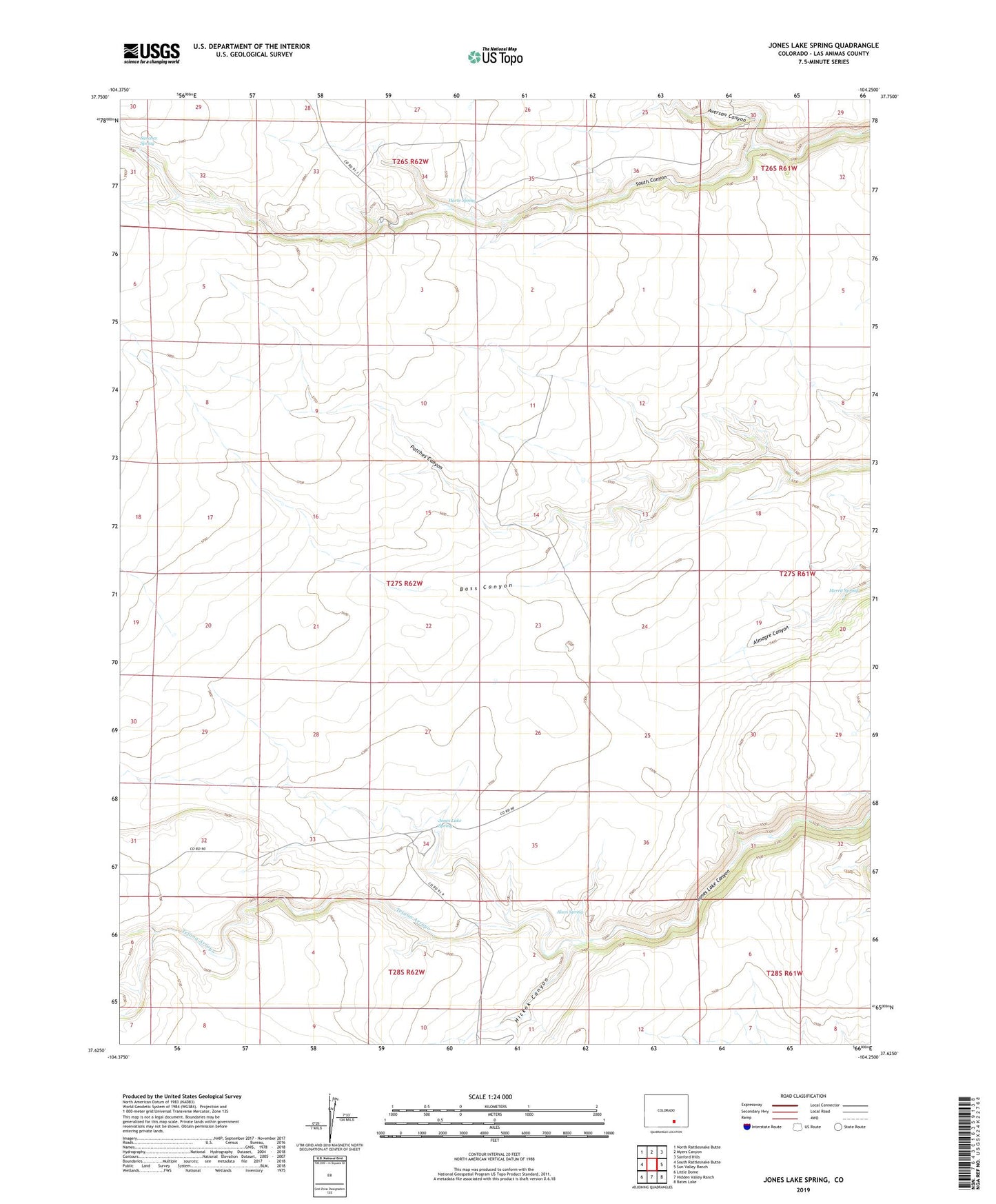
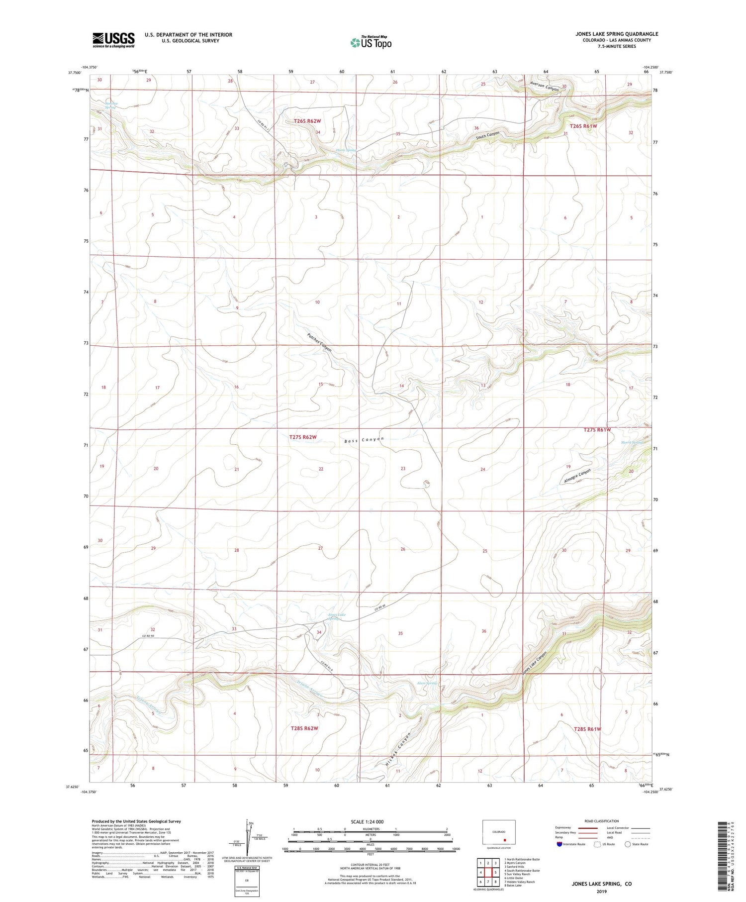
2022 topographic map quadrangle Jones Lake Spring in the state of Colorado. Scale: 1:24000. Based on the newly updated USGS 7.5' US Topo map series, this map is in the following counties: Las Animas. The map contains contour data, water features, and other items you are used to seeing on USGS maps, but also has updated roads and other features. This is the next generation of topographic maps. Printed on high-quality waterproof paper with UV fade-resistant inks.
Quads adjacent to this one:
West: South Rattlesnake Butte
Northwest: North Rattlesnake Butte
North: Myers Canyon
Northeast: Sanford Hills
East: Sun Valley Ranch
Southeast: Bates Lake
South: Hidden Valley Ranch
Southwest: Little Dome
This map covers the same area as the classic USGS quad with code o37104f3.
Contains the following named places: Alum Spring, Apishapa Game Management Area, Averson Canyon, Bull Pasture Well, Bushmire Well, Cross Canyon Well, East Downer Windmill, Harte Ranch, Harte Spring, Hickok Canyon, Jolly Well, Jones Lake Spring, Mare Pasture Well Number 1, Mare Pasture Well Number 2, McGee Windmill, Merrit Spring, Patches Canyon, Patches Windmill, Polder Well Number 1, Polder Well Number 2, Sanchez Spring, Stringer Windmill Number 1, Stringer Windmill Number 2, Tejana Arroyo