MyTopo
Hidden Valley Ranch Colorado US Topo Map
Couldn't load pickup availability
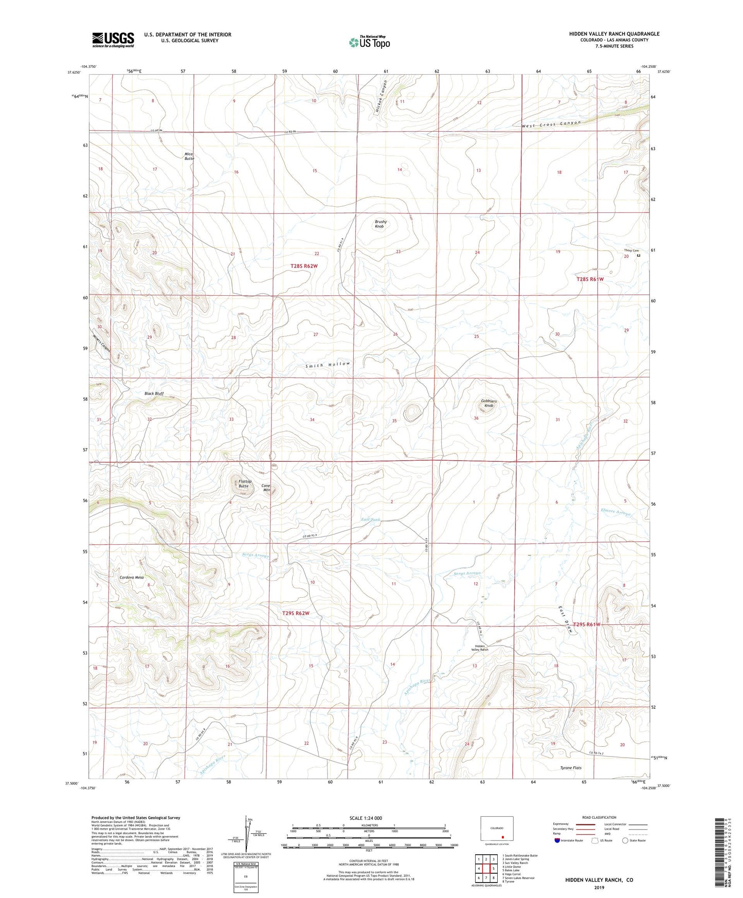
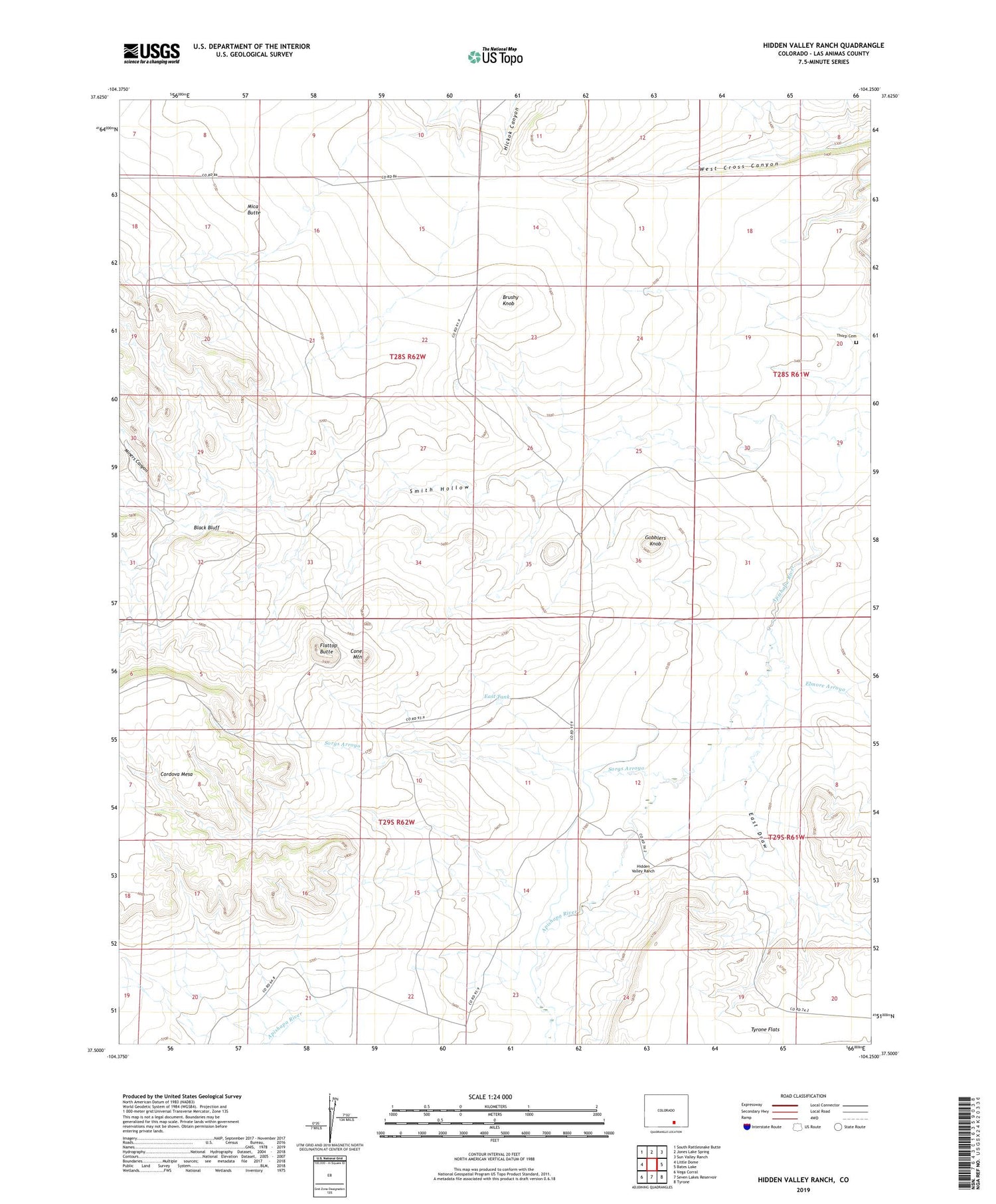
2022 topographic map quadrangle Hidden Valley Ranch in the state of Colorado. Scale: 1:24000. Based on the newly updated USGS 7.5' US Topo map series, this map is in the following counties: Las Animas. The map contains contour data, water features, and other items you are used to seeing on USGS maps, but also has updated roads and other features. This is the next generation of topographic maps. Printed on high-quality waterproof paper with UV fade-resistant inks.
Quads adjacent to this one:
West: Little Dome
Northwest: South Rattlesnake Butte
North: Jones Lake Spring
Northeast: Sun Valley Ranch
East: Bates Lake
Southeast: Tyrone
South: Seven Lakes Reservoir
Southwest: Vega Corral
This map covers the same area as the classic USGS quad with code o37104e3.
Contains the following named places: Bates Lake Arroyo, Black Bluff, Brushy Knob, Cone Mountain, East Draw, East Tank, Elmore Arroyo, Flattop Butte, Gobblers Knob, Hidden Valley Ranch, Mica Butte, Miners Canyon, Monroe Well, Revell Well, School Section Well, Smith Hollow, Sorgs Arroyo, Springer Well, Sulfur Well, Thorp Cemetery