MyTopo
Big Soap Park Colorado US Topo Map
Couldn't load pickup availability
Also explore the Big Soap Park Forest Service Topo of this same quad for updated USFS data
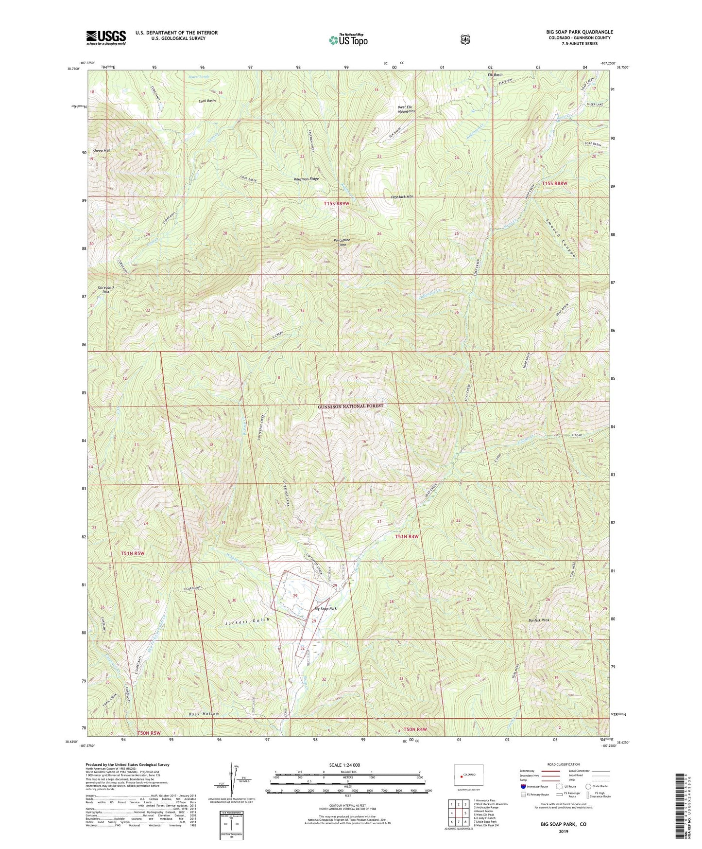
2022 topographic map quadrangle Big Soap Park in the state of Colorado. Scale: 1:24000. Based on the newly updated USGS 7.5' US Topo map series, this map is in the following counties: Gunnison. The map contains contour data, water features, and other items you are used to seeing on USGS maps, but also has updated roads and other features. This is the next generation of topographic maps. Printed on high-quality waterproof paper with UV fade-resistant inks.
Quads adjacent to this one:
West: Mount Guero
Northwest: Minnesota Pass
North: West Beckwith Mountain
Northeast: Anthracite Range
East: West Elk Peak
Southeast: West Elk Peak SW
South: Little Soap Park
Southwest: X Lazy F Ranch
This map covers the same area as the classic USGS quad with code o38107f3.
Contains the following named places: Big Soap Park, Bonfisk Peak, Buck Hollow, Coffeepot Creek, Curecanti Pass, Cureranti Pass Trail, Dry Fork Curecanti Creek, East Soap Creek, Elk Basin, Gunnison National Forest, Haystack Mountain, Jackass Gulch, Kaufman Ridge, Porcupine Cone, Smooth Canyon, Waterman Ranch, West Elk Wilderness, West Soap Creek