MyTopo
Lone Cone Colorado US Topo Map
Couldn't load pickup availability
Also explore the Lone Cone Forest Service Topo of this same quad for updated USFS data
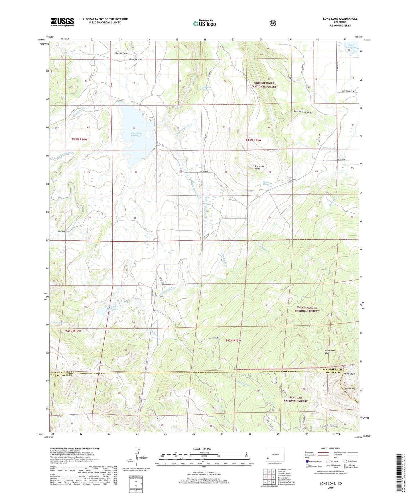
2022 topographic map quadrangle Lone Cone in the state of Colorado. Scale: 1:24000. Based on the newly updated USGS 7.5' US Topo map series, this map is in the following counties: San Miguel, Dolores. The map contains contour data, water features, and other items you are used to seeing on USGS maps, but also has updated roads and other features. This is the next generation of topographic maps. Printed on high-quality waterproof paper with UV fade-resistant inks.
Quads adjacent to this one:
West: North Mountain
Northwest: Barkelew Draw
North: Oak Hill
Northeast: Gurley Canyon
East: Beaver Park
Southeast: Groundhog Mountain
South: Groundhog Reservoir
Southwest: South Mountain
This map covers the same area as the classic USGS quad with code o37108h3.
Contains the following named places: Barrett Cow Camp, Bear Creek, Bear Spring, Bennett Creek, Brewster Creek, Busted Arm Draw, Cone Ditch, Devils Chair, Greager Flats, Last Chance Ditch, Lillylands Intake, Lily Lands Dam, Lilylands Intake, Lilylands Reservoir, Log Corral Creek, Lone Cone, Middle Naturita Creek, Miramonte Dam, Miramonte Reservoir, Miramonte Reservoir Campground, Nellies Flats, Nelson Springs, Piele Draw, Piele Lone Cone Camp, Preachers Hole, Redd Ranchs Summer Camp, Scotties Cabin, Spectacle Creek, Stockdale Creek, Stockdale Point, Stockdale Reservoir