MyTopo
Groundhog Reservoir Colorado US Topo Map
Couldn't load pickup availability
Also explore the Groundhog Reservoir Forest Service Topo of this same quad for updated USFS data
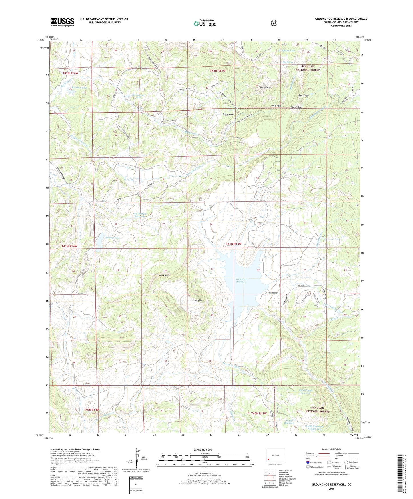
2022 topographic map quadrangle Groundhog Reservoir in the state of Colorado. Scale: 1:24000. Based on the newly updated USGS 7.5' US Topo map series, this map is in the following counties: Dolores. The map contains contour data, water features, and other items you are used to seeing on USGS maps, but also has updated roads and other features. This is the next generation of topographic maps. Printed on high-quality waterproof paper with UV fade-resistant inks.
Quads adjacent to this one:
West: South Mountain
Northwest: North Mountain
North: Lone Cone
Northeast: Beaver Park
East: Groundhog Mountain
Southeast: Clyde Lake
South: Nipple Mountain
Southwest: Willow Spring
This map covers the same area as the classic USGS quad with code o37108g3.
Contains the following named places: Arrowhead Lake, Beaver Creek Ditch, Belmear Lake, Belmear Lake Dam, Blue Ridge, Blue Spring, Boggy Basin, Clear Creek, Dunham Dam, Flattop Mountain, Groundhog Dam, Groundhog Reservoir, Hells Hole, Island Mesa, Lavender School, Little Fish Creek Ditch, Lone Cone State Wildlife Area, Morrison Dam, Morrison Lake, Nash Creek, North Nipple Reservoir, Old Dunham Reservoir, Rico Division, Saddle Reservoir, Saddle Reservoir Number Two, Spruce Lake, The Blowout, The Rincon