
MyTopo
Lost Canyon Colorado US Topo Map
Couldn't load pickup availability
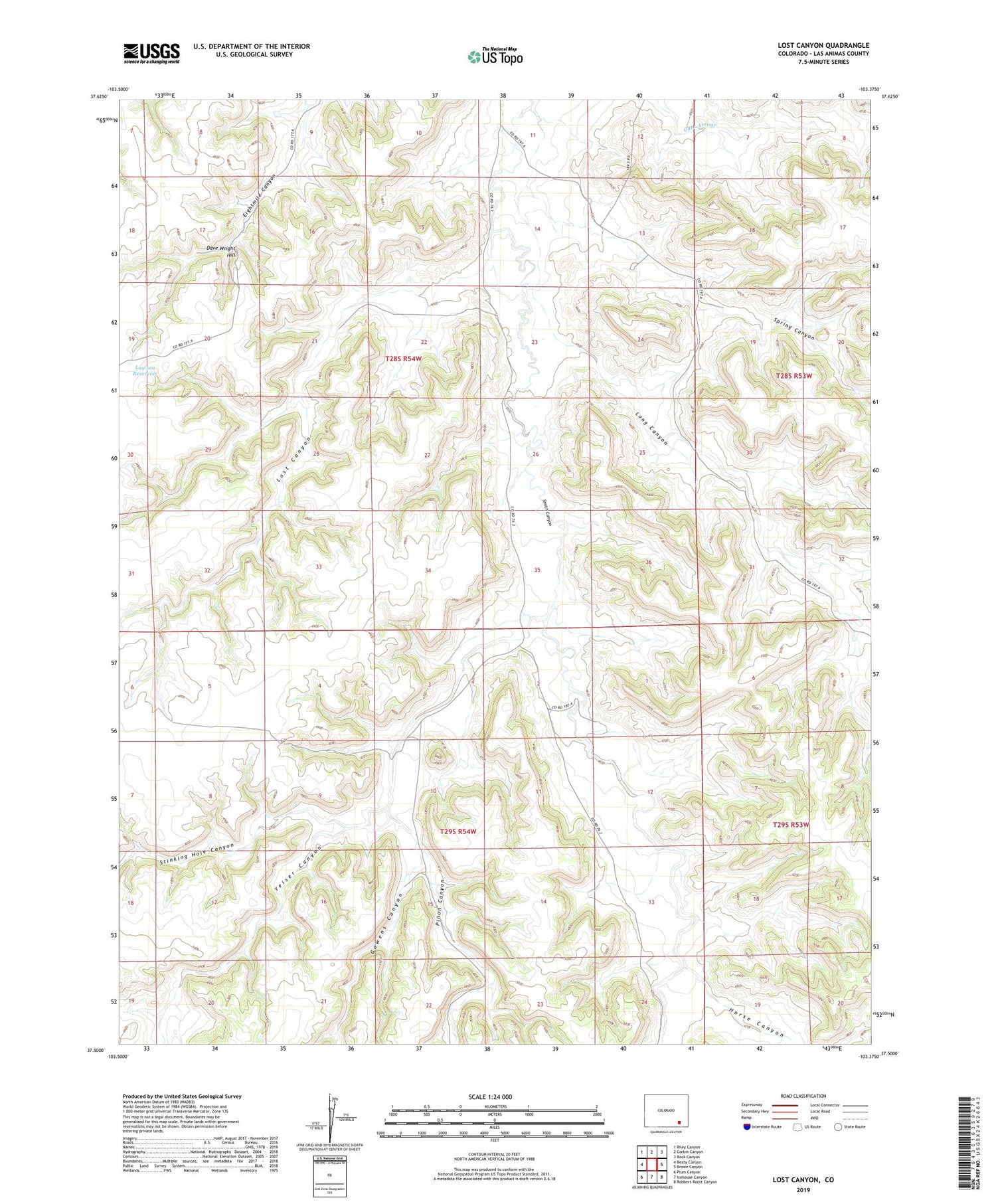
2022 topographic map quadrangle Lost Canyon in the state of Colorado. Scale: 1:24000. Based on the newly updated USGS 7.5' US Topo map series, this map is in the following counties: Las Animas. The map contains contour data, water features, and other items you are used to seeing on USGS maps, but also has updated roads and other features. This is the next generation of topographic maps. Printed on high-quality waterproof paper with UV fade-resistant inks.
Quads adjacent to this one:
West: Beaty Canyon
Northwest: Riley Canyon
North: Corbin Canyon
Northeast: Rock Canyon
East: Brown Canyon
Southeast: Robbers Roost Canyon
South: Icehouse Canyon
Southwest: Plum Canyon
This map covers the same area as the classic USGS quad with code o37103e4.
Contains the following named places: Cottonwood Crossing, Dave Wright Hill, Gowens Canyon, Horse Canyon, Lawson Reservoir, Long Canyon, Lost Canyon, Pinon Canyon, Spring Canyon, Stinking Hole Canyon, Yeiser Canyon


