MyTopo
Plum Canyon Colorado US Topo Map
Couldn't load pickup availability
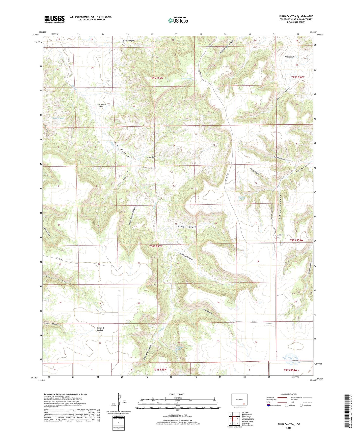
2022 topographic map quadrangle Plum Canyon in the state of Colorado. Scale: 1:24000. Based on the newly updated USGS 7.5' US Topo map series, this map is in the following counties: Las Animas. The map contains contour data, water features, and other items you are used to seeing on USGS maps, but also has updated roads and other features. This is the next generation of topographic maps. Printed on high-quality waterproof paper with UV fade-resistant inks.
Quads adjacent to this one:
West: Johnson Canyon
Northwest: O V Mesa
North: Beaty Canyon
Northeast: Lost Canyon
East: Icehouse Canyon
Southeast: Cherry Canyon
South: Villegreen
Southwest: Humbar Spring
This map covers the same area as the classic USGS quad with code o37103d5.
Contains the following named places: Blue Water Canyon, Briggs Canyon, Chapman Spring, Cherry Canyon, Courthouse Rock, Deadman Canyon, Deep Draw, Fox Canyon, Glover Spring, Indian Trail Canyon, J J Water Spring, Officer Canyon, Plum Canyon, Plum Windmill, Reed Canyon Windmill, Rough Canyon, School Section Canyon, Seven D Tank, Seven D Well, Sherman Canyon