MyTopo
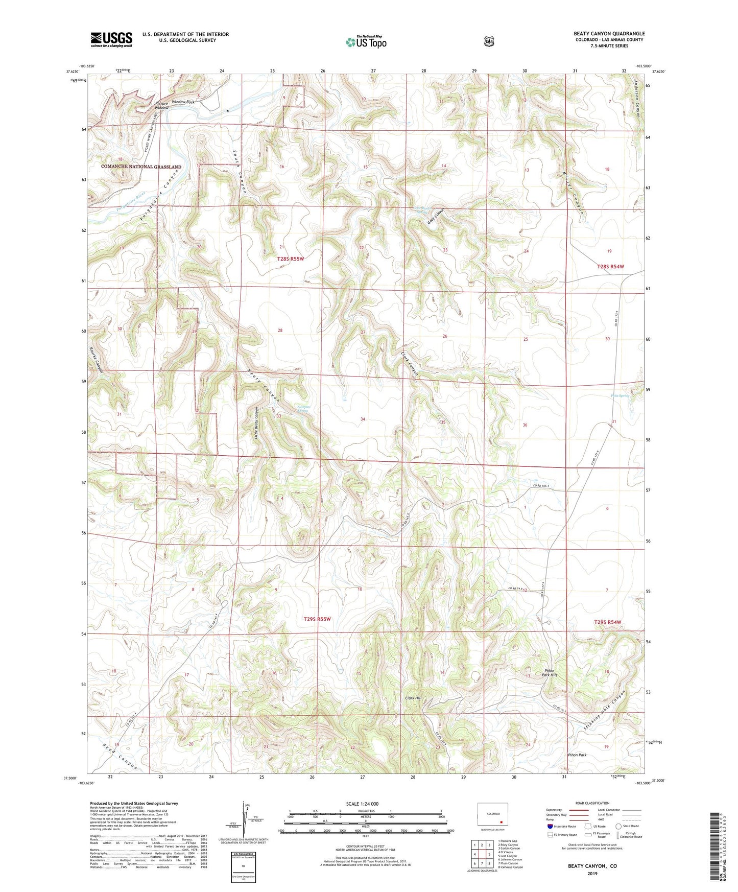
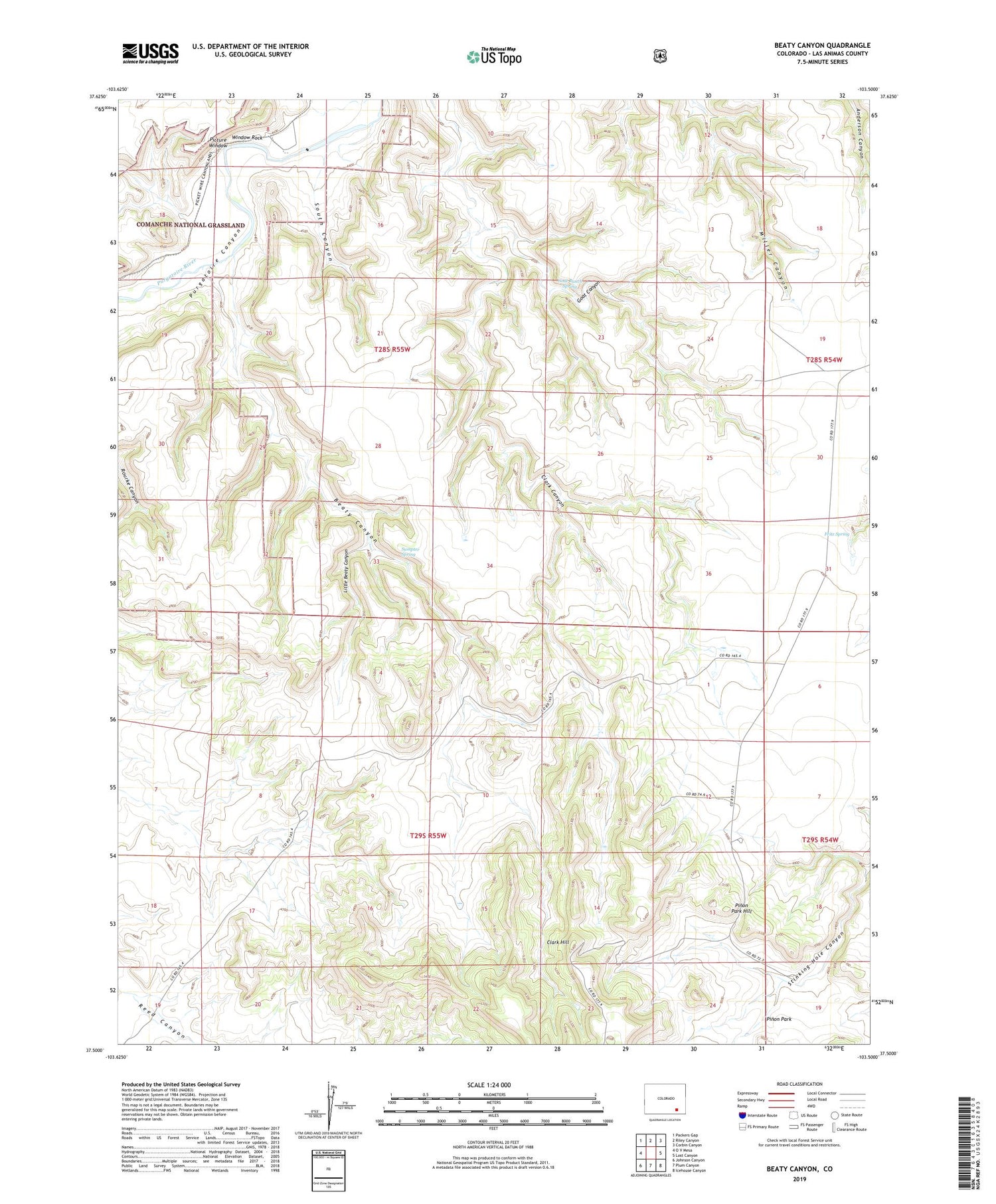
Beaty Canyon Colorado US Topo Map
Couldn't load pickup availability
Also explore the Beaty Canyon Forest Service Topo of this same quad for updated USFS data
2022 topographic map quadrangle Beaty Canyon in the state of Colorado. Scale: 1:24000. Based on the newly updated USGS 7.5' US Topo map series, this map is in the following counties: Las Animas. The map contains contour data, water features, and other items you are used to seeing on USGS maps, but also has updated roads and other features. This is the next generation of topographic maps. Printed on high-quality waterproof paper with UV fade-resistant inks.
Quads adjacent to this one:
West: O V Mesa
Northwest: Packers Gap
North: Riley Canyon
Northeast: Corbin Canyon
East: Lost Canyon
Southeast: Icehouse Canyon
South: Plum Canyon
Southwest: Johnson Canyon
This map covers the same area as the classic USGS quad with code o37103e5.
Contains the following named places: Beaty Canyon, Camp Windmill, Clark Hill, Dunbar Dam, East Dam, Fritz Spring, Goat Canyon, Goat Ranch Dam, Goat Ranch Spring, Little Beaty Canyon, Little Beaty Dam, Little Windmill, Lower Beaty Windmill, Northwest Dam, Padilla Windmill, Picture Window, Pinon Park, Pinon Park Hill, Red Bench Windmill, Reed Dam, Road Dam, Round Prairie, Sixteen Windmill, South Canyon, South Vaya Dam, Sumpter Spring, Telephone Dam, Trail Dam, Twin Windmills, Vaya Windmill, West Red Bench Windmill, West Vaya Dam, Window Rock