MyTopo
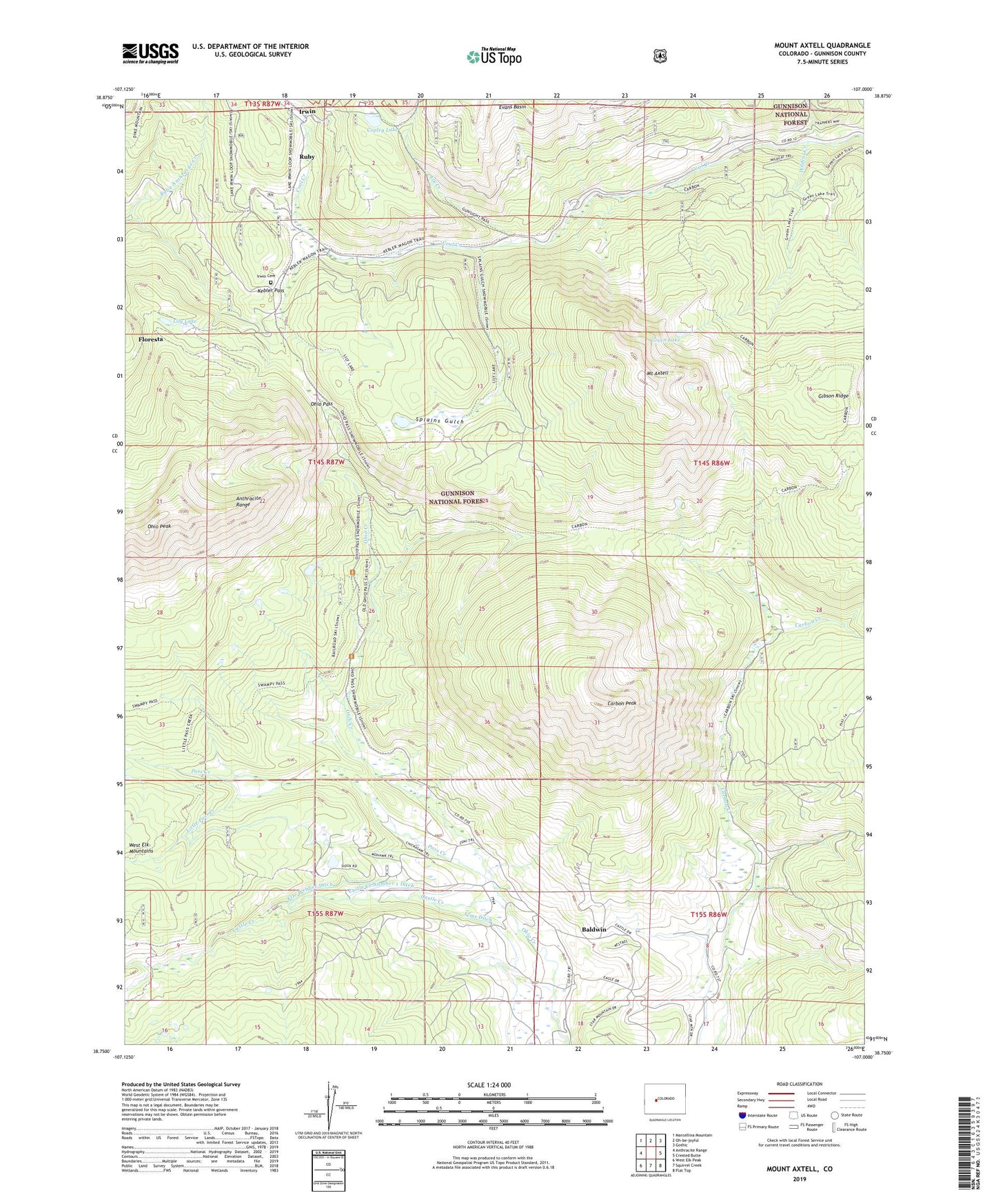
Mount Axtell Colorado US Topo Map
Couldn't load pickup availability
Also explore the Mount Axtell Forest Service Topo of this same quad for updated USFS data
2022 topographic map quadrangle Mount Axtell in the state of Colorado. Scale: 1:24000. Based on the newly updated USGS 7.5' US Topo map series, this map is in the following counties: Gunnison. The map contains contour data, water features, and other items you are used to seeing on USGS maps, but also has updated roads and other features. This is the next generation of topographic maps. Printed on high-quality waterproof paper with UV fade-resistant inks.
Quads adjacent to this one:
West: Anthracite Range
Northwest: Marcellina Mountain
North: Oh-be-joyful
Northeast: Gothic
East: Crested Butte
Southeast: Flat Top
South: Squirrel Creek
Southwest: West Elk Peak
This map covers the same area as the classic USGS quad with code o38107g1.
Contains the following named places: Alpine Mine, Baldwin, Baldwin Mine, Black Diamond Mine, Carbon Creek Mine, Carbon Peak, Castle Creek, Castle Creek Number 1 Ditch, Copley Lake, Elk Creek, Elze Webber Ditch, Emmon Mountain Mining and Milling Mine, Fan Mine, Floresta, Floresta Post Office, Forest Queen Mine, Gibson Ridge, Green Lake, Holly Mine, Iron Swamp Mine, Irwin, Irwin Cemetery, Kebler Pass, Keystone Mine, Kubler Mine, La Plant Mine, Lily Lake, Little Pass Creek, Mount Axtell, Mount Emmons Mine, New Baldwin Mine, Nu Mine, Ohio Pass, Ohio Peak, Pass Creek, Richardson Mine, Ruby, Ruby Mine, South Castle Creek, Spencer Mine, Splains Gulch, Superior Mine, Wildcat Creek