MyTopo
Gothic Colorado US Topo Map
Couldn't load pickup availability
Also explore the Gothic Forest Service Topo of this same quad for updated USFS data
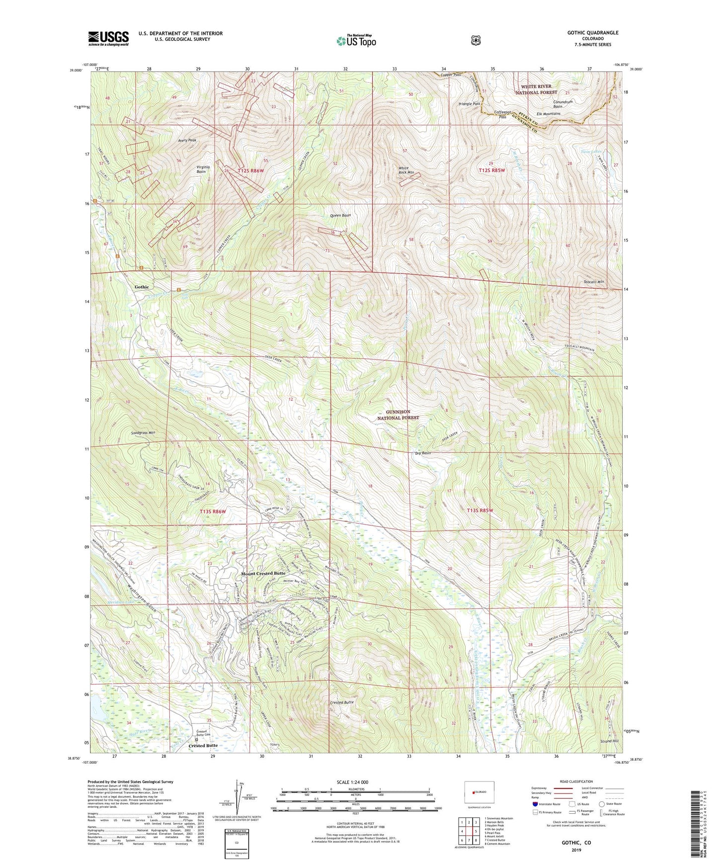
2022 topographic map quadrangle Gothic in the state of Colorado. Scale: 1:24000. Based on the newly updated USGS 7.5' US Topo map series, this map is in the following counties: Gunnison, Pitkin. The map contains contour data, water features, and other items you are used to seeing on USGS maps, but also has updated roads and other features. This is the next generation of topographic maps. Printed on high-quality waterproof paper with UV fade-resistant inks.
Quads adjacent to this one:
West: Oh-be-joyful
Northwest: Snowmass Mountain
North: Maroon Bells
Northeast: Hayden Peak
East: Pearl Pass
Southeast: Cement Mountain
South: Crested Butte
Southwest: Mount Axtell
This map covers the same area as the classic USGS quad with code o38106h8.
Contains the following named places: Avery Peak, Avery Peak Campground, Brush Creek, Brush Creek Cow Camp, Coal Creek, Coffeepot Pass, Conundrum Basin, Copper Creek, Copper Pass, Crested Butte, Crested Butte Cemetery, Deer Creek, Dry Basin, Gothic, Gothic Post Office, Horace Porter Mine, Judd Falls, Meridan Lake Park Number 1 Dam, Mount Crested Butte, Mount Crested Butte Police Department, Peanut Lake, Perry Creek, Queen Basin, Snodgrass Mountain, Teocalli Mountain, Town of Mount Crested Butte, Trail Riders Trail, Triangle Pass, Twin Lakes, Virginia Basin, Washington Gulch, West Brush Creek, White Rock Mountain, ZIP Codes: 81224, 81225