MyTopo
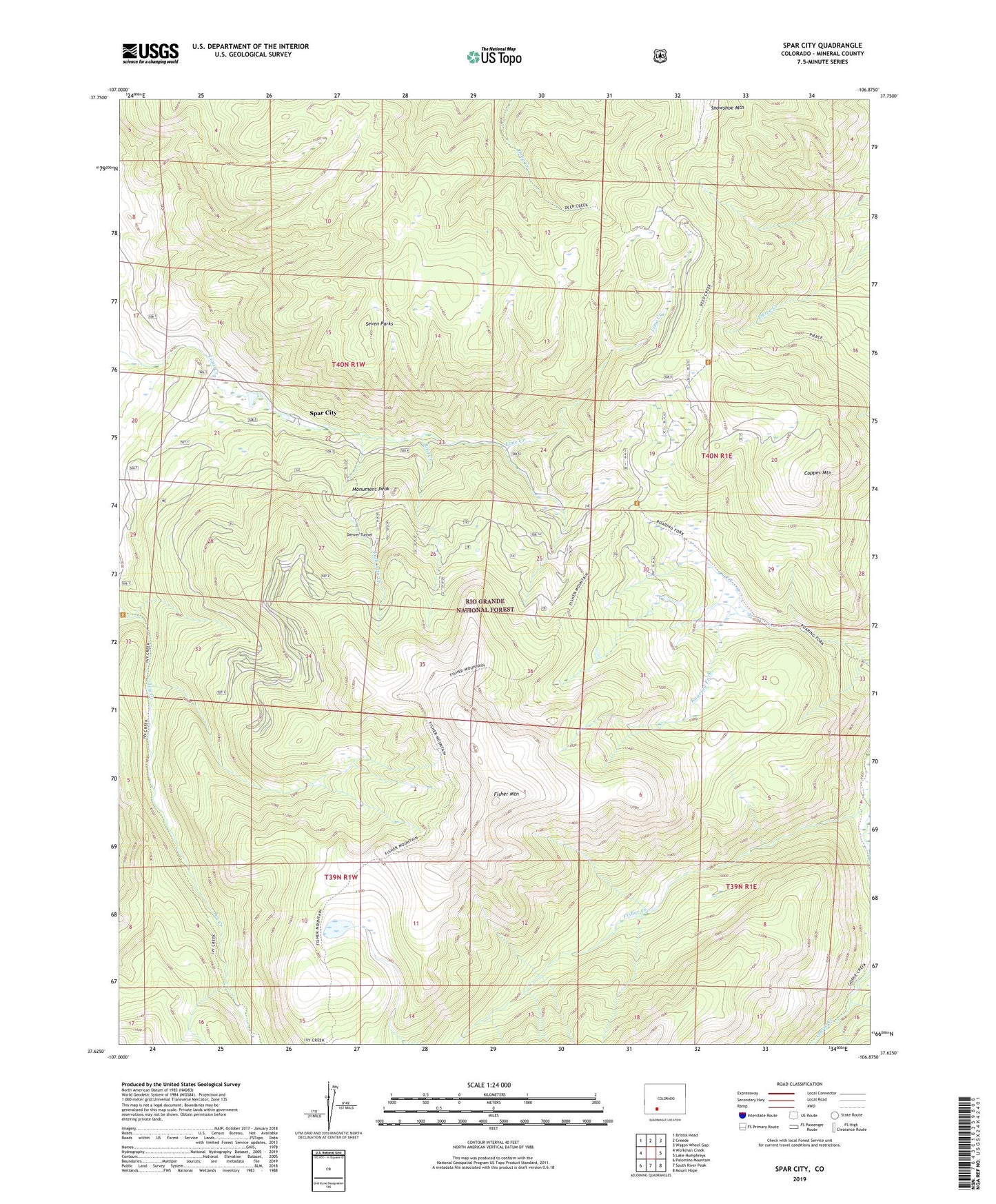
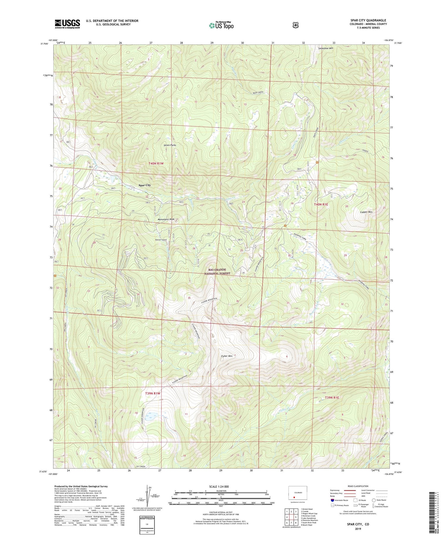
Spar City Colorado US Topo Map
Couldn't load pickup availability
Also explore the Spar City Forest Service Topo of this same quad for updated USFS data
2022 topographic map quadrangle Spar City in the state of Colorado. Scale: 1:24000. Based on the newly updated USGS 7.5' US Topo map series, this map is in the following counties: Mineral. The map contains contour data, water features, and other items you are used to seeing on USGS maps, but also has updated roads and other features. This is the next generation of topographic maps. Printed on high-quality waterproof paper with UV fade-resistant inks.
Quads adjacent to this one:
West: Workman Creek
Northwest: Bristol Head
North: Creede
Northeast: Wagon Wheel Gap
East: Lake Humphreys
Southeast: Mount Hope
South: South River Peak
Southwest: Palomino Mountain
This map covers the same area as the classic USGS quad with code o37106f8.
Contains the following named places: Bird Creek, Bird Creek Mine, Copper Mountain, Creede Division, Denver Tunnel, Denver Tunnel Mine, Emma Mine, Fisher Mountain, Ivy Creek Campground and Trailhead, Mineral County, Monument Peak, North Lime Trailhead, Palo Alto Creek, Seven Parks, Snowshoe Mountain, Spar City, Spar City Mine